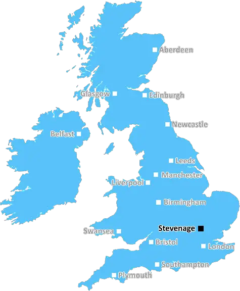
stevenage SG16 Postcodes
Spending a fortune on conveyancing?

Compare instant, low-cost online quotes from trusted conveyancing solicitors.
Backed by experts, our no-obligation service searches through the best conveyancing quotes on the market to save you time and money.
Stevenage (SG16)
The SG16 postcode area is located in the Stevenage postcode town region, within the county of Bedfordshire, and contains a total of 216 individual postcodes.
There are 7 electoral wards in the SG16 postcode area, including Arlesey, Baldock, Biggleswade, Buntingford, Henlow, Hertford, Hitchin, Knebworth, Letchworth Garden City, Much Hadham, Royston, Sandy, Shefford, Stevenage, Ware which come under the local authority of the Central Bedfordshire Council.
Combining the whole postcode region, 28% of people in SG16 are classed as having an AB social grade, (i.e. 'white-collar' middle-upper class), compared to 27% across the UK.
This does not mean that the people of SG16 are wealthier - or higher class - than average, but it can be an indication that the area may be prospering and desirable to live in.
SG16 is a postcode located in south east England and is part of the Hitchin post town. It serves the villages of Henlow, Bygrave, Langford, Lower Stondon, Stondon, and Upper Stondon.
Officially, the postcode covers an area that is seven miles long and four miles wide. Comprising of both rural and urban areas, you can expect to find several villages, hamlets and scattered communities in its vicinity.
The postcode has an estimated population of 11,398 (as of 2011). There are several educational institutions located in the area, such as Langford Primary School and the Thomas Alleyne Academy.
As SG16 is in close proximity to several major roads and motorways, it offers great access to the nearby towns and cities. These include London, Cambridge, and Milton Keynes, which are roughly an hour away by car.
The local area is home to a variety of amenities, such as supermarkets, retail stores, pubs, and a leisure centre. Henlow Waterside Park is a popular spot, with pathways and lakeside walks, while a golf course and gym can be found in nearby Hannah. There are also several wildlife reserves and parks in the surrounding area.
The nearest railway station is Arlesey, and Hitchin Station is just a short drive away. Both offer convenient access to the capital and other notable cities in the country.
When it comes to properties, SG16 is known for its developments. From Victorian cottages to modern houses, there is something to suit all tastes and budgets. Additionally, rental houses and apartments are also on the rise.

Demographics

Bedfordshire

SG16 is located in the county of Bedfordshire, in England.
Bedfordshire has a total population of 664,500, making it the 36th largest county in the UK.
Bedfordshire has a total area of 477 square miles, and a population density of 537 people per square kilometre. For comparison, Greater London has a density of 5,618 people/km2.
| Outward Code | SG16 |
| Postal Town | Stevenage |
| MSOA Name | Central Bedfordshire 010 |
| LSOA Name | Central Bedfordshire 010F |
| County | Bedfordshire |
| Region | Bedfordshire |
| Country | England |
| Local Authority | Central Bedfordshire |
| Area Classification | Largely Rural (rural including hub towns 50-79%) |
SG16 Electoral Wards
The postal region of SG16, includes the local towns, villages, electoral wards and stations of:
Dig even deeper into the SG16 postcode by clicking on a postcode below:
Click on an outward postal code below for more information about the area. Each 'outward' postcode give you a comprehensive list of all postcodes within the outward code area (SG) and estimated address.
Click on an 'outward' code for more information. For example, the outward postcode page 'EC2M' will give you an alphabetical list covering all postcodes located in the region, from 'EC2M 1BB' through to 'EC2M 7YA'.
Chris H
Tuesday, April 16, 2024
We don't have any views of SG16 right now. If you live in SG16 or have visited it, please help us to help others by telling others what you think of this neighbourhood.
Add your view of SG16
People need your local expertise. If you live in SG16 or have first-hand knowledge of the neighbourhood, please consider sharing your views. It's completely anonymous - all we ask is for your initials.
Please tell us what you like about the SG16 postcode area, what you don't like, and what it's like to live or work here.
| LOCAL AMENITIES | |
| FAMILY FRIENDLY | |
| PARKING | |
| GREEN SPACES |
Local News Bedfordshire
Stevenage 1-2 Burton Albion
Tom Hamer scores the vital goal in a 2-1 victory against 10-man Stevenage to move Burton three points clear of relegation.
BBC NewsThames Valley's police commissioner candidates
Meet the candidates preparing for the election in May.
BBC NewsHertfordshire's police commissioner candidates
The county is guaranteed a new commissioner as incumbent David Lloyd is standing down.
BBC News'Universal is fantastic if we get infrastructure'
People who live near a site which could become a movie-themed resort share their hopes and concerns.
BBC NewsWhen are the May local elections, and who can vote?
Voters in parts of England and Wales will elect councillors, mayors and police commissioners in May.
BBC NewsBedfordshire's police commissioner candidates
Meet the candidates preparing for the election in May.
BBC NewsTown 'bucking the trend of falling footfall'
A 1.7m investment in Bedford has "brought fresh optimism to the High Street", a council says.
BBC NewsThe reading rabbit who calms children
Winter the rabbit helps children to read at Animal Edge Farm in Millbrook.
BBC NewsFrom the Postcode Area blog

Deciphering Crime Rates - a Deep Dive Into UK Postcode Analysis
Ever wondered about the crime rate in your UK postcode? You're not alone. We've dug deep into the data, uncovering trends and patterns that'll make your head spin.

Death of the High Street?
The BBC reports that despite councils' attempts to kurb them, the UK's high streets have seen a huge growth in fast food outlets. Could this mark the death knell for the Great British high street, and what can we do about it to halt its decline?

Discrimination by Postcode
You really couldn't make it up, could you? Some of the country's most vulnerable people are missing out on their weekly £25 Cold Weather Payment, just because the system that's in operation is discriminating against them because payments are based on postcode, rather than geographic location.

The Redesign is Underway
Well, the current website was absolutely in dire need of a good redesign - from the ground up. So I set out to pull it all apart and get it up and running again to become the most comprehensive guide to every postcode in the UK. And it's been a long, tough job from start to finish - and quite possibly the biggest project I've ever undertaken.
SOCIAL GRADES
According to census records, 28% of people here have a social grade of AB (highest), compared to the national average of 27%.