stevenage SG14 Postcodes
Spending a fortune on conveyancing?

Compare instant, low-cost online quotes from trusted conveyancing solicitors.
Backed by experts, our no-obligation service searches through the best conveyancing quotes on the market to save you time and money.
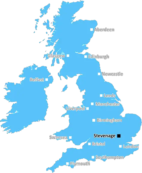
Stevenage (SG14)
The SG14 postcode area is located in the Stevenage postcode town region, within the county of Hertfordshire, and contains a total of 863 individual postcodes.
There are 29 electoral wards in the SG14 postcode area, including Arlesey, Baldock, Biggleswade, Buntingford, Henlow, Hertford, Hitchin, Knebworth, Letchworth Garden City, Much Hadham, Royston, Sandy, Shefford, Stevenage, Ware which come under the local authority of the East Hertfordshire Council.
Combining the whole postcode region, 37% of people in SG14 are classed as having an AB social grade, (i.e. 'white-collar' middle-upper class), compared to 27% across the UK.
This does not mean that the people of SG14 are wealthier - or higher class - than average, but it can be an indication that the area may be prospering and desirable to live in.
SG14 is a postcode district located in the Stevenage district of Hertfordshire in the United Kingdom.
It was created in 2001, and is the successor to parts of the SG1 and SG2 postcode districts. The district is bounded by the postcodes of SG13, SG15, SG4, SG6, SG7, SG8, SG9 and SG10.
The district is managed by the East of England postcode region, and is made up of five postcode sectors which cover a 4.9 square mile area. The sectors within SG14 start from SG14 1 and go through to SG14 5.
SG14 is predominantly a residential and commercial area, with a number of established businesses taking advantage of the area's close proximity to London. Retail businesses can also be found in the district, along with several public parks and recreational spaces, such as Panshanger Park and The Grange.
The district has continued to grow in popularity in recent times due to its affordable house prices which, when compared to the rest of Hertfordshire and the country as a whole, remain relatively cheap. It's also a popular choice for commuters as the average commuting time to London is only around 40 minutes.
Public transport in the area is excellent, with frequent bus routes and fast mainline trains from Stevenage Station. It is also well served by the A1(M) motorway, providing convenient access to the rest of Hertfordshire and surrounding counties.
SG14 is a desirable postcode district with a great quality of life and plenty of opportunities for its residents. With its low house prices and excellent transport links, it is the perfect place for both homebuyers and businesses.

Demographics

Hertfordshire

SG14 is located in the county of Hertfordshire, in England.
Hertfordshire has a total population of 1,176,700, making it the 12th largest county in the UK.
Hertfordshire has a total area of 634 square miles, and a population density of 716 people per square kilometre. For comparison, Greater London has a density of 5,618 people/km2.
| Outward Code | SG14 |
| Postal Town | Stevenage |
| MSOA Name | East Hertfordshire 017 |
| LSOA Name | East Hertfordshire 017D |
| County | Hertfordshire |
| Region | Hertfordshire |
| Country | England |
| Local Authority | East Hertfordshire |
| Area Classification | Unclassified |
SG14 Electoral Wards
The postal region of SG14, includes the local towns, villages, electoral wards and stations of:
Dig even deeper into the SG14 postcode by clicking on a postcode below:
Click on an outward postal code below for more information about the area. Each 'outward' postcode give you a comprehensive list of all postcodes within the outward code area (SG) and estimated address.
Click on an 'outward' code for more information. For example, the outward postcode page 'EC2M' will give you an alphabetical list covering all postcodes located in the region, from 'EC2M 1BB' through to 'EC2M 7YA'.
Chris H
Sunday, April 7, 2024
We don't have any views of SG14 right now. If you live in SG14 or have visited it, please help us to help others by telling others what you think of this neighbourhood.
Add your view of SG14
People need your local expertise. If you live in SG14 or have first-hand knowledge of the neighbourhood, please consider sharing your views. It's completely anonymous - all we ask is for your initials.
Please tell us what you like about the SG14 postcode area, what you don't like, and what it's like to live or work here.
| LOCAL AMENITIES | |
| FAMILY FRIENDLY | |
| PARKING | |
| GREEN SPACES |
Local News Hertfordshire
Residents emotional as Bedford postie retires
Graham McFiggins is said to have done more for the community than delivering letters.
BBC NewsUniversal begins public meetings for UK theme park
The company says the public engagement does not mean the proposal is confirmed.
BBC NewsDJ Greg James apologises for glass eye comment
James and Chris Smith say sorry for saying a glass eye would make a book character "more revolting".
BBC NewsSpanish funeral cancelled after UK passport mishap
Keith Rudd had five months left on his passport, but was not allowed to fly out of a UK airport.
BBC NewsHow a hard-boiled egg could determine Wembley glory
Kevin Chapman is going to be egging on Peterborough United in the EFL Trophy final on Sunday.
BBC NewsWoman defrauded stepfather out of shares and money
Geraldine Skevington-Roberts is considered to have used her power of attorney to "enrich herself".
BBC NewsWatford and Preston play out goalless draw
Watford and Preston play out a relatively drab goalless draw in the Championship.
BBC NewsForest Green Rovers 0-2 Milton Keynes Dons
MK Dons' automatic promotion hopes are handed a boost as goals in each half from Max Dean and Alex Gilbey sealed a 2-0 League Two win at bottom club Forest Green.
BBC NewsFrom the Postcode Area blog

Deciphering Crime Rates - a Deep Dive Into UK Postcode Analysis
Ever wondered about the crime rate in your UK postcode? You're not alone. We've dug deep into the data, uncovering trends and patterns that'll make your head spin.

Death of the High Street?
The BBC reports that despite councils' attempts to kurb them, the UK's high streets have seen a huge growth in fast food outlets. Could this mark the death knell for the Great British high street, and what can we do about it to halt its decline?

Discrimination by Postcode
You really couldn't make it up, could you? Some of the country's most vulnerable people are missing out on their weekly £25 Cold Weather Payment, just because the system that's in operation is discriminating against them because payments are based on postcode, rather than geographic location.

The Redesign is Underway
Well, the current website was absolutely in dire need of a good redesign - from the ground up. So I set out to pull it all apart and get it up and running again to become the most comprehensive guide to every postcode in the UK. And it's been a long, tough job from start to finish - and quite possibly the biggest project I've ever undertaken.
SOCIAL GRADES
According to census records, 37% of people here have a social grade of AB (highest), compared to the national average of 27%.