stevenage SG11 Postcodes
Spending a fortune on conveyancing?

Compare instant, low-cost online quotes from trusted conveyancing solicitors.
Backed by experts, our no-obligation service searches through the best conveyancing quotes on the market to save you time and money.
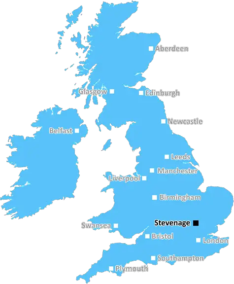
Stevenage (SG11)
The SG11 postcode area is located in the Stevenage postcode town region, within the county of Hertfordshire, and contains a total of 467 individual postcodes.
There are 58 electoral wards in the SG11 postcode area, including Arlesey, Baldock, Biggleswade, Buntingford, Henlow, Hertford, Hitchin, Knebworth, Letchworth Garden City, Much Hadham, Royston, Sandy, Shefford, Stevenage, Ware which come under the local authority of the East Hertfordshire Council.
Combining the whole postcode region, 33% of people in SG11 are classed as having an AB social grade, (i.e. 'white-collar' middle-upper class), compared to 27% across the UK.
This does not mean that the people of SG11 are wealthier - or higher class - than average, but it can be an indication that the area may be prospering and desirable to live in.
The SG11 postcode is located in the Stevenage district of Hertfordshire, one of the most historic towns in England. The area was first settled by the Romans who chose the area due to its geographical position along major roads and is the location of the world's oldest functioning computer.
SG11 is a mainly residential area and has seen a lot of growth in recent years due to its close proximity to London. It is well served by transport links with regular services to London St Pancras International, which provides easy access into the capital. The area is also served by regular bus and train services which allow for easy access to neighbouring towns and further afield.
The area has good amenities and services, with a selection of supermarkets, restaurants, pubs and retail outlets. There is also a leisure centre and a choice of primary and secondary schools.
The area is home to a range of property types, including detached houses as well as a mix of smaller terraced properties. There are also a few blocks of modern flats which have been built in recent years.
The area is largely affluent and is popular with professionals thanks to the proximity of the local hospital and telecommunications companies.
Stevenage is a great place to live and work and the postcode of SG11 has seen a surge in popularity in recent years, with house prices increasing due to demand. It's a great area with good amenities, access to London, and lots of other services in the area, making it an ideal choice for families and individuals alike.

Demographics

Hertfordshire

SG11 is located in the county of Hertfordshire, in England.
Hertfordshire has a total population of 1,176,700, making it the 12th largest county in the UK.
Hertfordshire has a total area of 634 square miles, and a population density of 716 people per square kilometre. For comparison, Greater London has a density of 5,618 people/km2.
| Outward Code | SG11 |
| Postal Town | Stevenage |
| MSOA Name | East Hertfordshire 006 |
| LSOA Name | East Hertfordshire 006B |
| County | Hertfordshire |
| Region | Hertfordshire |
| Country | England |
| Local Authority | East Hertfordshire |
| Area Classification | Unclassified |
SG11 Electoral Wards
The postal region of SG11, includes the local towns, villages, electoral wards and stations of:
Dig even deeper into the SG11 postcode by clicking on a postcode below:
Click on an outward postal code below for more information about the area. Each 'outward' postcode give you a comprehensive list of all postcodes within the outward code area (SG) and estimated address.
Click on an 'outward' code for more information. For example, the outward postcode page 'EC2M' will give you an alphabetical list covering all postcodes located in the region, from 'EC2M 1BB' through to 'EC2M 7YA'.
Chris H
Monday, April 8, 2024
We don't have any views of SG11 right now. If you live in SG11 or have visited it, please help us to help others by telling others what you think of this neighbourhood.
Add your view of SG11
People need your local expertise. If you live in SG11 or have first-hand knowledge of the neighbourhood, please consider sharing your views. It's completely anonymous - all we ask is for your initials.
Please tell us what you like about the SG11 postcode area, what you don't like, and what it's like to live or work here.
| LOCAL AMENITIES | |
| FAMILY FRIENDLY | |
| PARKING | |
| GREEN SPACES |
Local News Hertfordshire
Just forgotten': The adults who can't read
Sue Warden is Coordinator at Readeasy in Milton Keynes which helps adults with literacy.
BBC NewsDelays on M25 and M1 as equipment is transported
An abnormal load bound for a power station will affect some M1 and M25 traffic this weekend.
BBC NewsNature reserves waterlogged after 'wettest winter'
The Wildlife Trust says there is no update on when closed sites will be re-opened.
BBC NewsHow a hard-boiled egg could determine Wembley glory
Kevin Chapman is going to be egging on Peterborough United in the EFL Trophy final on Sunday.
BBC NewsBus driver in hospital after crashing into wall
Police are appealing for information, such as dashcam footage, following the collision in St Albans.
BBC NewsWatford and Preston play out goalless draw
Watford and Preston play out a relatively drab goalless draw in the Championship.
BBC NewsRunning 5k every day while fasting during Ramadan
Bilal Hussain took on the challenge to raise money for Luton Food Bank.
BBC NewsGB newcomer Newman-Baronius equals world record
Olivia Newman-Baronius, 17, equals the S14 100m butterfly world record in her first major event to all but confirm her place at this summer's Paralympics.
BBC NewsFrom the Postcode Area blog

Deciphering Crime Rates - a Deep Dive Into UK Postcode Analysis
Ever wondered about the crime rate in your UK postcode? You're not alone. We've dug deep into the data, uncovering trends and patterns that'll make your head spin.

Death of the High Street?
The BBC reports that despite councils' attempts to kurb them, the UK's high streets have seen a huge growth in fast food outlets. Could this mark the death knell for the Great British high street, and what can we do about it to halt its decline?

Discrimination by Postcode
You really couldn't make it up, could you? Some of the country's most vulnerable people are missing out on their weekly £25 Cold Weather Payment, just because the system that's in operation is discriminating against them because payments are based on postcode, rather than geographic location.

The Redesign is Underway
Well, the current website was absolutely in dire need of a good redesign - from the ground up. So I set out to pull it all apart and get it up and running again to become the most comprehensive guide to every postcode in the UK. And it's been a long, tough job from start to finish - and quite possibly the biggest project I've ever undertaken.
SOCIAL GRADES
According to census records, 33% of people here have a social grade of AB (highest), compared to the national average of 27%.