nottingham NG25 Postcodes
Spending a fortune on conveyancing?

Compare instant, low-cost online quotes from trusted conveyancing solicitors.
Backed by experts, our no-obligation service searches through the best conveyancing quotes on the market to save you time and money.
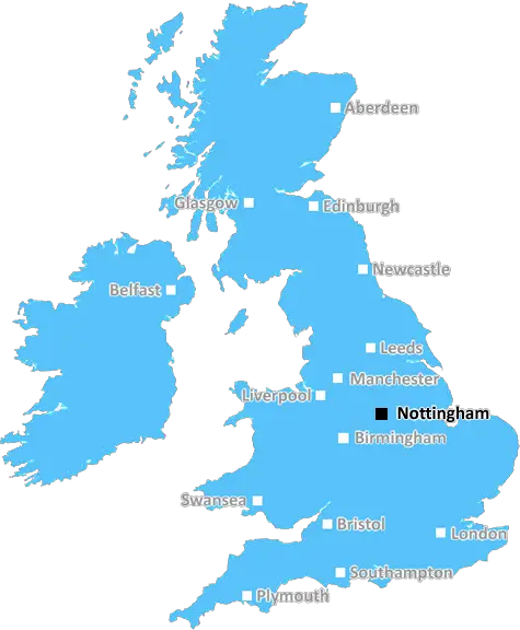
Nottingham (NG25)
The NG25 postcode area is located in the Nottingham postcode town region, within the county of Nottinghamshire, and contains a total of 322 individual postcodes.
There are 22 electoral wards in the NG25 postcode area, including Grantham, Mansfield, Newark, Nottingham, Sleaford, Southwell, Sutton-In-Ashfield which come under the local authority of the Newark and Sherwood Council.
Combining the whole postcode region, 38% of people in NG25 are classed as having an AB social grade, (i.e. 'white-collar' middle-upper class), compared to 27% across the UK.
This does not mean that the people of NG25 are wealthier - or higher class - than average, but it can be an indication that the area may be prospering and desirable to live in.
The NG25 postcode is a postal area in Nottingham in the East Midlands of England. It covers several suburbs, such as Balderton, Caunton, Collingham, Farndon, Newark-on-Trent, North Muskham, Claypole, North Scarle, Newark and East Stoke, South Muskham, South Scarle, Thurgarton, and Winthorpe.
The NG25 postcode has a population of 20,085 people living in an area of 46.2 km2. The majority of people living in NG25 are economically active with unemployment rate below the national average. The NG25 postcode area is less affluent than other parts of the UK, with an average household income of �24,719.
The district is served by Newark & Sherwood District Council which is responsible for the delivery of public services within the area.
The NG25 postcode has a few tourist attractions, such as Newark Castle, Galleries of Justice Museum, Nottinghamshire County Showground, and Southwell Racecourse. The district is also known for its educational institutions, with schools such as Scarborough College, Toot Hill School, Gray's School of Art and Caunton C of E Primary School, among others.
The area is well connected to the surrounding areas by Nottingham's bus service and the Nottingham Express Transit tram system, providing easy access to and from the city centre. Its proximity to the A46 offers road access to the rest of the Midlands and beyond.
With its parks, country inns, cafes and shopping, NG25 is a great place to live and visit. Its close proximity to Nottingham and other major cities makes it a great place for day trips and weekend breaks.

Demographics

Nottinghamshire

NG25 is located in the county of Nottinghamshire, in England.
Nottinghamshire has a total population of 1,136,000, making it the 15th largest county in the UK.
Nottinghamshire has a total area of 834 square miles, and a population density of 526 people per square kilometre. For comparison, Greater London has a density of 5,618 people/km2.
| Outward Code | NG25 |
| Postal Town | Nottingham |
| MSOA Name | Newark and Sherwood 008 |
| LSOA Name | Newark and Sherwood 008C |
| County | Nottinghamshire |
| Region | Nottinghamshire |
| Country | England |
| Local Authority | Newark and Sherwood |
| Area Classification | Largely Rural (rural including hub towns 50-79%) |
NG25 Electoral Wards
The postal region of NG25, includes the local towns, villages, electoral wards and stations of:
Dig even deeper into the NG25 postcode by clicking on a postcode below:
Click on an outward postal code below for more information about the area. Each 'outward' postcode give you a comprehensive list of all postcodes within the outward code area (NG) and estimated address.
Click on an 'outward' code for more information. For example, the outward postcode page 'EC2M' will give you an alphabetical list covering all postcodes located in the region, from 'EC2M 1BB' through to 'EC2M 7YA'.
Chris H
Monday, May 13, 2024
We don't have any views of NG25 right now. If you live in NG25 or have visited it, please help us to help others by telling others what you think of this neighbourhood.
Add your view of NG25
People need your local expertise. If you live in NG25 or have first-hand knowledge of the neighbourhood, please consider sharing your views. It's completely anonymous - all we ask is for your initials.
Please tell us what you like about the NG25 postcode area, what you don't like, and what it's like to live or work here.
| LOCAL AMENITIES | |
| FAMILY FRIENDLY | |
| PARKING | |
| GREEN SPACES |
Local News Nottinghamshire
Mayor makes council tax pledge for first term
Claire Ward has the power to introduce a precept to fund different projects.
BBC News'I fell in 6ft sewage hole on dream holiday and didn't have travel insurance'
Millie Stephenson, 24, had just arrived in Hawaii to meet a group of online friends after a 46-hour journey
Nottingham PostNew Nottinghamshire school to be built to cope with increase in demand
A new 160-space special free school will be set up in the county as part of an initiative announced by the Department for Education (DfE) on Thursday, May 9
Nottingham PostJoe Swash and Stacey Solomon's 'scary' realisation that's made them consider big change
Joe Swash has opened up about his family's connection to the foster care system
Nottingham PostRural businesses encouraged to bid for funding
Rural community groups and businesses can benefit from a share of 110,000 funding.
BBC NewsStray dog who had 'tough start to life' joins police
Russo's potential was spotted by experts after he was found wandering around Heathrow Airport.
BBC NewsWheeler Dealers' Mike Brewer fears car tax 'loophole' will be axed
Wheeler Dealers star Mike Brewer has warned that a 'loophole' could be axed in the near future
Nottingham PostThe Blaze beat Western Storm by four wickets
Eve Jones makes an unbeaten 136 to lead Central Sparks to victory over Thunder in the Rachael Heyhoe Flint Trophy.
BBC NewsFrom the Postcode Area blog

Deciphering Crime Rates - a Deep Dive Into UK Postcode Analysis
Ever wondered about the crime rate in your UK postcode? You're not alone. We've dug deep into the data, uncovering trends and patterns that'll make your head spin.

Death of the High Street?
The BBC reports that despite councils' attempts to kurb them, the UK's high streets have seen a huge growth in fast food outlets. Could this mark the death knell for the Great British high street, and what can we do about it to halt its decline?

Discrimination by Postcode
You really couldn't make it up, could you? Some of the country's most vulnerable people are missing out on their weekly £25 Cold Weather Payment, just because the system that's in operation is discriminating against them because payments are based on postcode, rather than geographic location.

The Redesign is Underway
Well, the current website was absolutely in dire need of a good redesign - from the ground up. So I set out to pull it all apart and get it up and running again to become the most comprehensive guide to every postcode in the UK. And it's been a long, tough job from start to finish - and quite possibly the biggest project I've ever undertaken.
SOCIAL GRADES
According to census records, 38% of people here have a social grade of AB (highest), compared to the national average of 27%.