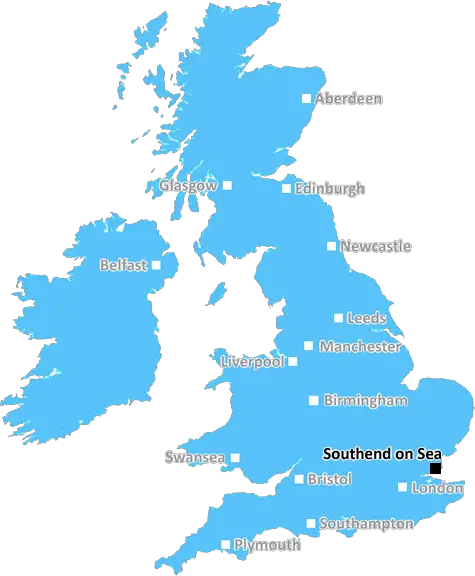
southend-on-sea SS7 Postcodes
Spending a fortune on conveyancing?

Compare instant, low-cost online quotes from trusted conveyancing solicitors.
Backed by experts, our no-obligation service searches through the best conveyancing quotes on the market to save you time and money.
Southend On Sea (SS7)
The SS7 postcode area is located in the Southend On Sea postcode town region, within the county of Essex, and contains a total of 1515 individual postcodes.
There are 11 electoral wards in the SS7 postcode area, including Basildon, Benfleet, Canvey Island, Hockley, Leigh-On-Sea, Rayleigh, Rochford, Southend-On-Sea, Stanford-Le-Hope, Westcliff-On-Sea, Wickford which come under the local authority of the Castle Point Council.
Combining the whole postcode region, 21% of people in SS7 are classed as having an AB social grade, (i.e. 'white-collar' middle-upper class), compared to 27% across the UK.
This does not mean that the people of SS7 are poorer than other areas, but it may give an indication that there are areas of deprivation.
SS7 is a postcode in the Southend on Sea district of the United Kingdom, located in the south of England. It lies within the boundaries of Rochford borough, and is part of the Essex region. The SS postcode format consists of a two-character outward code (�SS� for Essex) followed by a single number and two letters, with each individual sector letter providing a further level of detail.
SS7 covers the eastern portions of Hawkwell, Ashingdon, Rochford and Hockley. This postcode district also includes the parishes of North Fambridge, Stow Maries, Cold Norton, Hullbridge, Canewdon, Paglesham and Foulness. The total population of the postcode district is 19,849, with 8,517 dwellings recorded in the 2011 census.
The SS7 postcode district offers a range of amenities and leisure activities. There are a variety of local shops and supermarkets, and a selection of pubs, restaurants, and cafes. It's also well situated for an array of outdoor activities, with the nearby Shenfield Common and Ham Hill both providing scenic trails and pleasant outdoor spaces.
Public transport links are good, with a regular bus route running through the area. SS7 has also been designated as a Cycle Network route, providing a further option for sustainable travel.
Education facilities in SS7 are provided by the Rochford District Humanities and Arts College, plus a number of smaller primary and pre-schools within the postcode district. Healthcare in the area is managed by the Rochford and Castle Point Foundation Trust, responsible for a range of community healthcare services throughout the region.
Major employers in the SS7 area include TTTSteering Ltd, Air Products Plc and the Military Aviation Museum. In addition, the district is home to some of Essex's oldest working farms, providing locally sourced fruit, vegetables and meat produce.

Demographics

Essex

SS7 is located in the county of Essex, in England.
Essex has a total population of 1,802,200, making it the 7th largest county in the UK.
Essex has a total area of 1417 square miles, and a population density of 491 people per square kilometre. For comparison, Greater London has a density of 5,618 people/km2.
| Outward Code | SS7 |
| Postal Town | Southend On Sea |
| MSOA Name | Castle Point 004 |
| LSOA Name | Castle Point 004B |
| County | Essex |
| Region | Essex |
| Country | England |
| Local Authority | Castle Point |
| Area Classification | Urban with City and Town |
SS7 Electoral Wards
The postal region of SS7, includes the local towns, villages, electoral wards and stations of:
Dig even deeper into the SS7 postcode by clicking on a postcode below:
Click on an outward postal code below for more information about the area. Each 'outward' postcode give you a comprehensive list of all postcodes within the outward code area (SS) and estimated address.
Click on an 'outward' code for more information. For example, the outward postcode page 'EC2M' will give you an alphabetical list covering all postcodes located in the region, from 'EC2M 1BB' through to 'EC2M 7YA'.
BO, southend-on-sea
Friday, April 5, 2019
Neighbours tend to be very insular. There is a degree of politeness but not to the extent of a welcoming community. Lots of walking and dog walkers, an influx of young families with children is helping to renew the age profile. More could be done to some houses to reflect pride in the house frontages. Eg getting rid of old and abandoned cars. All in all though it's a pleasant enough neighbourhood with no one bothering anyone.
Add your view of SS7
People need your local expertise. If you live in SS7 or have first-hand knowledge of the neighbourhood, please consider sharing your views. It's completely anonymous - all we ask is for your initials.
Please tell us what you like about the SS7 postcode area, what you don't like, and what it's like to live or work here.
| LOCAL AMENITIES | |
| FAMILY FRIENDLY | |
| PARKING | |
| GREEN SPACES |
Local News Essex
Ted Baker to shut 15 stores in UK - but Stansted Airport and Braintree stores will remain open
The fashion company - which has two stores in the north of the county - went into administration last month
Essex LiveFord Focus written-off in late night Leigh hit-and-run
The Bellhouse Crescent resident's car is now set to be scrapped and he is appealing for any witnesses or anyone with CCTV footage which could show the crash
The EchoA127 plans to demolish Dick Turpin pub are thrown out
Basildon Council has rejected the application due to the potential loss of a non-designated heritage asset.
The EchoA12 traffic was held on Saturday night due to 'vehicle fire'
The incident took place shortly before 10pm on Saturday night near Kelvedon when a vehicle was 100 per cent alight, a fire service spokesman said.
Daily Gazette9-year-old pianist stars in Wivenhoe charity concert
A multi-generational charity concert featuring a nine-year-old piano prodigy will be held next month at St Mary's Church, Wivenhoe.
Daily GazetteL&G acquires Cambridgeshire BTR scheme from Stonebond
The 41-unit development comprises 10 flats and 31 houses.
Property WeekPaddington hotel to go under the hammer for 16m at Strettons' April auction
The asset is among the highest-valued lots ever to be offered at an auction in the UK.
Property Week'Strong possibility' of Clarke rematch - Wardley
British heavyweight champion Fabio Wardley says there is a "very strong possibility" of a hotly-anticipated rematch with Frazer Clarke.
BBC NewsFrom the Postcode Area blog

Deciphering Crime Rates - a Deep Dive Into UK Postcode Analysis
Ever wondered about the crime rate in your UK postcode? You're not alone. We've dug deep into the data, uncovering trends and patterns that'll make your head spin.

Death of the High Street?
The BBC reports that despite councils' attempts to kurb them, the UK's high streets have seen a huge growth in fast food outlets. Could this mark the death knell for the Great British high street, and what can we do about it to halt its decline?

Discrimination by Postcode
You really couldn't make it up, could you? Some of the country's most vulnerable people are missing out on their weekly £25 Cold Weather Payment, just because the system that's in operation is discriminating against them because payments are based on postcode, rather than geographic location.

The Redesign is Underway
Well, the current website was absolutely in dire need of a good redesign - from the ground up. So I set out to pull it all apart and get it up and running again to become the most comprehensive guide to every postcode in the UK. And it's been a long, tough job from start to finish - and quite possibly the biggest project I've ever undertaken.
SOCIAL GRADES
According to census records, 21% of people here have a social grade of AB (highest), compared to the national average of 27%.