southend-on-sea SS5 Postcodes
Spending a fortune on conveyancing?

Compare instant, low-cost online quotes from trusted conveyancing solicitors.
Backed by experts, our no-obligation service searches through the best conveyancing quotes on the market to save you time and money.
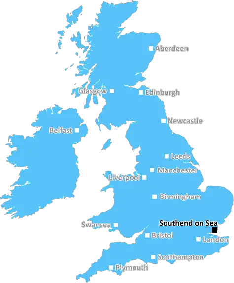
Southend On Sea (SS5)
The SS5 postcode area is located in the Southend On Sea postcode town region, within the county of Essex, and contains a total of 733 individual postcodes.
There are 8 electoral wards in the SS5 postcode area, including Basildon, Benfleet, Canvey Island, Hockley, Leigh-On-Sea, Rayleigh, Rochford, Southend-On-Sea, Stanford-Le-Hope, Westcliff-On-Sea, Wickford which come under the local authority of the Rochford Council.
Combining the whole postcode region, 24% of people in SS5 are classed as having an AB social grade, (i.e. 'white-collar' middle-upper class), compared to 27% across the UK.
This does not mean that the people of SS5 are poorer than other areas, but it may give an indication that there are areas of deprivation.
SS5 is a postcode district in the Southend-on-Sea borough of Essex, England. It covers the suburbs of Hawkwell, Hullbridge and Rawreth, located east of Rochford. It is bordered by the SS4 and SS6 postcodes to the north, the SS4 postcode to the west, the SS7 postcode to the south and the Canvey Island postcodes to the east. It is located within the parliamentary constituency of Rochford and Southend-East.
The SS5 postcode serves a range of commercial, shopping and leisure activities, including the Shire Retail Park, Beedell Gardens Industrial Estate, Asda, Morrisons, Tesco, Wickford Market, The Bell, The Royal Oak and The Cheshire Cat pubs and the Focus and Society nightclubs.
The SS5 postcode includes a wide range of housing from older local authority properties to modern family homes, often with gardens, as well as flats in purpose-built apartment blocks. Through the district, the River Crouch forms clusters of moorings and jetties, providing access to the sea. The area also has a large number of modern residential streets, which have formed the bulk of its settlement and expansion in recent decades.
Education in the SS5 postcode district is provided by several schools including the Hawkwell Primary School and Hullbridge Primary School for younger children as well as St. Peter's and Honywood Comprehensive Schools for older children. Additionally, the Prittle Brook Children's Centre provides childcare services, supporting families with children aged 0-4.
Transportation within the SS5 postcode district is provided by a number of bus routes operated by services like Arriva, First, Go-Ahead, and Thameslink. Manchester Airport is the closest international airport, located just over an hour away by train.

Demographics

Essex

SS5 is located in the county of Essex, in England.
Essex has a total population of 1,802,200, making it the 7th largest county in the UK.
Essex has a total area of 1417 square miles, and a population density of 491 people per square kilometre. For comparison, Greater London has a density of 5,618 people/km2.
| Outward Code | SS5 |
| Postal Town | Southend On Sea |
| MSOA Name | Rochford 003 |
| LSOA Name | Rochford 003E |
| County | Essex |
| Region | Essex |
| Country | England |
| Local Authority | Rochford |
| Area Classification | Urban with City and Town |
SS5 Electoral Wards
The postal region of SS5, includes the local towns, villages, electoral wards and stations of:
Dig even deeper into the SS5 postcode by clicking on a postcode below:
Click on an outward postal code below for more information about the area. Each 'outward' postcode give you a comprehensive list of all postcodes within the outward code area (SS) and estimated address.
Click on an 'outward' code for more information. For example, the outward postcode page 'EC2M' will give you an alphabetical list covering all postcodes located in the region, from 'EC2M 1BB' through to 'EC2M 7YA'.
Chris H
Monday, April 15, 2024
We don't have any views of SS5 right now. If you live in SS5 or have visited it, please help us to help others by telling others what you think of this neighbourhood.
Add your view of SS5
People need your local expertise. If you live in SS5 or have first-hand knowledge of the neighbourhood, please consider sharing your views. It's completely anonymous - all we ask is for your initials.
Please tell us what you like about the SS5 postcode area, what you don't like, and what it's like to live or work here.
| LOCAL AMENITIES | |
| FAMILY FRIENDLY | |
| PARKING | |
| GREEN SPACES |
Local News Essex
Essex Police set up cordon in St John's Green, Colchester
Police set up the cordon in St John's Green, Colchester, on Saturday morning. A police van also blocked entry to the area from the A134.
The EchoGove rejects 12-storey hotel and energy park plan for Bucks village
Developer Adveneco had proposed an exemplar of sustainable development for the site in Dorney.
Property WeekHomes England acquires Worthing site to deliver 250 homes
The acquisition forms part of the body's plans to regenerate challenging brownfield areas.
Property WeekColchester author and illustrator reveal new children's book
An author-illustrator pair is set to take the literary world by storm with a series of children's books.
Daily GazetteThe Essex MPs most active in Parliament and the one yet to speak this year
Sir Duddridge is among a significant number of MPs who have failed to speak up in Parliament since the New Year.
Essex LiveCCTV image released after man is robbed of wallet as he walked down Shoeburyness street
Police want to speak to the man pictured in connection with the incident
Essex LiveWhat flowers and plants are best for bees in the UK?
The experts at Flying Flowers have produced a guide on the best flowers and plants for you to bring bees to your garden.
Daily GazetteThe village just a short drive from Essex that played a key part in a Harry Potter film
The area's 'striking architecture' has made it a popular filming location in the past
Essex LiveFrom the Postcode Area blog

Deciphering Crime Rates - a Deep Dive Into UK Postcode Analysis
Ever wondered about the crime rate in your UK postcode? You're not alone. We've dug deep into the data, uncovering trends and patterns that'll make your head spin.

Death of the High Street?
The BBC reports that despite councils' attempts to kurb them, the UK's high streets have seen a huge growth in fast food outlets. Could this mark the death knell for the Great British high street, and what can we do about it to halt its decline?

Discrimination by Postcode
You really couldn't make it up, could you? Some of the country's most vulnerable people are missing out on their weekly £25 Cold Weather Payment, just because the system that's in operation is discriminating against them because payments are based on postcode, rather than geographic location.

The Redesign is Underway
Well, the current website was absolutely in dire need of a good redesign - from the ground up. So I set out to pull it all apart and get it up and running again to become the most comprehensive guide to every postcode in the UK. And it's been a long, tough job from start to finish - and quite possibly the biggest project I've ever undertaken.
SOCIAL GRADES
According to census records, 24% of people here have a social grade of AB (highest), compared to the national average of 27%.