southampton SO31 Postcodes
Spending a fortune on conveyancing?

Compare instant, low-cost online quotes from trusted conveyancing solicitors.
Backed by experts, our no-obligation service searches through the best conveyancing quotes on the market to save you time and money.
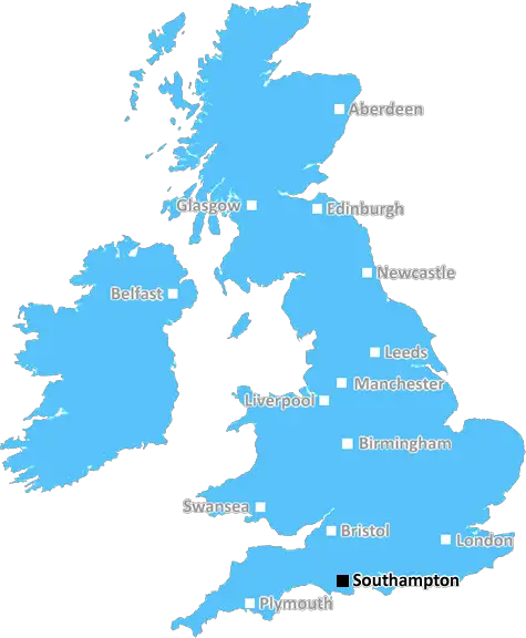
Southampton (SO31)
The SO31 postcode area is located in the Southampton postcode town region, within the county of , and contains a total of 1533 individual postcodes.
There are 26 electoral wards in the SO31 postcode area, including Alresford, Brockenhurst, Eastleigh, Lymington, Lyndhurst, Romsey, Southampton, Stockbridge, Winchester which come under the local authority of the Council.
Combining the whole postcode region, 31% of people in SO31 are classed as having an AB social grade, (i.e. 'white-collar' middle-upper class), compared to 27% across the UK.
This does not mean that the people of SO31 are wealthier - or higher class - than average, but it can be an indication that the area may be prospering and desirable to live in.
The SO31 postcode is a postcode district in Hampshire that covers largely the area and town of Eastleigh. It lies within the SO (Southampton) postal area and additionally covers several sub districts. The SO31 postcode area starts in the North-West at the Itchen River, covering Eastleigh and then moving South-Eastward beyond Fair Oak and Bishopstoke.
The SO31 postcode is served by Eastleigh overground railway station, which provides services to Portsmouth, Southampton, Salisbury and other cities further afield such as London and Bournemouth. Eastleigh also has many nearby shopping centres, including The Swan Centre and Village Centre, which are popular destinations for local residents.
Within the SO31 postcode there are many different types of housing. This includes large detached properties, bungalows and semi-detached homes. These are spread across a select few neighbourhoods, namely the townships of Eastleigh, Fair Oak, Bishopstoke and Hedge End. In total there are approximately 15,000 homes in the SO31 postcode district.
The area is served by several good state primary and secondary schools, including Bishopstoke Park School, Hiltingbury Junior School, as well as numerous private primary and secondary schools too.
Eastleigh is home to many parks and green spaces. These include The David English Gardens, which provides a picturesque setting for a Victorian manor and its surrounding parklands; Leigh Park, which offers itself as a place to walk, relax, and football playing fields; and Allbrook and North Stoneham Park, which offer sports fields, a pond, children's play area, and much more.
In terms of health needs, Eastleigh is served by Southampton University Hospitals NHS Trust (SUHNT) and the University Hospital Southampton (UHS) provides acute services such as A&E, specialist services, cancer care and maternity. In addition, several doctors' surgeries are dotted around Eastleigh.
The SO31 district is home to a vast selection of recreation opportunities, from golf courses, to libraries, to a well utilised cinema, and a wide variety of restaurants and pubs. There are a large number of churches in and around the postcode area, reflecting the strong Christian community. Additionally, Eastley also has a n entrepreneurial park on its outskirts, hosting a range of businesses.

Demographics


SO31 is located in the county of , in .
has a total population of 0, making it the largest county in the UK.
has a total area of square miles, and a population density of people per square kilometre. For comparison, Greater London has a density of 5,618 people/km2.
| Outward Code | SO31 |
| Postal Town | Southampton |
| MSOA Name | |
| LSOA Name | |
| County | |
| Region | |
| Country | |
| Local Authority | |
| Area Classification | Unclassified |
SO31 Electoral Wards
The postal region of SO31, includes the local towns, villages, electoral wards and stations of:
Dig even deeper into the SO31 postcode by clicking on a postcode below:
Click on an outward postal code below for more information about the area. Each 'outward' postcode give you a comprehensive list of all postcodes within the outward code area (SO) and estimated address.
Click on an 'outward' code for more information. For example, the outward postcode page 'EC2M' will give you an alphabetical list covering all postcodes located in the region, from 'EC2M 1BB' through to 'EC2M 7YA'.
Chris H
Saturday, April 6, 2024
We don't have any views of SO31 right now. If you live in SO31 or have visited it, please help us to help others by telling others what you think of this neighbourhood.
Add your view of SO31
People need your local expertise. If you live in SO31 or have first-hand knowledge of the neighbourhood, please consider sharing your views. It's completely anonymous - all we ask is for your initials.
Please tell us what you like about the SO31 postcode area, what you don't like, and what it's like to live or work here.
| LOCAL AMENITIES | |
| FAMILY FRIENDLY | |
| PARKING | |
| GREEN SPACES |
Local News Hampshire
Penguin in bid to become world champion
Frank from Paultons Park is a contestant in the international March of the Penguin Madness competition.
BBC NewsWinchester CUPP launches new Sushi range with 10 meal deal
CUPP launches new Sushi range with 10 meal deal in Winchester branch
Hampshire ChronicleWinchester Taylor Wimpey supports Food Bank with Easter eggs
Taylor Wimpey Southern Counties have given over 700 Easter Eggs to local hospitals and food banks this Easter.
Hampshire ChronicleRussia's neighbours urge Nato allies to bring back military service
Following Vladimir Putin's full-scale invasion of Ukraine, conscription is being rebooted and expanded across Europe.
BBC NewsBishop's Waltham community news
A FOOD festival is making its return to a Hampshire market town. Bishop's Waltham Bites will be held in the town centre on Saturday, April 20 from 11am to 3pm. It will costs 8 and include Anyfish, &hellip
Hampshire ChronicleHistorical watermill to close to the public
Calbourne Mill, the Isle of Wight's only working watermill, will close to the public on 14 April.
BBC NewsPensioner buys Ukrainian refugees home
Oksana and her two daughters fled Ukraine two years ago and now have their own home.
BBC NewsAntiques expert talks about chairs and why we should buy an old settee
It's said that the average person spends seven hours a day sitting,
Hampshire ChronicleFrom the Postcode Area blog

Deciphering Crime Rates - a Deep Dive Into UK Postcode Analysis
Ever wondered about the crime rate in your UK postcode? You're not alone. We've dug deep into the data, uncovering trends and patterns that'll make your head spin.

Death of the High Street?
The BBC reports that despite councils' attempts to kurb them, the UK's high streets have seen a huge growth in fast food outlets. Could this mark the death knell for the Great British high street, and what can we do about it to halt its decline?

Discrimination by Postcode
You really couldn't make it up, could you? Some of the country's most vulnerable people are missing out on their weekly £25 Cold Weather Payment, just because the system that's in operation is discriminating against them because payments are based on postcode, rather than geographic location.

The Redesign is Underway
Well, the current website was absolutely in dire need of a good redesign - from the ground up. So I set out to pull it all apart and get it up and running again to become the most comprehensive guide to every postcode in the UK. And it's been a long, tough job from start to finish - and quite possibly the biggest project I've ever undertaken.
SOCIAL GRADES
According to census records, 31% of people here have a social grade of AB (highest), compared to the national average of 27%.