slough SL9 Postcodes
Spending a fortune on conveyancing?

Compare instant, low-cost online quotes from trusted conveyancing solicitors.
Backed by experts, our no-obligation service searches through the best conveyancing quotes on the market to save you time and money.
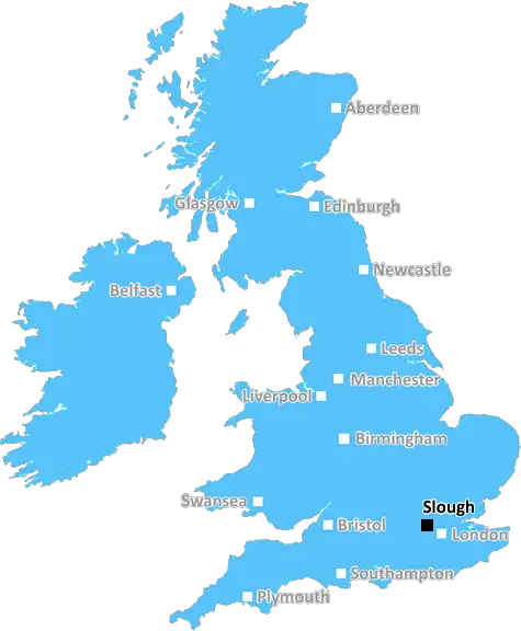
Slough (SL9)
The SL9 postcode area is located in the Slough postcode town region, within the county of Buckinghamshire, and contains a total of 1328 individual postcodes.
There are 15 electoral wards in the SL9 postcode area, including Ascot, Bourne End, Gerrards Cross, Iver, Maidenhead, Marlow, Slough, Windsor which come under the local authority of the Chiltern Council.
Combining the whole postcode region, 45% of people in SL9 are classed as having an AB social grade, (i.e. 'white-collar' middle-upper class), compared to 27% across the UK.
This does not mean that the people of SL9 are wealthier - or higher class - than average, but it can be an indication that the area may be prospering and desirable to live in.
SL9 is a postcode in the Slough district of Buckinghamshire in the United Kingdom. It is located to the south of Slough, within the borough of South Bucks, and includes the villages of Iver, Iver Heath, Dorney and Woolmer Green. The postcode is mainly residential, covering a large number of homes and small businesses.
SL9 includes the well-known Pinewood Studios, a world-renowned film, television and video production studio which has been the location of many famous film and television productions including James Bond, The Avengers, and Tinker Tailor Soldier Spy, alongside many more.
The area has excellent transport links to London, with the M25 motorway and Heathrow Airport both nearby, a direct rail link to London Paddington, picking up at both Iver railway station and nearby Slough, and easy access to London Heathrow airport by car or bus.
SL9 contains many well-known landmarks, including the grand Iver golf course, Crane Park Nature Reserve, Denham Country Park and Black Park, a 1000 acre parkland woodland that was a famous location for a number of feature films.
A number of local businesses and retailers are based in the area, including large retail centres such as Uxbridge Retail Park, and many well-known restaurants, bars and pubs.
Education is also of a high standard in SL9, with a good number of schools in the area, including Iver Heath Primary School and the nearby Nelson Primary School, as well as other well-regarded private and state-run schools in surrounding areas such as Harefield Academy, Windsor Boys' and Girls' School.
The healthcare system in the SL9 postcode is also well-developed, with many primary care health clinics and GPs that provide a wide range of medical services, and strong links to local hospitals in the area such as Wexham Park and Hillingdon Hospitals.
In addition, there are many sports clubs and activities available in the area, as well as numerous parks and recreational facilities. Finally, local places of worship of all denominations are also well represented in the area.

Demographics

Buckinghamshire

SL9 is located in the county of Buckinghamshire, in England.
Buckinghamshire has a total population of 799,200, making it the 30th largest county in the UK.
Buckinghamshire has a total area of 723 square miles, and a population density of 426 people per square kilometre. For comparison, Greater London has a density of 5,618 people/km2.
| Outward Code | SL9 |
| Postal Town | Slough |
| MSOA Name | Chiltern 011 |
| LSOA Name | Chiltern 011A |
| County | Buckinghamshire |
| Region | Buckinghamshire |
| Country | England |
| Local Authority | Chiltern |
| Area Classification | Urban with Significant Rural (rural including hub towns 26-49%) |
SL9 Electoral Wards
The postal region of SL9, includes the local towns, villages, electoral wards and stations of:
Dig even deeper into the SL9 postcode by clicking on a postcode below:
Click on an outward postal code below for more information about the area. Each 'outward' postcode give you a comprehensive list of all postcodes within the outward code area (SL) and estimated address.
Click on an 'outward' code for more information. For example, the outward postcode page 'EC2M' will give you an alphabetical list covering all postcodes located in the region, from 'EC2M 1BB' through to 'EC2M 7YA'.
Chris H
Sunday, April 7, 2024
We don't have any views of SL9 right now. If you live in SL9 or have visited it, please help us to help others by telling others what you think of this neighbourhood.
Add your view of SL9
People need your local expertise. If you live in SL9 or have first-hand knowledge of the neighbourhood, please consider sharing your views. It's completely anonymous - all we ask is for your initials.
Please tell us what you like about the SL9 postcode area, what you don't like, and what it's like to live or work here.
| LOCAL AMENITIES | |
| FAMILY FRIENDLY | |
| PARKING | |
| GREEN SPACES |
Local News Buckinghamshire
Mirabaud buys Virgin Atlantic HQ in UK debut
Swiss investor snaps up grade-A office scheme let to Virgin Atlantic until 2032.
Property WeekCarter Jonas opens first Kent office
The office will be lead by Steven Drennan, a partner in Carter Jonas's infrastructure team.
Property WeekFirst-time buyers account for record third of all housing sales
Hamptons' research also showsthe most popular area to a buy home for first-time buyers is Slough.
Property WeekResidents emotional as Bedford postie retires
Graham McFiggins is said to have done more for the community than delivering letters.
BBC NewsAm-dram group thankful for support after burglary
The group says equipment worth about 5,000 was taken from its village hall base.
BBC NewsTT Group sells BT's old Southampton offices to consortium
BT's former Friary House office building has permission for residential conversion under permitted development rights.
Property Week99 for a private ambulance in Hertfordshire
MET Medical has launched the service for St Albans, Harpenden, Hatfield and Welwyn.
BBC NewsMixed-use London freehold to lead Allsop's March residential auction
Thefreeholdbuilding in Hampstead is guided at 2.5m-plus.
Property WeekFrom the Postcode Area blog

Deciphering Crime Rates - a Deep Dive Into UK Postcode Analysis
Ever wondered about the crime rate in your UK postcode? You're not alone. We've dug deep into the data, uncovering trends and patterns that'll make your head spin.

Death of the High Street?
The BBC reports that despite councils' attempts to kurb them, the UK's high streets have seen a huge growth in fast food outlets. Could this mark the death knell for the Great British high street, and what can we do about it to halt its decline?

Discrimination by Postcode
You really couldn't make it up, could you? Some of the country's most vulnerable people are missing out on their weekly £25 Cold Weather Payment, just because the system that's in operation is discriminating against them because payments are based on postcode, rather than geographic location.

The Redesign is Underway
Well, the current website was absolutely in dire need of a good redesign - from the ground up. So I set out to pull it all apart and get it up and running again to become the most comprehensive guide to every postcode in the UK. And it's been a long, tough job from start to finish - and quite possibly the biggest project I've ever undertaken.
SOCIAL GRADES
According to census records, 45% of people here have a social grade of AB (highest), compared to the national average of 27%.