dartford DA14 Postcodes
Spending a fortune on conveyancing?

Compare instant, low-cost online quotes from trusted conveyancing solicitors.
Backed by experts, our no-obligation service searches through the best conveyancing quotes on the market to save you time and money.
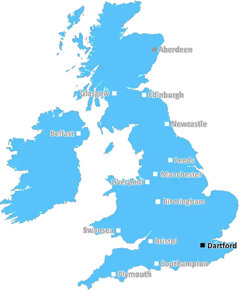
Dartford (DA14)
The DA14 postcode area is located in the Dartford postcode town region, within the county of Greater London, and contains a total of 732 individual postcodes.
There are 7 electoral wards in the DA14 postcode area, including Belvedere, Bexley, Bexleyheath, Dartford, Erith, Gravesend, Greenhithe, Longfield, Sidcup, Swanscombe, Welling which come under the local authority of the Bexley Council.
Combining the whole postcode region, 24% of people in DA14 are classed as having an AB social grade, (i.e. 'white-collar' middle-upper class), compared to 27% across the UK.
This does not mean that the people of DA14 are poorer than other areas, but it may give an indication that there are areas of deprivation.
The DA14 postcode is a postcode district in the UK, covering parts of south-east London, Kent and Bexley. It is located in the London Borough of Bexley, to the east of London's financial district.
The district is mainly residential, and is known for its proximity to the River Thames and Dartford Crossing. It is bordered by the post towns of Dartford, Greenwich and Bexley. The area lies between the outskirts of London towards southeast Kent, so it is an attractive and popular area for commuters and businesses alike. The urban sprawl is made up of a number of suburban towns, of which Sidcup is the largest.
DA14 postcodes predominantly include the towns of Albany Park, Northumberland Heath, Crayford, Bexleyheath, Sidcup and parts of Slade Green. Landmarks in the area include Danson Park and Crook Log Leisure Centre, and Erith Stadium.
The area has a selection of highly regarded schools and colleges, including The John Roan School, Bexley Grammar School and St Paul's CofE Primary School. There are leisure activities available for all ages, such as Kew Gardens, the historic Hall Place and Bexley and The British Music Experience.
Shopping facilities in the area are high quality and varied, with cafes, supermarkets, department stores and independent stores all available. Transport links are excellent, with regular trains to London and access to the TFL Underground, M25 and M20 motorways. The area also has numerous bus services and routes which run around and through the district.
DA14 postcode is an attractive place to live, offering residents and businesses a vibrant and modern living experience that is close to the heart of London. Residents can enjoy the convenience of London living with excellent transport links while still being able to enjoy a suburban lifestyle.

Demographics

Greater London

DA14 is located in the county of Greater London, in England.
Greater London has a total population of 8,778,500, making it the 1st largest county in the UK.
Greater London has a total area of 606 square miles, and a population density of 5594 people per square kilometre. For comparison, Greater London has a density of 5,618 people/km2.
| Outward Code | DA14 |
| Postal Town | Dartford |
| MSOA Name | Bexley 027 |
| LSOA Name | Bexley 027F |
| County | Greater London |
| Region | Greater London |
| Country | England |
| Local Authority | Bexley |
| Area Classification | Urban with Major Conurbation |
DA14 Electoral Wards
The postal region of DA14, includes the local towns, villages, electoral wards and stations of:
Dig even deeper into the DA14 postcode by clicking on a postcode below:
Click on an outward postal code below for more information about the area. Each 'outward' postcode give you a comprehensive list of all postcodes within the outward code area (DA) and estimated address.
Click on an 'outward' code for more information. For example, the outward postcode page 'EC2M' will give you an alphabetical list covering all postcodes located in the region, from 'EC2M 1BB' through to 'EC2M 7YA'.
Chris H
Sunday, April 7, 2024
We don't have any views of DA14 right now. If you live in DA14 or have visited it, please help us to help others by telling others what you think of this neighbourhood.
Add your view of DA14
People need your local expertise. If you live in DA14 or have first-hand knowledge of the neighbourhood, please consider sharing your views. It's completely anonymous - all we ask is for your initials.
Please tell us what you like about the DA14 postcode area, what you don't like, and what it's like to live or work here.
| LOCAL AMENITIES | |
| FAMILY FRIENDLY | |
| PARKING | |
| GREEN SPACES |
Local News Kent
Great big hole' in town centre set to finally be filled
A development of 17 flats set to fill a great big hole in a town centre is due to be completed next year, bosses say.
Kent OnlineBradford City 1-0 Gillingham
Gillingham's play-off hopes take another dent with a second defeat in five days in Yorkshire.
BBC NewsPlaces for People acquires Rosewood Housing
The affordable homes provider was previously owned by housing developer Inland Homes.
Property WeekFirst-time buyers account for record third of all housing sales
Hamptons' research also showsthe most popular area to a buy home for first-time buyers is Slough.
Property WeekCan Surrey be beaten as County Championship returns?
With the new County Championship season starting on Friday, can anyone prevent Surrey winning a third straight title?
BBC NewsL&G acquires Cambridgeshire BTR scheme from Stonebond
The 41-unit development comprises 10 flats and 31 houses.
Property WeekUniversity staff vote to strike over job losses and cut courses
Staff at a Kent university have voted to strike over courses being cut and in defence of jobs.
Kent OnlineGames retailer signs HQ pre-let at London Brentwood Commercial Park
Wayland Games will occupy the space at Goodman's Essex development from 2025.
Property WeekFrom the Postcode Area blog

Deciphering Crime Rates - a Deep Dive Into UK Postcode Analysis
Ever wondered about the crime rate in your UK postcode? You're not alone. We've dug deep into the data, uncovering trends and patterns that'll make your head spin.

Death of the High Street?
The BBC reports that despite councils' attempts to kurb them, the UK's high streets have seen a huge growth in fast food outlets. Could this mark the death knell for the Great British high street, and what can we do about it to halt its decline?

Discrimination by Postcode
You really couldn't make it up, could you? Some of the country's most vulnerable people are missing out on their weekly £25 Cold Weather Payment, just because the system that's in operation is discriminating against them because payments are based on postcode, rather than geographic location.

The Redesign is Underway
Well, the current website was absolutely in dire need of a good redesign - from the ground up. So I set out to pull it all apart and get it up and running again to become the most comprehensive guide to every postcode in the UK. And it's been a long, tough job from start to finish - and quite possibly the biggest project I've ever undertaken.
SOCIAL GRADES
According to census records, 24% of people here have a social grade of AB (highest), compared to the national average of 27%.