sheffield S43 Postcodes
Spending a fortune on conveyancing?

Compare instant, low-cost online quotes from trusted conveyancing solicitors.
Backed by experts, our no-obligation service searches through the best conveyancing quotes on the market to save you time and money.
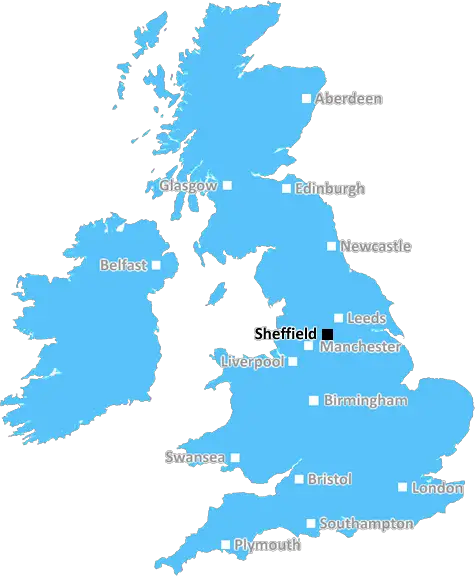
Sheffield (S43)
The S43 postcode area is located in the Sheffield postcode town region, within the county of Derbyshire, and contains a total of 1220 individual postcodes.
There are 47 electoral wards in the S43 postcode area, including Barnsley, Chesterfield, Dronfield, Hope Valley, Mexborough, Rotherham, Sheffield, Worksop which come under the local authority of the Chesterfield Council.
Combining the whole postcode region, 14% of people in S43 are classed as having an AB social grade, (i.e. 'white-collar' middle-upper class), compared to 27% across the UK.
This does not mean that the people of S43 are poorer than other areas, but it may give an indication that there are areas of deprivation.
The S43 postcode is located in the Sheffield district of South Yorkshire, England. It includes the villages of Beighton, Mosborough, Ridgeway, Wales, and Westfield, as well as parts of Killamarsh, Renishaw, and Treeton. The area is well-known for its rolling hills, countryside, and scenic views.
The postcode area is served by a variety of amenities and services, including schools, supermarkets, doctors' surgeries, essential transport links, eateries, and leisure activities. Beighton and Mosborough have seen the biggest transformation over the past few years, with the building of new homes as part of the mass regeneration of the area.
Beighton is currently home to a number of popular local businesses, such as the independent Beigel Bake, which serves some of the best bagels in Sheffield, and the Steel Barbers. Cyclists and walkers alike can make use of the Trans Pennine Trail, which passes through Killamarsh, giving them access to two national parks, and access to both Killamarsh and Rippon Naze, allowing them to enjoy some of the best views the area has to offer.
The Beighton Lifestyle Centre is a great place for the whole community to enjoy activity classes and sports activities, such as badminton and swimming. The Ridgeway Centre houses a community library, as well as a caf� and soft play area. Here, children can enjoy a range of activities, such as reading, arts and crafts, sensory play, and music lessons.
S43 is easily accessible by road, with easy connections to the nearby M1 and M18 motorways. The nearest train station is the Sheffield Midland station, which offers direct links to Sheffield, Leeds, and beyond. The area is served by frequent bus services, making it easy to travel around the area.
Culturally, S43 is a vibrant and diverse area with a range of attractions that cater to the whole family. The nearby Chatsworth House offers visitors the chance to explore its grounds and gardens, and see the famous art collections. The numerous pubs, shops and restaurants offer something for everyone in the area. For those looking to experience something a bit different, there are plenty of bars, cinema, regular music events, and interesting markets to enjoy.

Demographics

Derbyshire

S43 is located in the county of Derbyshire, in England.
Derbyshire has a total population of 1,042,000, making it the 20th largest county in the UK.
Derbyshire has a total area of 1013 square miles, and a population density of 396 people per square kilometre. For comparison, Greater London has a density of 5,618 people/km2.
| Outward Code | S43 |
| Postal Town | Sheffield |
| MSOA Name | Chesterfield 005 |
| LSOA Name | Chesterfield 005C |
| County | Derbyshire |
| Region | Derbyshire |
| Country | England |
| Local Authority | Chesterfield |
| Area Classification | Urban with City and Town |
S43 Electoral Wards
The postal region of S43, includes the local towns, villages, electoral wards and stations of:
Dig even deeper into the S43 postcode by clicking on a postcode below:
Click on an outward postal code below for more information about the area. Each 'outward' postcode give you a comprehensive list of all postcodes within the outward code area (S) and estimated address.
Click on an 'outward' code for more information. For example, the outward postcode page 'EC2M' will give you an alphabetical list covering all postcodes located in the region, from 'EC2M 1BB' through to 'EC2M 7YA'.
Chris H
Sunday, April 7, 2024
We don't have any views of S43 right now. If you live in S43 or have visited it, please help us to help others by telling others what you think of this neighbourhood.
Add your view of S43
People need your local expertise. If you live in S43 or have first-hand knowledge of the neighbourhood, please consider sharing your views. It's completely anonymous - all we ask is for your initials.
Please tell us what you like about the S43 postcode area, what you don't like, and what it's like to live or work here.
| LOCAL AMENITIES | |
| FAMILY FRIENDLY | |
| PARKING | |
| GREEN SPACES |
Local News Derbyshire
Man who stabbed Costa worker in head jailed
Darren Laken, 31, stole a pack of knives before attacking the worker, a court hears.
BBC NewsPicture-perfect Peak District village dark past brought back to life
The village became famous after the Black Death
Derby TelegraphHuge manor house with formal gardens close to Derby city centre up for sale
Parts of the Old Rectory date back to the 1750s
Derby TelegraphLara Croft voted most iconic video game character
Lara Croft beat old favourites Mario, Sonic and Pac-Man to claim the title, voted for by gamers.
BBC News'Rarely busy' stunning beach just two hours away from Derby voted best in the region
The beach is described as an "unspoilt sandy beach backed by sand dunes"
Derby TelegraphDay one of County Championship season hit by rain
Day one of the County Championship season sees play abandoned at Derbyshire, Durham, Lancashire and Kent without a ball bowled.
BBC NewsTesco is now charging customers 10p for an item that has always been free
The supermarket chain announced it would be testing out a new pilot scheme
Derby TelegraphUnfit and frustrated Mackworth man sheds eight stone in 12 months
John turned his life around after realising he was too unfit to walk to the local park
Derby TelegraphFrom the Postcode Area blog

Deciphering Crime Rates - a Deep Dive Into UK Postcode Analysis
Ever wondered about the crime rate in your UK postcode? You're not alone. We've dug deep into the data, uncovering trends and patterns that'll make your head spin.

Death of the High Street?
The BBC reports that despite councils' attempts to kurb them, the UK's high streets have seen a huge growth in fast food outlets. Could this mark the death knell for the Great British high street, and what can we do about it to halt its decline?

Discrimination by Postcode
You really couldn't make it up, could you? Some of the country's most vulnerable people are missing out on their weekly £25 Cold Weather Payment, just because the system that's in operation is discriminating against them because payments are based on postcode, rather than geographic location.

The Redesign is Underway
Well, the current website was absolutely in dire need of a good redesign - from the ground up. So I set out to pull it all apart and get it up and running again to become the most comprehensive guide to every postcode in the UK. And it's been a long, tough job from start to finish - and quite possibly the biggest project I've ever undertaken.
SOCIAL GRADES
According to census records, 14% of people here have a social grade of AB (highest), compared to the national average of 27%.