sheffield S36 Postcodes
Spending a fortune on conveyancing?

Compare instant, low-cost online quotes from trusted conveyancing solicitors.
Backed by experts, our no-obligation service searches through the best conveyancing quotes on the market to save you time and money.
Sheffield (S36)
The S36 postcode area is located in the Sheffield postcode town region, within the county of , and contains a total of 866 individual postcodes.
There are 84 electoral wards in the S36 postcode area, including Barnsley, Chesterfield, Dronfield, Hope Valley, Mexborough, Rotherham, Sheffield, Worksop which come under the local authority of the Council.
Combining the whole postcode region, 23% of people in S36 are classed as having an AB social grade, (i.e. 'white-collar' middle-upper class), compared to 27% across the UK.
This does not mean that the people of S36 are poorer than other areas, but it may give an indication that there are areas of deprivation.
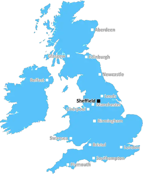
The S36 postcode is part of the Sheffield postcode district in Yorkshire and the Humber. It covers post towns, including Penistone, Hoyland, Silkstone, and Thurgoland, and a number of suburbs and villages in the area. This postcode district stretches from the edge of the Peak District in the north, down to the outskirts of Barnsley in the south, and covers a wide area of north Sheffield and a part of the Barnsley district.
It is primarily a rural area, with a large population of livestock farming, as well as extensive areas of heather moorland. Both the Peak District and the South Pennines pass through the postcode district, meaning that it is the gateway to a range of outdoor activities such as hiking, mountain biking, and horse riding.
As well as the glorious countryside, the S36 postcode district is also home to some of the finest traditional architecture in the South Yorkshire region. The most prominent of these are Silkstone Manor, a Grade-I listed building, and the Market Cross of Penistone, a Grade-II listed structure.
The postcode district is well-connected by road and rail, as it sits just off the M1 and the A628 motorway, which leads directly into Barnsley. It is served by the Penistone Line and the Dearne Valley Line, which connect the outskirts of Barnsley at Wombwell to Manchester and Leeds, via Penistone and Dodworth, respectively.
The S36 postcode district provides the perfect base for settling down, with its variety of attractive villages and towns, accompanied by an array of walks and hikes through the surrounding terrain, and an array of entertainment and leisure activities within the area. There are a number of pubs, restaurants, and bars, as well as a variety of shops and amenities, especially in Penistone. The nearby Silkstone Golf Course is a popular attraction for locals, as are the adjacent Catcliffe Flash Country Park and Wentworth Country Park. With so many great outdoor activities, a rich history of traditional architecture, and its easy accessibility to major cities in the Yorkshire region, it's no wonder the S36 postcode district is one of the most coveted in South Yorkshire.

Demographics


S36 is located in the county of , in .
has a total population of 0, making it the largest county in the UK.
has a total area of square miles, and a population density of people per square kilometre. For comparison, Greater London has a density of 5,618 people/km2.
| Outward Code | S36 |
| Postal Town | Sheffield |
| MSOA Name | |
| LSOA Name | |
| County | |
| Region | |
| Country | |
| Local Authority | |
| Area Classification | Unclassified |
S36 Electoral Wards
The postal region of S36, includes the local towns, villages, electoral wards and stations of:
Dig even deeper into the S36 postcode by clicking on a postcode below:
Click on an outward postal code below for more information about the area. Each 'outward' postcode give you a comprehensive list of all postcodes within the outward code area (S) and estimated address.
Click on an 'outward' code for more information. For example, the outward postcode page 'EC2M' will give you an alphabetical list covering all postcodes located in the region, from 'EC2M 1BB' through to 'EC2M 7YA'.
Chris H
Sunday, April 7, 2024
We don't have any views of S36 right now. If you live in S36 or have visited it, please help us to help others by telling others what you think of this neighbourhood.
Add your view of S36
People need your local expertise. If you live in S36 or have first-hand knowledge of the neighbourhood, please consider sharing your views. It's completely anonymous - all we ask is for your initials.
Please tell us what you like about the S36 postcode area, what you don't like, and what it's like to live or work here.
| LOCAL AMENITIES | |
| FAMILY FRIENDLY | |
| PARKING | |
| GREEN SPACES |
From the Postcode Area blog

Deciphering Crime Rates - a Deep Dive Into UK Postcode Analysis
Ever wondered about the crime rate in your UK postcode? You're not alone. We've dug deep into the data, uncovering trends and patterns that'll make your head spin.

Death of the High Street?
The BBC reports that despite councils' attempts to kurb them, the UK's high streets have seen a huge growth in fast food outlets. Could this mark the death knell for the Great British high street, and what can we do about it to halt its decline?

Discrimination by Postcode
You really couldn't make it up, could you? Some of the country's most vulnerable people are missing out on their weekly £25 Cold Weather Payment, just because the system that's in operation is discriminating against them because payments are based on postcode, rather than geographic location.

The Redesign is Underway
Well, the current website was absolutely in dire need of a good redesign - from the ground up. So I set out to pull it all apart and get it up and running again to become the most comprehensive guide to every postcode in the UK. And it's been a long, tough job from start to finish - and quite possibly the biggest project I've ever undertaken.
SOCIAL GRADES
According to census records, 23% of people here have a social grade of AB (highest), compared to the national average of 27%.