romford RM6 Postcodes
Spending a fortune on conveyancing?

Compare instant, low-cost online quotes from trusted conveyancing solicitors.
Backed by experts, our no-obligation service searches through the best conveyancing quotes on the market to save you time and money.
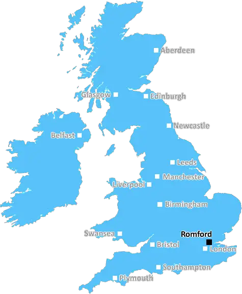
Romford (RM6)
The RM6 postcode area is located in the Romford postcode town region, within the county of Greater London, and contains a total of 756 individual postcodes.
There are 1 electoral wards in the RM6 postcode area, including Dagenham, Grays, Hornchurch, Purfleet, Rainham, Romford, South Ockendon, Tilbury, Upminster which come under the local authority of the Redbridge Council.
Combining the whole postcode region, 19% of people in RM6 are classed as having an AB social grade, (i.e. 'white-collar' middle-upper class), compared to 27% across the UK.
This does not mean that the people of RM6 are poorer than other areas, but it may give an indication that there are areas of deprivation.
The RM6 postcode in the Romford district is a postal district in London covering parts of the London Borough of Havering. It includes the area of Romford, as well as several other surrounding locations. It was allocated in 1880 when the post office first introduced postal districts.
The RM6 postcode area is roughly coterminous with the Romford ward. It lies south and east of A12 and broadly corresponds to the Romford Market area. It is north of the Gidea Park area, and northwest of Dagenham. The boundary of RM6 follows Grange Road, Squirrels Heath Lane, Ockendon Road, and Wembley Road to the west, Church Road and Osborne Road to the north, and Rom Valley Way, Balgores Lane, and Pettits Lane to the east.
The area is primarily residential, consisting mainly of terraced and semi-detached housing with some low-rise flats. It is a largely working-class district and boasts a range of traditional pubs, independent shops, and street markets throughout the week. The nearby Liberty shopping centre also provides a range of facilities.
The area is served by several bus routes that link it to wider London and various underground and overground stations, including Upney, Elm Park, and Romford. The area also benefits from its proximity to the M25, the North Circular, and the A12.
residents in the RM6 postcode area enjoy close proximity to a wide range of amenities and attractions, and the area is increasingly popular due to accessible transport links and its traditional English charm.

Demographics

Greater London

RM6 is located in the county of Greater London, in England.
Greater London has a total population of 8,778,500, making it the 1st largest county in the UK.
Greater London has a total area of 606 square miles, and a population density of 5594 people per square kilometre. For comparison, Greater London has a density of 5,618 people/km2.
| Outward Code | RM6 |
| Postal Town | Romford |
| MSOA Name | Redbridge 019 |
| LSOA Name | Redbridge 019B |
| County | Greater London |
| Region | Greater London |
| Country | England |
| Local Authority | Redbridge |
| Area Classification | Urban with Major Conurbation |
RM6 Electoral Wards
The postal region of RM6, includes the local towns, villages, electoral wards and stations of:
Dig even deeper into the RM6 postcode by clicking on a postcode below:
Click on an outward postal code below for more information about the area. Each 'outward' postcode give you a comprehensive list of all postcodes within the outward code area (RM) and estimated address.
Click on an 'outward' code for more information. For example, the outward postcode page 'EC2M' will give you an alphabetical list covering all postcodes located in the region, from 'EC2M 1BB' through to 'EC2M 7YA'.
Chris H
Sunday, April 7, 2024
We don't have any views of RM6 right now. If you live in RM6 or have visited it, please help us to help others by telling others what you think of this neighbourhood.
Add your view of RM6
People need your local expertise. If you live in RM6 or have first-hand knowledge of the neighbourhood, please consider sharing your views. It's completely anonymous - all we ask is for your initials.
Please tell us what you like about the RM6 postcode area, what you don't like, and what it's like to live or work here.
| LOCAL AMENITIES | |
| FAMILY FRIENDLY | |
| PARKING | |
| GREEN SPACES |
From the Postcode Area blog

Deciphering Crime Rates - a Deep Dive Into UK Postcode Analysis
Ever wondered about the crime rate in your UK postcode? You're not alone. We've dug deep into the data, uncovering trends and patterns that'll make your head spin.

Death of the High Street?
The BBC reports that despite councils' attempts to kurb them, the UK's high streets have seen a huge growth in fast food outlets. Could this mark the death knell for the Great British high street, and what can we do about it to halt its decline?

Discrimination by Postcode
You really couldn't make it up, could you? Some of the country's most vulnerable people are missing out on their weekly £25 Cold Weather Payment, just because the system that's in operation is discriminating against them because payments are based on postcode, rather than geographic location.

The Redesign is Underway
Well, the current website was absolutely in dire need of a good redesign - from the ground up. So I set out to pull it all apart and get it up and running again to become the most comprehensive guide to every postcode in the UK. And it's been a long, tough job from start to finish - and quite possibly the biggest project I've ever undertaken.
SOCIAL GRADES
According to census records, 19% of people here have a social grade of AB (highest), compared to the national average of 27%.