romford RM17 Postcodes
Spending a fortune on conveyancing?

Compare instant, low-cost online quotes from trusted conveyancing solicitors.
Backed by experts, our no-obligation service searches through the best conveyancing quotes on the market to save you time and money.
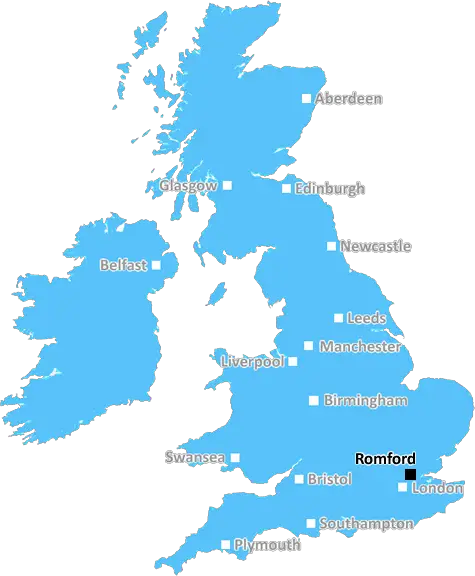
Romford (RM17)
The RM17 postcode area is located in the Romford postcode town region, within the county of Essex, and contains a total of 866 individual postcodes.
There are 1 electoral wards in the RM17 postcode area, including Dagenham, Grays, Hornchurch, Purfleet, Rainham, Romford, South Ockendon, Tilbury, Upminster which come under the local authority of the Thurrock Council.
Combining the whole postcode region, 16% of people in RM17 are classed as having an AB social grade, (i.e. 'white-collar' middle-upper class), compared to 27% across the UK.
This does not mean that the people of RM17 are poorer than other areas, but it may give an indication that there are areas of deprivation.
RM17 postcode is located in the Romford district of Essex, England. It is one of seven postcode sectors located in the town. The RM17 postcode covers areas in the northeast of Romford, stretching from Chadwell Heath in the north across to Gallows Corner and Harold Hill in the south. It also includes Occold in the west and the parts of Gidea Park in the east.
The majority of the RM17 postcode is made up of family homes built between 1930 and 1980. These include terraced, semi-detached and detached houses, as well as bungalows. A number of modern flats have been built in the area in recent years as well.
The area has several schools, including nursery, primary, secondary and special schools. In addition, there are numerous retail parks and large supermarkets located close to the area. There are popular local pubs which offer traditional home cooked meals, as well as bars and eateries around the area.
Havering College of Further and Higher Education also has its main campus within the boundaries of the RM17 postcode area.
The area is well connected and is serviced by London Buses and the Overground service, which connect the area to nearby railways stations such as Romford. The Northern line also makes stops at stations in the postcode. The area can also be easily accessed by road via several major motorways like the M25, A12, and the A127.
The area has an abundance of green spaces, such as Raphael Park, Clockhouse Lane, and Cottons Park. It also offers plenty of recreational activities such as cycling, walking, horse riding, fishing and boating.
In terms of local government, the RM17 postcode area falls under the Borough of Havering, with some parts of the area also being part of the London Borough of Barking and Dagenham.

Demographics

Essex

RM17 is located in the county of Essex, in England.
Essex has a total population of 1,802,200, making it the 7th largest county in the UK.
Essex has a total area of 1417 square miles, and a population density of 491 people per square kilometre. For comparison, Greater London has a density of 5,618 people/km2.
| Outward Code | RM17 |
| Postal Town | Romford |
| MSOA Name | Thurrock 009 |
| LSOA Name | Thurrock 009A |
| County | Essex |
| Region | Essex |
| Country | England |
| Local Authority | Thurrock |
| Area Classification | Urban with Major Conurbation |
RM17 Electoral Wards
The postal region of RM17, includes the local towns, villages, electoral wards and stations of:
Dig even deeper into the RM17 postcode by clicking on a postcode below:
Click on an outward postal code below for more information about the area. Each 'outward' postcode give you a comprehensive list of all postcodes within the outward code area (RM) and estimated address.
Click on an 'outward' code for more information. For example, the outward postcode page 'EC2M' will give you an alphabetical list covering all postcodes located in the region, from 'EC2M 1BB' through to 'EC2M 7YA'.
Chris H
Sunday, April 7, 2024
We don't have any views of RM17 right now. If you live in RM17 or have visited it, please help us to help others by telling others what you think of this neighbourhood.
Add your view of RM17
People need your local expertise. If you live in RM17 or have first-hand knowledge of the neighbourhood, please consider sharing your views. It's completely anonymous - all we ask is for your initials.
Please tell us what you like about the RM17 postcode area, what you don't like, and what it's like to live or work here.
| LOCAL AMENITIES | |
| FAMILY FRIENDLY | |
| PARKING | |
| GREEN SPACES |
Local News Essex
Places for People acquires Rosewood Housing
The affordable homes provider was previously owned by housing developer Inland Homes.
Property WeekWhat makes the best Guinness? I tested all the methods
From the pub to my own kitchen, I decided to try and find out which is the most affordable way of enjoying Guinness.
The EchoColchester man fined 60 for breaching court order
Steven Matthews, of Avon Way, Colchester, was hit with a community order in August last year.
Daily GazettePolice confirm missing Colchester woman, 38, has been found
Helen May, 38, from Colchester, is currently missing and was last seen yesterday, April 4
Daily GazetteFirst-time buyers account for record third of all housing sales
Hamptons' research also showsthe most popular area to a buy home for first-time buyers is Slough.
Property WeekColchester nurse has 2,500 e-bike stolen from McDonald's
Jo Pearson, 46, had her Specialized Turbo Como 3.0 e-bike stolen from outside McDonald's in Colchester on Monday evening.
Daily GazetteMixed-use London freehold to lead Allsop's March residential auction
Thefreeholdbuilding in Hampstead is guided at 2.5m-plus.
Property WeekDementia support group saved despite cuts
The council says its new prevention service will keep some of the expert knowledge residents value.
BBC NewsFrom the Postcode Area blog

Deciphering Crime Rates - a Deep Dive Into UK Postcode Analysis
Ever wondered about the crime rate in your UK postcode? You're not alone. We've dug deep into the data, uncovering trends and patterns that'll make your head spin.

Death of the High Street?
The BBC reports that despite councils' attempts to kurb them, the UK's high streets have seen a huge growth in fast food outlets. Could this mark the death knell for the Great British high street, and what can we do about it to halt its decline?

Discrimination by Postcode
You really couldn't make it up, could you? Some of the country's most vulnerable people are missing out on their weekly £25 Cold Weather Payment, just because the system that's in operation is discriminating against them because payments are based on postcode, rather than geographic location.

The Redesign is Underway
Well, the current website was absolutely in dire need of a good redesign - from the ground up. So I set out to pull it all apart and get it up and running again to become the most comprehensive guide to every postcode in the UK. And it's been a long, tough job from start to finish - and quite possibly the biggest project I've ever undertaken.
SOCIAL GRADES
According to census records, 16% of people here have a social grade of AB (highest), compared to the national average of 27%.