romford RM11 Postcodes
Spending a fortune on conveyancing?

Compare instant, low-cost online quotes from trusted conveyancing solicitors.
Backed by experts, our no-obligation service searches through the best conveyancing quotes on the market to save you time and money.
Romford (RM11)
The RM11 postcode area is located in the Romford postcode town region, within the county of Greater London, and contains a total of 854 individual postcodes.
There are 7 electoral wards in the RM11 postcode area, including Dagenham, Grays, Hornchurch, Purfleet, Rainham, Romford, South Ockendon, Tilbury, Upminster which come under the local authority of the Havering Council.
Combining the whole postcode region, 24% of people in RM11 are classed as having an AB social grade, (i.e. 'white-collar' middle-upper class), compared to 27% across the UK.
This does not mean that the people of RM11 are poorer than other areas, but it may give an indication that there are areas of deprivation.
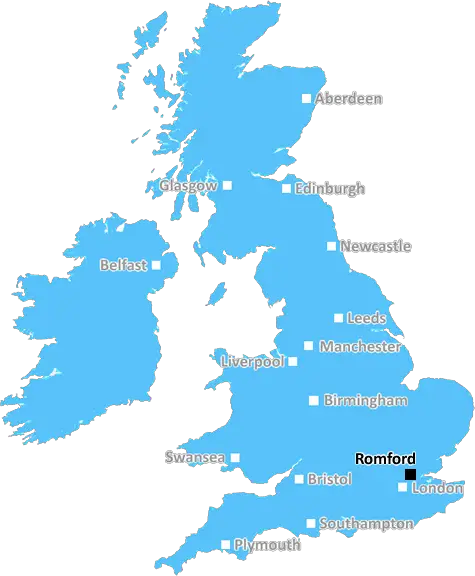
RM11 is a postcode in the north-eastern part of the Borough of Havering, located in the eastern part of Greater London. The postcode covers several parts of Romford, including parts of the Romford Town and Emerson Park wards, as well as parts of the surrounding borough. The postcode is within the local Romford post town and is served by the Romford mail sorting office.
RM11 covers a largely residential area, although there are some industrial estates and retail parks in the postcode's area too. Transport links are well served, with the nearby Romford railway station providing direct links to London Liverpool Street station as well as local regional destinations. Underground links are provided at nearby Upminster, with a number of connecting bus routes also operating in the area.
Romford is home to a number of notable landmarks which are located in the RM11 postcode, including the ancient parish church of St Edward the Confessor, located in Romford Town Centre. South Street Romford, a listed building from the 16th century, is also located in the postcode, as is Romford War Memorial Hospital. The area is also home to numerous parks and green spaces, including Ilford Place, Kelvedon Close Garden and Verderers Urban Country Park.
Romford also has a rich retail offering with a bustling market and a number of unique and independent shops adding to the town centre's unique character. High street favourites are also plentiful, with numerous major retailers in the postcode's area and a number of large shopping centres, such as Mercury Mall, offering further retail and leisure options. In addition to these, the Kingsgate Shopping Centre (formerly the Brewery Centre) is also located in the RM11 postcode.

Demographics

Greater London

RM11 is located in the county of Greater London, in England.
Greater London has a total population of 8,778,500, making it the 1st largest county in the UK.
Greater London has a total area of 606 square miles, and a population density of 5594 people per square kilometre. For comparison, Greater London has a density of 5,618 people/km2.
| Outward Code | RM11 |
| Postal Town | Romford |
| MSOA Name | Havering 016 |
| LSOA Name | Havering 016B |
| County | Greater London |
| Region | Greater London |
| Country | England |
| Local Authority | Havering |
| Area Classification | Urban with Major Conurbation |
RM11 Electoral Wards
The postal region of RM11, includes the local towns, villages, electoral wards and stations of:
Dig even deeper into the RM11 postcode by clicking on a postcode below:
Click on an outward postal code below for more information about the area. Each 'outward' postcode give you a comprehensive list of all postcodes within the outward code area (RM) and estimated address.
Click on an 'outward' code for more information. For example, the outward postcode page 'EC2M' will give you an alphabetical list covering all postcodes located in the region, from 'EC2M 1BB' through to 'EC2M 7YA'.
Chris H
Monday, April 8, 2024
We don't have any views of RM11 right now. If you live in RM11 or have visited it, please help us to help others by telling others what you think of this neighbourhood.
Add your view of RM11
People need your local expertise. If you live in RM11 or have first-hand knowledge of the neighbourhood, please consider sharing your views. It's completely anonymous - all we ask is for your initials.
Please tell us what you like about the RM11 postcode area, what you don't like, and what it's like to live or work here.
| LOCAL AMENITIES | |
| FAMILY FRIENDLY | |
| PARKING | |
| GREEN SPACES |
Local News Essex
Here's how many Essex motorists got pay-outs for pothole damage
Essex County Council paid 219,387 to 139 drivers in 2023... but only 5% of drivers received pay-outs from County Hall last year, figures show.
Daily GazetteD-Day 80th anniversary event in Southend this summer
A commemoration of the 80th anniversary of D-Day is set to be held in Southend later this summer
The EchoDebenhams Essex leisure hub opening times revealed
The former Debenhams site in Culver Square and Culver Street West is set undergo a radical transformation.
The EchoCan Surrey be beaten as County Championship returns?
With the new County Championship season starting on Friday, can anyone prevent Surrey winning a third straight title?
BBC NewsWeston Homes gets go-ahead for 33m resi scheme in Epping
The project will see the development of 62 homes and almost five acres of open space.
Property WeekEssex Police appeal to find boy, 15, last seen six days ago
Essex Police officers are searching for Marley Stapleton, 15, who is missing from the Great Dunmow area
Daily GazetteCarter Jonas opens first Kent office
The office will be lead by Steven Drennan, a partner in Carter Jonas's infrastructure team.
Property WeekA12 police stop: Two charged with human trafficking offences
Two people are charged with Class A drugs and human trafficking offences in Essex
Daily GazetteFrom the Postcode Area blog

Deciphering Crime Rates - a Deep Dive Into UK Postcode Analysis
Ever wondered about the crime rate in your UK postcode? You're not alone. We've dug deep into the data, uncovering trends and patterns that'll make your head spin.

Death of the High Street?
The BBC reports that despite councils' attempts to kurb them, the UK's high streets have seen a huge growth in fast food outlets. Could this mark the death knell for the Great British high street, and what can we do about it to halt its decline?

Discrimination by Postcode
You really couldn't make it up, could you? Some of the country's most vulnerable people are missing out on their weekly £25 Cold Weather Payment, just because the system that's in operation is discriminating against them because payments are based on postcode, rather than geographic location.

The Redesign is Underway
Well, the current website was absolutely in dire need of a good redesign - from the ground up. So I set out to pull it all apart and get it up and running again to become the most comprehensive guide to every postcode in the UK. And it's been a long, tough job from start to finish - and quite possibly the biggest project I've ever undertaken.
SOCIAL GRADES
According to census records, 24% of people here have a social grade of AB (highest), compared to the national average of 27%.