redhill RH6 Postcodes
Spending a fortune on conveyancing?

Compare instant, low-cost online quotes from trusted conveyancing solicitors.
Backed by experts, our no-obligation service searches through the best conveyancing quotes on the market to save you time and money.
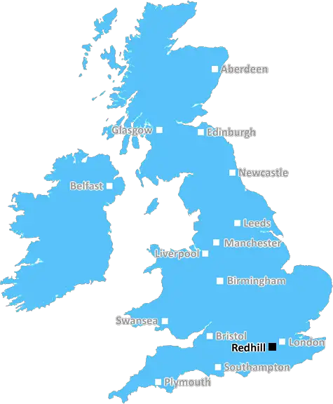
Redhill (RH6)
The RH6 postcode area is located in the Redhill postcode town region, within the county of Surrey, and contains a total of 1289 individual postcodes.
There are 20 electoral wards in the RH6 postcode area, including Betchworth, Billingshurst, Burgess Hill, Crawley, Dorking, East Grinstead, Forest Row, Gatwick, Godstone, Haywards Heath, Horley, Horsham, Lingfield, Oxted, Pulborough, Redhill, Reigate which come under the local authority of the Mole Valley Council.
Combining the whole postcode region, 25% of people in RH6 are classed as having an AB social grade, (i.e. 'white-collar' middle-upper class), compared to 27% across the UK.
This does not mean that the people of RH6 are poorer than other areas, but it may give an indication that there are areas of deprivation.
RH6 is an postcode district in the Redhill area in the southeast of England. It is located in the district of Reigate and Banstead and covers an area of about 10.45 square miles (27.04 sq km) to the west of Gatwick Airport.
RH6 falls mostly within the town of Reigate, with some parts of it taken up by Redhill, Earlswood, Smallfield, Horley, and parts of Salfords and Sidlow. The RH6 postcode is made up of two parts: Redhill (RH1) and Horley (RH6).
The local area is surrounded by a vast array of exciting leisure activities, such as leisure walks along the Mole Valley Way or the Pilgrim's Way, a national heritage trail. For the athletes, nearby Merstham cricket ground is a great place to hit some balls or enjoy an afternoon's cricket match. For golfers, the local courses are situated within easy reach and offer a great opportunity to practice.
Residents of RH6 also benefit from a close proximity to the M25 and M23 motorways linking London to the south coast. The local train service is accessible from Redhill and Horley stations, with direct routes into London and other cities across the south east of England.
The RH6 postcode offers a wide range of housing options. The town of Redhill provides a range of mid-price and luxury housing, while its modern outlying villages provide modern terraced and semidetached housing. One of the most desirable locations in the RH6 postcode is the desirable area of Gatton. This area boasts excellent quality housing, shops, and amenities in a very well-connected location.
Residents are mainly served by Horley Library and the public leisure centre located in Horley. There are also many independent shops and restaurants situated in the area. Rh6 also has an abundance of open space, parks, and nature reserves, making it a great choice for those looking for a more rural setting.

Demographics

Surrey

RH6 is located in the county of Surrey, in England.
Surrey has a total population of 1,176,500, making it the 13th largest county in the UK.
Surrey has a total area of 642 square miles, and a population density of 707 people per square kilometre. For comparison, Greater London has a density of 5,618 people/km2.
| Outward Code | RH6 |
| Postal Town | Redhill |
| MSOA Name | Mole Valley 013 |
| LSOA Name | Mole Valley 013D |
| County | Surrey |
| Region | Surrey |
| Country | England |
| Local Authority | Mole Valley |
| Area Classification | Urban with Significant Rural (rural including hub towns 26-49%) |
RH6 Electoral Wards
The postal region of RH6, includes the local towns, villages, electoral wards and stations of:
Dig even deeper into the RH6 postcode by clicking on a postcode below:
Click on an outward postal code below for more information about the area. Each 'outward' postcode give you a comprehensive list of all postcodes within the outward code area (RH) and estimated address.
Click on an 'outward' code for more information. For example, the outward postcode page 'EC2M' will give you an alphabetical list covering all postcodes located in the region, from 'EC2M 1BB' through to 'EC2M 7YA'.
Chris H
Tuesday, April 9, 2024
We don't have any views of RH6 right now. If you live in RH6 or have visited it, please help us to help others by telling others what you think of this neighbourhood.
Add your view of RH6
People need your local expertise. If you live in RH6 or have first-hand knowledge of the neighbourhood, please consider sharing your views. It's completely anonymous - all we ask is for your initials.
Please tell us what you like about the RH6 postcode area, what you don't like, and what it's like to live or work here.
| LOCAL AMENITIES | |
| FAMILY FRIENDLY | |
| PARKING | |
| GREEN SPACES |
Local News Surrey
Woman whose remains found in Croydon park named and pictured
A man and a woman have been arrested on suspicion of murder
Get SurreyThe Wheatsheaf Hotel: Popular pub with lakeside views to shut for massive refurb
A recruitment drive with a range of new jobs has been launched as part of the investment
Get SurreyOvernight road closures this week in Wisley, Staines and Caterham including on the M25, M3 and A3
Check your journey before setting off this week
Get SurreyPotential new lower speed limits coming to four Surrey areas
Molesey, Guildford, Camberley and Tandridge could all see new speed limits
Get SurreySurrey Ambulance Trust wants over a third of callouts to be done remotely by 2029
Urgent medical needs such as cardiac arrest, a stroke, heart attack, pneumonia, childbirth and newborn care will still be attended to with ambulances, the Trust said.
Get SurreyCCTV appeal after gang steal 3k of perfume from Reigate Jo Malone shop
Police have released CCTV images of three men they want to identify as part of the investigation
Get SurreyUnwanted 'slum boats' that 'change character of Surrey riverside' ordered to move
The watchdog said it hopes its actions will ensure fair access for all
Get Surrey'Heartbreaking' vandalism of Reigate Scouts minibus torched and abandoned in field
This is the second time one of the unit's mini buses has been targeted
Get SurreyFrom the Postcode Area blog

Deciphering Crime Rates - a Deep Dive Into UK Postcode Analysis
Ever wondered about the crime rate in your UK postcode? You're not alone. We've dug deep into the data, uncovering trends and patterns that'll make your head spin.

Death of the High Street?
The BBC reports that despite councils' attempts to kurb them, the UK's high streets have seen a huge growth in fast food outlets. Could this mark the death knell for the Great British high street, and what can we do about it to halt its decline?

Discrimination by Postcode
You really couldn't make it up, could you? Some of the country's most vulnerable people are missing out on their weekly £25 Cold Weather Payment, just because the system that's in operation is discriminating against them because payments are based on postcode, rather than geographic location.

The Redesign is Underway
Well, the current website was absolutely in dire need of a good redesign - from the ground up. So I set out to pull it all apart and get it up and running again to become the most comprehensive guide to every postcode in the UK. And it's been a long, tough job from start to finish - and quite possibly the biggest project I've ever undertaken.
SOCIAL GRADES
According to census records, 25% of people here have a social grade of AB (highest), compared to the national average of 27%.