redhill RH18 Postcodes
Spending a fortune on conveyancing?

Compare instant, low-cost online quotes from trusted conveyancing solicitors.
Backed by experts, our no-obligation service searches through the best conveyancing quotes on the market to save you time and money.
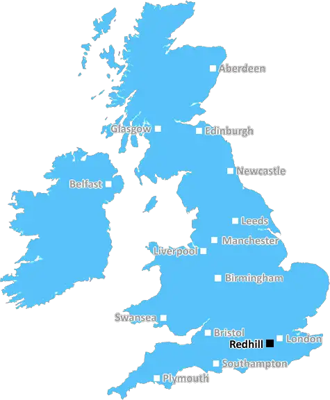
Redhill (RH18)
The RH18 postcode area is located in the Redhill postcode town region, within the county of East Sussex, and contains a total of 232 individual postcodes.
There are 8 electoral wards in the RH18 postcode area, including Betchworth, Billingshurst, Burgess Hill, Crawley, Dorking, East Grinstead, Forest Row, Gatwick, Godstone, Haywards Heath, Horley, Horsham, Lingfield, Oxted, Pulborough, Redhill, Reigate which come under the local authority of the Wealden Council.
Combining the whole postcode region, 37% of people in RH18 are classed as having an AB social grade, (i.e. 'white-collar' middle-upper class), compared to 27% across the UK.
This does not mean that the people of RH18 are wealthier - or higher class - than average, but it can be an indication that the area may be prospering and desirable to live in.
RH18 is a postcode in the Redhill district of England. It covers the large village of Forest Row in East Sussex and stretches across the southern edge of the High Weald Area of Outstanding Natural Beauty, as well as parts of Nutley, Chelwood Common, Birchden and Ashurstwood. The RH18 postcode covers a number of rural communities which are mainly situated within close proximity of each other. These include the villages of Crawley Down, Felbridge, Furners Green, Lingfield, Dormansland, Hartfield, Cuckfield, Maresfield and Danehill, as well as numerous smaller hamlets such as Tilburstow Hill, Turners Hill and Hammerwood.
RH18 has several attractive features, such as the impressive forest of Ashdown, which straddles the border between West Sussex and East Sussex. The forest is home to a vast array of wildlife, including rare birds and unusual plants. Other notable features in the RH18 postcode include Ashdown Park and the surrounding Ashdown Forest, a national nature reserve. The area is also home to a number of historic sites, such as Hammerwood Park, a Grade II listed building located near Turners Hill.
The Redhill district has many excellent leisure attractions, including a wide variety of dining, shopping and recreational opportunities to suit both locals and visitors alike. The area is well connected and connected to major regional and national transport networks, and residents enjoy access to regular train and bus services.
When it comes to education, RH18 boasts highly acclaimed schools such as Lingfield and Dormans, as well as two outstanding academies. The RH18 postcode also benefits from excellent medical facilities, with two health centres covering the local area. For those interested in sports and recreation, there are a number of local clubs and teams, as well as access to numerous outdoor activities including walking, golf and horse riding.
All in all, RH18 is an attractive postcode which enjoys the benefits of easy connectivity, unique attractions, a variety of leisure facilities and excellent educational and medical provision.

Demographics

East Sussex

RH18 is located in the county of East Sussex, in England.
East Sussex has a total population of 837,000, making it the 29th largest county in the UK.
East Sussex has a total area of 692 square miles, and a population density of 467 people per square kilometre. For comparison, Greater London has a density of 5,618 people/km2.
| Outward Code | RH18 |
| Postal Town | Redhill |
| MSOA Name | Wealden 001 |
| LSOA Name | Wealden 001A |
| County | East Sussex |
| Region | East Sussex |
| Country | England |
| Local Authority | Wealden |
| Area Classification | Mainly Rural (rural including hub towns >=80%) |
RH18 Electoral Wards
The postal region of RH18, includes the local towns, villages, electoral wards and stations of:
Dig even deeper into the RH18 postcode by clicking on a postcode below:
Click on an outward postal code below for more information about the area. Each 'outward' postcode give you a comprehensive list of all postcodes within the outward code area (RH) and estimated address.
Click on an 'outward' code for more information. For example, the outward postcode page 'EC2M' will give you an alphabetical list covering all postcodes located in the region, from 'EC2M 1BB' through to 'EC2M 7YA'.
Chris H
Tuesday, April 9, 2024
We don't have any views of RH18 right now. If you live in RH18 or have visited it, please help us to help others by telling others what you think of this neighbourhood.
Add your view of RH18
People need your local expertise. If you live in RH18 or have first-hand knowledge of the neighbourhood, please consider sharing your views. It's completely anonymous - all we ask is for your initials.
Please tell us what you like about the RH18 postcode area, what you don't like, and what it's like to live or work here.
| LOCAL AMENITIES | |
| FAMILY FRIENDLY | |
| PARKING | |
| GREEN SPACES |
Local News Sussex
Northants hang on to deny Sussex an opening win
Northamptonshire, and bad light, deny Sussex an opening County Championship Division Two victory at Hove.
BBC NewsNew 1m football pitch to get community funding
Funds collected from developers will complete the financing for a new 3G pitch at Three Bridges FC.
BBC NewsFormer Brighton player Kinnear dies aged 77
Former Wimbledon and Newcastle United manager Joe Kinnear dies at the age of 77, his family announces.
BBC NewsCharity making memories for sick children on stage
Forward Facing organises an event at Brighton Dome for children with life-limiting conditions.
BBC NewsPolice officer denies hotel room sex attack
Sussex PC Daniel Julian is on trial accused of trying to rape female police officer in a hotel room.
BBC NewsSexual harassment of NHS staff widespread - survey
A study was carried out of more than 12,200 health workers.
BBC NewsHardest Geezer eyes next challenge after Africa run
Russ Cook says it is "hard to contemplate the whole thing" after completing the mammoth challenge.
BBC News'Hardest Geezer' Cook completes run across Africa
Almost one year after starting, Russ Cook - more widely known as the Hardest Geezer - completes his challenge to run the length of Africa.
BBC NewsFrom the Postcode Area blog

Deciphering Crime Rates - a Deep Dive Into UK Postcode Analysis
Ever wondered about the crime rate in your UK postcode? You're not alone. We've dug deep into the data, uncovering trends and patterns that'll make your head spin.

Death of the High Street?
The BBC reports that despite councils' attempts to kurb them, the UK's high streets have seen a huge growth in fast food outlets. Could this mark the death knell for the Great British high street, and what can we do about it to halt its decline?

Discrimination by Postcode
You really couldn't make it up, could you? Some of the country's most vulnerable people are missing out on their weekly £25 Cold Weather Payment, just because the system that's in operation is discriminating against them because payments are based on postcode, rather than geographic location.

The Redesign is Underway
Well, the current website was absolutely in dire need of a good redesign - from the ground up. So I set out to pull it all apart and get it up and running again to become the most comprehensive guide to every postcode in the UK. And it's been a long, tough job from start to finish - and quite possibly the biggest project I've ever undertaken.
SOCIAL GRADES
According to census records, 37% of people here have a social grade of AB (highest), compared to the national average of 27%.