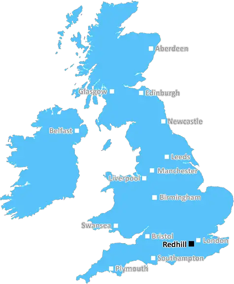
redhill RH13 Postcodes
Spending a fortune on conveyancing?

Compare instant, low-cost online quotes from trusted conveyancing solicitors.
Backed by experts, our no-obligation service searches through the best conveyancing quotes on the market to save you time and money.
Redhill (RH13)
The RH13 postcode area is located in the Redhill postcode town region, within the county of West Sussex, and contains a total of 1797 individual postcodes.
There are 50 electoral wards in the RH13 postcode area, including Betchworth, Billingshurst, Burgess Hill, Crawley, Dorking, East Grinstead, Forest Row, Gatwick, Godstone, Haywards Heath, Horley, Horsham, Lingfield, Oxted, Pulborough, Redhill, Reigate which come under the local authority of the Horsham Council.
Combining the whole postcode region, 34% of people in RH13 are classed as having an AB social grade, (i.e. 'white-collar' middle-upper class), compared to 27% across the UK.
This does not mean that the people of RH13 are wealthier - or higher class - than average, but it can be an indication that the area may be prospering and desirable to live in.
RH13 is a postcode located in the Redhill district of Surrey, England. The postcode for RH13 consists of six parts: two letters, two numbers, a single letter and two more numbers. RH13 covers a large region that runs along the northern and eastern edges of Redhill. This includes parts of chipping hurst, Merstham, Worth, Salfords, South Nutfield, Bletchingley, Outwood and Nutfield.
RH13 is a predominantly residential area with a wide range of properties, including terraced houses, semi-detached houses, detached houses, bungalows, apartments and modern developments. Although Redhill itself does not fall within RH13, the postcode is close to Redhill town centre, which is well served by a range of shopping facilities. Redhill railway station is also close by, making it an ideal location for commuters.
The RH13 postcode falls within the Surrey Hills Area of Outstanding Natural Beauty and is surrounded by stunning countryside and open spaces, as well as a number of picturesque villages and historic sites. The region also benefits from many cycling and walking trails, making it a great choice for those who enjoy the outdoors. RH13 is home to a number of renowned golf courses, including the renowned Chart Hills golf and country club, as well as a wealth of other leisure activities.
RH13 is well-connected to the rest of the UK, as it is just a short drive from Gatwick airport, and is also within easy reach of London, Brighton and other destinations. The area benefits from excellent transport links, with access to a range of regular bus services and two popular railway stations: Merstham and Redhill.
RH13 is an ideal area for families, due to its excellent schools, peaceful surroundings, and abundance of leisure activities and picturesque open spaces. With its close proximity to London and Gatwick airport, it is also the perfect choice for commuters.

Demographics

West Sussex

RH13 is located in the county of West Sussex, in England.
West Sussex has a total population of 843,800, making it the 28th largest county in the UK.
West Sussex has a total area of 770 square miles, and a population density of 423 people per square kilometre. For comparison, Greater London has a density of 5,618 people/km2.
| Outward Code | RH13 |
| Postal Town | Redhill |
| MSOA Name | Horsham 008 |
| LSOA Name | Horsham 008A |
| County | West Sussex |
| Region | West Sussex |
| Country | England |
| Local Authority | Horsham |
| Area Classification | Largely Rural (rural including hub towns 50-79%) |
RH13 Electoral Wards
The postal region of RH13, includes the local towns, villages, electoral wards and stations of:
Dig even deeper into the RH13 postcode by clicking on a postcode below:
Click on an outward postal code below for more information about the area. Each 'outward' postcode give you a comprehensive list of all postcodes within the outward code area (RH) and estimated address.
Click on an 'outward' code for more information. For example, the outward postcode page 'EC2M' will give you an alphabetical list covering all postcodes located in the region, from 'EC2M 1BB' through to 'EC2M 7YA'.
Chris H
Tuesday, April 9, 2024
We don't have any views of RH13 right now. If you live in RH13 or have visited it, please help us to help others by telling others what you think of this neighbourhood.
Add your view of RH13
People need your local expertise. If you live in RH13 or have first-hand knowledge of the neighbourhood, please consider sharing your views. It's completely anonymous - all we ask is for your initials.
Please tell us what you like about the RH13 postcode area, what you don't like, and what it's like to live or work here.
| LOCAL AMENITIES | |
| FAMILY FRIENDLY | |
| PARKING | |
| GREEN SPACES |
Local News Sussex
Procter leads Northants batting effort at Sussex
Northamptonshire battle to 292-7 on the second day of their County Championship game against Sussex.
BBC NewsNew 1m football pitch to get community funding
Funds collected from developers will complete the financing for a new 3G pitch at Three Bridges FC.
BBC NewsCritical incident at hospital stood down
Visiting at Chichester's St Richard's Hospital remains suspended following a norovirus outbreak.
BBC NewsFormer Brighton player Kinnear dies aged 77
Former Wimbledon and Newcastle United manager Joe Kinnear dies at the age of 77, his family announces.
BBC NewsSexual harassment of NHS staff widespread - survey
A study was carried out of more than 12,200 health workers.
BBC NewsCharity making memories for sick children on stage
Forward Facing organises an event at Brighton Dome for children with life-limiting conditions.
BBC NewsPolice officer denies hotel room sex attack
Sussex PC Daniel Julian is on trial accused of trying to rape female police officer in a hotel room.
BBC NewsViews on autism services sought by county council
The authority is creating a plan to improve services and opportunities for people with autism.
BBC NewsFrom the Postcode Area blog

Deciphering Crime Rates - a Deep Dive Into UK Postcode Analysis
Ever wondered about the crime rate in your UK postcode? You're not alone. We've dug deep into the data, uncovering trends and patterns that'll make your head spin.

Death of the High Street?
The BBC reports that despite councils' attempts to kurb them, the UK's high streets have seen a huge growth in fast food outlets. Could this mark the death knell for the Great British high street, and what can we do about it to halt its decline?

Discrimination by Postcode
You really couldn't make it up, could you? Some of the country's most vulnerable people are missing out on their weekly £25 Cold Weather Payment, just because the system that's in operation is discriminating against them because payments are based on postcode, rather than geographic location.

The Redesign is Underway
Well, the current website was absolutely in dire need of a good redesign - from the ground up. So I set out to pull it all apart and get it up and running again to become the most comprehensive guide to every postcode in the UK. And it's been a long, tough job from start to finish - and quite possibly the biggest project I've ever undertaken.
SOCIAL GRADES
According to census records, 34% of people here have a social grade of AB (highest), compared to the national average of 27%.