reading RG9 Postcodes
Spending a fortune on conveyancing?

Compare instant, low-cost online quotes from trusted conveyancing solicitors.
Backed by experts, our no-obligation service searches through the best conveyancing quotes on the market to save you time and money.
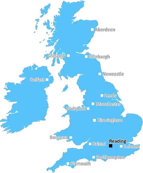
Reading (RG9)
The RG9 postcode area is located in the Reading postcode town region, within the county of Oxfordshire, and contains a total of 1744 individual postcodes.
There are 108 electoral wards in the RG9 postcode area, including Basingstoke, Bracknell, Crowthorne, Henley-On-Thames, Hook, Hungerford, Newbury, Reading, Tadley, Thatcham, Whitchurch, Wokingham which come under the local authority of the South Oxfordshire Council.
Combining the whole postcode region, 45% of people in RG9 are classed as having an AB social grade, (i.e. 'white-collar' middle-upper class), compared to 27% across the UK.
This does not mean that the people of RG9 are wealthier - or higher class - than average, but it can be an indication that the area may be prospering and desirable to live in.
RG9 postcode is an area in the Reading district of the UK. It is located in South Oxfordshire and is an affluent area with average house prices in the higher end of the scale. It is of note as being the birthplace of the famous author, George Orwell.
RG9 covers a reasonably large area, containing several villages on the borders of Oxfordshire and Buckinghamshire and the village of Nettlebed in the middle. The postcode covers an area including the towns of Watlington, Benson, Goring-on-Thames, Nettlebed, and Stonor to the north and Aston Tirrold, Pishill and Stonor to the south. It also encompasses a number of small hamlets and rural areas surrounding the villages.
The RG9 region is known for its natural beauty, and its typically undulating hills and landscape are dotted with small woods, meadows and fields of crops. The River Thame runs through the centre of the district and offers many beautiful stretches of water, as well as charming rural villages along its banks.
As for transport, RG9 benefits from excellent access links to the nearby towns of Henley and Reading. From there, you can hop onto a direct train to London, or catch a coach, bus or shuttle service from the various locations. The RG9 postcode covers all of the above locations, and there are several zones of residential and commercial development within the area.
The area is home to a range of features, such as the Greys Court National Trust Gardens, the picturesque Benson Lock, and Woodcote Garden Centre & Nurseries just outside Henley, as well as Chiltern Hills Golf Club & Tribute Events in Chinnor.
In addition, RG9 is home to the National Collection of Propagators, as well as two well-established Farmer's Markets in Goring & Nettlebed and Aston Tirrold. Arts and cultural attractions include the Watlington Art Weekend, local art studios, and the nearby River and Rowing Museum.
The area also caters to a range of local services, such as restaurants, pubs, shops and caf�s, as well as many local events & festivals. These include the Swan Upping Festival and the Nettlebed Scarecrow Festival, both of which draw in large crowds of visitors each year.
TheRG9 postcode area is a great place to live, with its natural beauty, excellent transport links and range of local services and cultural attractions. It has a wonderful combination of rural charm and modern convenience, making it an attractive area for both families and professionals looking to relocate.

Demographics

Oxfordshire

RG9 is located in the county of Oxfordshire, in England.
Oxfordshire has a total population of 683,200, making it the 35th largest county in the UK.
Oxfordshire has a total area of 1005 square miles, and a population density of 262 people per square kilometre. For comparison, Greater London has a density of 5,618 people/km2.
| Outward Code | RG9 |
| Postal Town | Reading |
| MSOA Name | South Oxfordshire 017 |
| LSOA Name | South Oxfordshire 017C |
| County | Oxfordshire |
| Region | Oxfordshire |
| Country | England |
| Local Authority | South Oxfordshire |
| Area Classification | Mainly Rural (rural including hub towns >=80%) |
RG9 Electoral Wards
The postal region of RG9, includes the local towns, villages, electoral wards and stations of:
Dig even deeper into the RG9 postcode by clicking on a postcode below:
Click on an outward postal code below for more information about the area. Each 'outward' postcode give you a comprehensive list of all postcodes within the outward code area (RG) and estimated address.
Click on an 'outward' code for more information. For example, the outward postcode page 'EC2M' will give you an alphabetical list covering all postcodes located in the region, from 'EC2M 1BB' through to 'EC2M 7YA'.
Chris H
Sunday, April 7, 2024
We don't have any views of RG9 right now. If you live in RG9 or have visited it, please help us to help others by telling others what you think of this neighbourhood.
Add your view of RG9
People need your local expertise. If you live in RG9 or have first-hand knowledge of the neighbourhood, please consider sharing your views. It's completely anonymous - all we ask is for your initials.
Please tell us what you like about the RG9 postcode area, what you don't like, and what it's like to live or work here.
| LOCAL AMENITIES | |
| FAMILY FRIENDLY | |
| PARKING | |
| GREEN SPACES |
Local News Oxfordshire
Water damage forces theatre to extended closure
The Mill in Banbury, had expected to be closed until mid-April, but will reopen at the end of June.
BBC NewsSavills bolsters Chelmsford office with return of senior development director
Kibblewhite originally joined the agency in 1990 and spent 16 years working there.
Property WeekArrest after reports of man seen with gun near mosque
A man is held on suspicion of having an imitation firearm after police were sent to the area.
BBC NewsFusion power plant plan reaches 'major milestone'
First Light Fusion, in Oxfordshire, hopes to develop a commercial fusion power plant.
BBC NewsPortsmouth NHS trust takes offices at Lakeside North Harbour
The trust has signed a 10-year lease for space at the business park.
Property WeekTT Group sells BT's old Southampton offices to consortium
BT's former Friary House office building has permission for residential conversion under permitted development rights.
Property WeekApproval granted for village pub to become homes
Councillors voted to allow the Horse and Harrow in West Hagbourne to be converted into two houses.
BBC NewsBarnet 3-1 Oxford City
Nicke Kabamba scores twice as leading National League play-off contenders Barnet beat bottom club Oxford City.
BBC NewsFrom the Postcode Area blog

Deciphering Crime Rates - a Deep Dive Into UK Postcode Analysis
Ever wondered about the crime rate in your UK postcode? You're not alone. We've dug deep into the data, uncovering trends and patterns that'll make your head spin.

Death of the High Street?
The BBC reports that despite councils' attempts to kurb them, the UK's high streets have seen a huge growth in fast food outlets. Could this mark the death knell for the Great British high street, and what can we do about it to halt its decline?

Discrimination by Postcode
You really couldn't make it up, could you? Some of the country's most vulnerable people are missing out on their weekly £25 Cold Weather Payment, just because the system that's in operation is discriminating against them because payments are based on postcode, rather than geographic location.

The Redesign is Underway
Well, the current website was absolutely in dire need of a good redesign - from the ground up. So I set out to pull it all apart and get it up and running again to become the most comprehensive guide to every postcode in the UK. And it's been a long, tough job from start to finish - and quite possibly the biggest project I've ever undertaken.
SOCIAL GRADES
According to census records, 45% of people here have a social grade of AB (highest), compared to the national average of 27%.