reading RG5 Postcodes
Spending a fortune on conveyancing?

Compare instant, low-cost online quotes from trusted conveyancing solicitors.
Backed by experts, our no-obligation service searches through the best conveyancing quotes on the market to save you time and money.
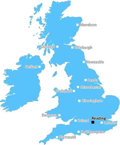
Reading (RG5)
The RG5 postcode area is located in the Reading postcode town region, within the county of Berkshire, and contains a total of 673 individual postcodes.
There are 2 electoral wards in the RG5 postcode area, including Basingstoke, Bracknell, Crowthorne, Henley-On-Thames, Hook, Hungerford, Newbury, Reading, Tadley, Thatcham, Whitchurch, Wokingham which come under the local authority of the Wokingham Council.
Combining the whole postcode region, 34% of people in RG5 are classed as having an AB social grade, (i.e. 'white-collar' middle-upper class), compared to 27% across the UK.
This does not mean that the people of RG5 are wealthier - or higher class - than average, but it can be an indication that the area may be prospering and desirable to live in.
RG5 is a postcode district within the Reading post town, in the Royal Borough of Windsor and Maidenhead in the Royal County of Berkshire, located in the southeast of England. It covers the area of Lower Earley, with most of its residents living in the town.
The district is home to a number of notable businesses, such as Nestl� and Fujitsu, and its development is one of the highest in the UK. Shopping is also popular in the area, with multiple large retail parks, such as Theale Retail Park, located in Lower Earley. As well as this, there are various smaller independent stores and shopping centres located in the area.
Lower Earley is a residential area which has shown excellent, sustained growth over the past decade. Among the amenities are good schools � such as St Crispin's School, home to the Earley Football Academy, and The Piggott School � and several parks, including Whiteknights Lake and Dinton Pastures Country Park. It also boasts a newly developed leisure centre.
The RG5 region is well connected to the rest of the area, via a range of transport links. By road, the M4 motorway is a major thoroughfare, as is the A329 which links Lower Earley to the local area. By rail, the area is served by two main train stations � Winnersh Triangle and Winnersh � meaning quick access to Reading, London, and all the surrounding regions.
Local culture is well represented in RG5, with the LGEG Centre - Lower Earley's community centre � located within the district. As well as this, nearby attractions such as the Museum of English Rural Life and Reading Abbey Ruins, amongst other historical sites, are also close by.

Demographics

Berkshire

RG5 is located in the county of Berkshire, in England.
Berkshire has a total population of 896,800, making it the 24th largest county in the UK.
Berkshire has a total area of 487 square miles, and a population density of 710 people per square kilometre. For comparison, Greater London has a density of 5,618 people/km2.
| Outward Code | RG5 |
| Postal Town | Reading |
| MSOA Name | Wokingham 003 |
| LSOA Name | Wokingham 003D |
| County | Berkshire |
| Region | Berkshire |
| Country | England |
| Local Authority | Wokingham |
| Area Classification | Urban with City and Town |
RG5 Electoral Wards
The postal region of RG5, includes the local towns, villages, electoral wards and stations of:
Dig even deeper into the RG5 postcode by clicking on a postcode below:
Click on an outward postal code below for more information about the area. Each 'outward' postcode give you a comprehensive list of all postcodes within the outward code area (RG) and estimated address.
Click on an 'outward' code for more information. For example, the outward postcode page 'EC2M' will give you an alphabetical list covering all postcodes located in the region, from 'EC2M 1BB' through to 'EC2M 7YA'.
Chris H
Sunday, April 7, 2024
We don't have any views of RG5 right now. If you live in RG5 or have visited it, please help us to help others by telling others what you think of this neighbourhood.
Add your view of RG5
People need your local expertise. If you live in RG5 or have first-hand knowledge of the neighbourhood, please consider sharing your views. It's completely anonymous - all we ask is for your initials.
Please tell us what you like about the RG5 postcode area, what you don't like, and what it's like to live or work here.
| LOCAL AMENITIES | |
| FAMILY FRIENDLY | |
| PARKING | |
| GREEN SPACES |
Local News Berkshire
Council invests 225k in thermal sensors
The council says collecting data on road temperature will have financial and environmental benefits.
BBC NewsBerkshire villagers mock water company after sewage leak floods street
Fed-up villagers in Lambourn, Berks., have been forced to wade through faeces and sanitary products after raw sewage began spewing out of manholes.
Local BerkshireLuton Airport operating company buys hangars of collapsed airline Monarch
Hangars can accommodate wide body jets up to the size of a Boeing 767.
Property WeekFlats plan for shopping centre amended
The proposed height of two towers containing hundreds of flats has been amended.
BBC NewsReading 4-0 Cambridge United
Financially-troubled Reading put aside their off-field worries with a 4-0 home win over fellow League One strugglers Cambridge.
BBC NewsDrive Fast Die Young
The story of a teenage road death told by his family and first responders.
BBC NewsUpdate as new Reading bar and shops near completion
Progress is being made on opening a new bar, retail space and more in the heart of Reading town centre as part of a huge project.
Local BerkshireNewFlex opens new Cambridge workspace The Quad
NewFlex said the site isone of the UK's strongest out-of-London business destinations.
Property WeekFrom the Postcode Area blog

Deciphering Crime Rates - a Deep Dive Into UK Postcode Analysis
Ever wondered about the crime rate in your UK postcode? You're not alone. We've dug deep into the data, uncovering trends and patterns that'll make your head spin.

Death of the High Street?
The BBC reports that despite councils' attempts to kurb them, the UK's high streets have seen a huge growth in fast food outlets. Could this mark the death knell for the Great British high street, and what can we do about it to halt its decline?

Discrimination by Postcode
You really couldn't make it up, could you? Some of the country's most vulnerable people are missing out on their weekly £25 Cold Weather Payment, just because the system that's in operation is discriminating against them because payments are based on postcode, rather than geographic location.

The Redesign is Underway
Well, the current website was absolutely in dire need of a good redesign - from the ground up. So I set out to pull it all apart and get it up and running again to become the most comprehensive guide to every postcode in the UK. And it's been a long, tough job from start to finish - and quite possibly the biggest project I've ever undertaken.
SOCIAL GRADES
According to census records, 34% of people here have a social grade of AB (highest), compared to the national average of 27%.