reading RG29 Postcodes
Spending a fortune on conveyancing?

Compare instant, low-cost online quotes from trusted conveyancing solicitors.
Backed by experts, our no-obligation service searches through the best conveyancing quotes on the market to save you time and money.
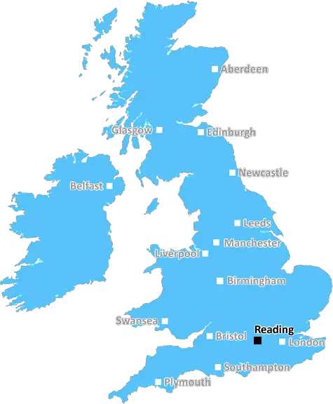
Reading (RG29)
The RG29 postcode area is located in the Reading postcode town region, within the county of Hampshire, and contains a total of 316 individual postcodes.
There are 26 electoral wards in the RG29 postcode area, including Basingstoke, Bracknell, Crowthorne, Henley-On-Thames, Hook, Hungerford, Newbury, Reading, Tadley, Thatcham, Whitchurch, Wokingham which come under the local authority of the Hart Council.
Combining the whole postcode region, 43% of people in RG29 are classed as having an AB social grade, (i.e. 'white-collar' middle-upper class), compared to 27% across the UK.
This does not mean that the people of RG29 are wealthier - or higher class - than average, but it can be an indication that the area may be prospering and desirable to live in.
The RG29 postcode is an area in the Reading borough in the UK. The area consists of Wokingham without parish and the small part of Remenham parish falling in the Civil District. It also includes parts of the Arborfield Garrison, a former military base. The military base is now empty but is being redeveloped as a housing estate.
Located within the RG29 postcode is the village of Three Mile Cross, which is accessible from the B3348 road and has a village pub, Three Tuns and a post office. The village also has a large garden centre and a cricket club.
The closest train station to the RG29 postcode is Winnersh Triangle, located on the Great Western Main Line. This station has direct links to the towns of Reading, Guildford and Wokingham.
The surrounding area is rural and is part of the designated area of outstanding natural beauty (AONB), the North Wessex Downs, where the Berkshire Downs, Chiltern Hills and North Wessex Hills meet. With a mixture of chalk downlands, beech woods and heathlands, these hills form part of the largest area of outstanding natural beauty in England.
The area has a number of schools including St Crispin's secondary school in Wokingham and a Church of England primary and secondary school in Arborfield Gatin. It is home to the famous Wellington Country Park, which features over 800 acres of countryside, including the picturesque Warren Lake.
The area also has a number of gastronomic attractions such as The Gables pub in Winnersh and Thornbers Deli in Wokingham. Additionally there are popular golf courses at Sindlesham and which bring visitors from all over the UK.
While in the area, do not miss out on visiting the Grade II* listed Lapland UK, a magical Christmas experience nestled in Whitmoor. RG29 provides easy access to downtown Reading, with its many shops, cinema, restaurants and nightlife.

Demographics

Hampshire

RG29 is located in the county of Hampshire, in England.
Hampshire has a total population of 1,829,500, making it the 5th largest county in the UK.
Hampshire has a total area of 1455 square miles, and a population density of 485 people per square kilometre. For comparison, Greater London has a density of 5,618 people/km2.
| Outward Code | RG29 |
| Postal Town | Reading |
| MSOA Name | Hart 011 |
| LSOA Name | Hart 011C |
| County | Hampshire |
| Region | Hampshire |
| Country | England |
| Local Authority | Hart |
| Area Classification | Urban with Significant Rural (rural including hub towns 26-49%) |
RG29 Electoral Wards
The postal region of RG29, includes the local towns, villages, electoral wards and stations of:
Dig even deeper into the RG29 postcode by clicking on a postcode below:
Click on an outward postal code below for more information about the area. Each 'outward' postcode give you a comprehensive list of all postcodes within the outward code area (RG) and estimated address.
Click on an 'outward' code for more information. For example, the outward postcode page 'EC2M' will give you an alphabetical list covering all postcodes located in the region, from 'EC2M 1BB' through to 'EC2M 7YA'.
Chris H
Thursday, April 11, 2024
We don't have any views of RG29 right now. If you live in RG29 or have visited it, please help us to help others by telling others what you think of this neighbourhood.
Add your view of RG29
People need your local expertise. If you live in RG29 or have first-hand knowledge of the neighbourhood, please consider sharing your views. It's completely anonymous - all we ask is for your initials.
Please tell us what you like about the RG29 postcode area, what you don't like, and what it's like to live or work here.
| LOCAL AMENITIES | |
| FAMILY FRIENDLY | |
| PARKING | |
| GREEN SPACES |
Local News Hampshire
Family of Victor Farrant victim speak out against his release
The children of a woman killed by a murderer have said the possibility of his release from prison on compassionate grounds would be a national scandal.
Hampshire ChronicleGoin' Home with Adam and Jo - Ep 43
Saints suffer a crushing promotion blow at Ipswich
BBC NewsBroughton: Man questioned after dead animals dumped at shop
As previously reported,police received reports that around 50 dead hares, a kestrel and a barn owl were found outside Broughton Community Shop in High Street on the morning of Friday, March 15.
Hampshire ChronicleOxford university professor to give talk on life since Covid
Tickets for the talk, which will take place on Saturday, April 28 at 7pm, are 12 each. Tickets can be reserved in advance, bought at the village shop or at the door on the night.
Hampshire ChronicleRelive Portsmouth's draw with Derby and Doncaster's win over Wrexham
Relive live EFL text commentary of Portsmouth's draw with Derby and Doncaster's win over Wrexham.
BBC NewsWilcox leaving affects me - Martin
Southampton manager Russell Martin says that director of football Jason Wilcox leaving does affect him.
BBC NewsFarmers from SSEN's annual 'Look out, Look up' campaign
Scottish and Southern Electricity Networks (SSEN) Distribution reminds farmers to be cautious around their electrical infrastructure during this harvest season.
Hampshire ChronicleHas Fratton Park found its roar again?
BBC Radio Solent's Portsmouth commentator Andy Moon says the atmosphere at Fratton Park could make the difference in the final eight games.
BBC NewsFrom the Postcode Area blog

Deciphering Crime Rates - a Deep Dive Into UK Postcode Analysis
Ever wondered about the crime rate in your UK postcode? You're not alone. We've dug deep into the data, uncovering trends and patterns that'll make your head spin.

Death of the High Street?
The BBC reports that despite councils' attempts to kurb them, the UK's high streets have seen a huge growth in fast food outlets. Could this mark the death knell for the Great British high street, and what can we do about it to halt its decline?

Discrimination by Postcode
You really couldn't make it up, could you? Some of the country's most vulnerable people are missing out on their weekly £25 Cold Weather Payment, just because the system that's in operation is discriminating against them because payments are based on postcode, rather than geographic location.

The Redesign is Underway
Well, the current website was absolutely in dire need of a good redesign - from the ground up. So I set out to pull it all apart and get it up and running again to become the most comprehensive guide to every postcode in the UK. And it's been a long, tough job from start to finish - and quite possibly the biggest project I've ever undertaken.
SOCIAL GRADES
According to census records, 43% of people here have a social grade of AB (highest), compared to the national average of 27%.