canterbury CT12 Postcodes
Spending a fortune on conveyancing?

Compare instant, low-cost online quotes from trusted conveyancing solicitors.
Backed by experts, our no-obligation service searches through the best conveyancing quotes on the market to save you time and money.
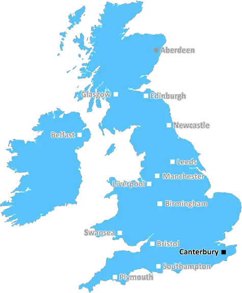
Canterbury (CT12)
The CT12 postcode area is located in the Canterbury postcode town region, within the county of Kent, and contains a total of 609 individual postcodes.
There are 23 electoral wards in the CT12 postcode area, including Birchington, Broadstairs, Canterbury, Deal, Dover, Folkestone, Herne Bay, Hythe, Margate, Ramsgate, Sandwich, Westgate-On-Sea, Whitstable which come under the local authority of the Thanet Council.
Combining the whole postcode region, 15% of people in CT12 are classed as having an AB social grade, (i.e. 'white-collar' middle-upper class), compared to 27% across the UK.
This does not mean that the people of CT12 are poorer than other areas, but it may give an indication that there are areas of deprivation.
The CT12 postcode area is located in the Canterbury district of England, encompassing parts of the Dover, Folkestone and Hythe districts. CT12 postcodes cover an area that includes the town of Sandwich, some surrounding countryside and several smaller villages. The area boasts a number of historical attractions, from Canterbury Cathedral to St Peter's Church, one of the best-preserved medieval churches in the UK. It is also home to Riviera Malt, an historical malt factory that has been producing top-quality malts for over 150 years.
This picturesque area has a number of beaches, as well as an abundance of stunning gardens, parks and other green spaces. The coastline in the CT12 postcode area is a great destination for nature lovers, with sightings of dolphins, seals and rare birds a common occurrence. Along the beach, there are plenty of cafes and restaurants to relax and take in the breathtaking views, as well as lots of activities for both adults and children.
The area is also home to some fine architecture, ranging from Grade II listed buildings to Georgian facades. Key historical sites in the CT12 postcode area include Sandwich Guildhall, which dates back to the 15th century, and St Mary's Church, which dates back to the 12th century.
In terms of transport links, road access is provided by the A256 road, which runs through the postcode area and links to the nearby major towns and cities, such as Folkestone and Dover. There is also a regular train service to and from London, as well as a number of buses that run to both Dover and Canterbury.
The postcode area also has a good range of schools, from primary to secondary, with a variety of facilities available, such as sports facilities and art galleries. There are also a number of shopping experiences in the area, from farmers markets to high street names.
As one of the most popular destinations in the Canterbury district, the CT12 postcode area is a great place to visit and explore all that the region has to offer. With historic attractions, stunning beaches, a variety of parks and green spaces and fine architecture, it is an ideal spot for a family day out or a relaxing weekend break.

Demographics

Kent

CT12 is located in the county of Kent, in England.
Kent has a total population of 1,820,400, making it the 6th largest county in the UK.
Kent has a total area of 1443 square miles, and a population density of 486 people per square kilometre. For comparison, Greater London has a density of 5,618 people/km2.
| Outward Code | CT12 |
| Postal Town | Canterbury |
| MSOA Name | Thanet 014 |
| LSOA Name | Thanet 014B |
| County | Kent |
| Region | Kent |
| Country | England |
| Local Authority | Thanet |
| Area Classification | Urban with City and Town |
CT12 Electoral Wards
The postal region of CT12, includes the local towns, villages, electoral wards and stations of:
Dig even deeper into the CT12 postcode by clicking on a postcode below:
Click on an outward postal code below for more information about the area. Each 'outward' postcode give you a comprehensive list of all postcodes within the outward code area (CT) and estimated address.
Click on an 'outward' code for more information. For example, the outward postcode page 'EC2M' will give you an alphabetical list covering all postcodes located in the region, from 'EC2M 1BB' through to 'EC2M 7YA'.
Chris H
Sunday, April 7, 2024
We don't have any views of CT12 right now. If you live in CT12 or have visited it, please help us to help others by telling others what you think of this neighbourhood.
Add your view of CT12
People need your local expertise. If you live in CT12 or have first-hand knowledge of the neighbourhood, please consider sharing your views. It's completely anonymous - all we ask is for your initials.
Please tell us what you like about the CT12 postcode area, what you don't like, and what it's like to live or work here.
| LOCAL AMENITIES | |
| FAMILY FRIENDLY | |
| PARKING | |
| GREEN SPACES |
Local News Kent
Greencore secures 30m investment to support sustainable development
The funding will support the developer's plans to build up to 10,000 low-carbon homes.
Property WeekStarbucks partner signs lease at Prologis Park Hemel Hempstead
Food Service Logisticshas agreed a 15-year lease at the161,134 sq ftdistribution centre.
Property WeekAnother blow for theme park plans as key figure quits 2.5bn project
Another leading figure behind ambitious plans to build a multi-billion pound entertainment park in the county has quit.
Kent OnlineBurglar on the run after leaping from dock and fleeing court
Police have launched a manhunt for a burglar who distracted a dock officer before bolting for the courtroom door and escaping.
Kent OnlinePlay area climbing frame removed after safety inspection
A climbing frame in a children's play park has been removed after an inspection highlighted safety concerns and extensive repairs' needed.
Kent OnlineYASA to move UK HQ to Bicester Motion Innovation Quarter
TheMercedes-Benz subsidiary will relocate its teams to the Bicester site in 2026
Property WeekTT Group sells BT's old Southampton offices to consortium
BT's former Friary House office building has permission for residential conversion under permitted development rights.
Property WeekHomes England acquires Worthing site to deliver 250 homes
The acquisition forms part of the body's plans to regenerate challenging brownfield areas.
Property WeekFrom the Postcode Area blog

Deciphering Crime Rates - a Deep Dive Into UK Postcode Analysis
Ever wondered about the crime rate in your UK postcode? You're not alone. We've dug deep into the data, uncovering trends and patterns that'll make your head spin.

Death of the High Street?
The BBC reports that despite councils' attempts to kurb them, the UK's high streets have seen a huge growth in fast food outlets. Could this mark the death knell for the Great British high street, and what can we do about it to halt its decline?

Discrimination by Postcode
You really couldn't make it up, could you? Some of the country's most vulnerable people are missing out on their weekly £25 Cold Weather Payment, just because the system that's in operation is discriminating against them because payments are based on postcode, rather than geographic location.

The Redesign is Underway
Well, the current website was absolutely in dire need of a good redesign - from the ground up. So I set out to pull it all apart and get it up and running again to become the most comprehensive guide to every postcode in the UK. And it's been a long, tough job from start to finish - and quite possibly the biggest project I've ever undertaken.
SOCIAL GRADES
According to census records, 15% of people here have a social grade of AB (highest), compared to the national average of 27%.