romford RM13 Postcodes
Spending a fortune on conveyancing?

Compare instant, low-cost online quotes from trusted conveyancing solicitors.
Backed by experts, our no-obligation service searches through the best conveyancing quotes on the market to save you time and money.
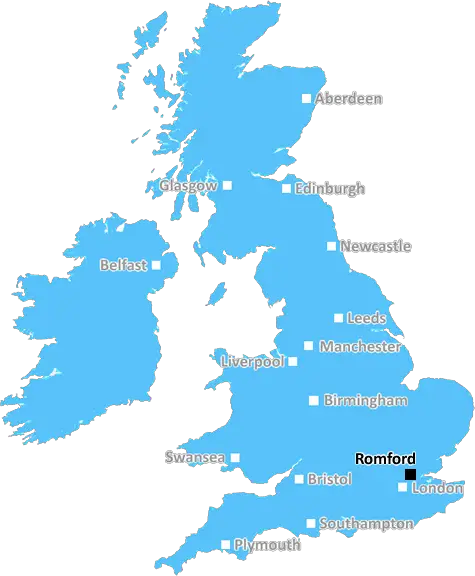
Romford (RM13)
The RM13 postcode area is located in the Romford postcode town region, within the county of Greater London, and contains a total of 899 individual postcodes.
There are 6 electoral wards in the RM13 postcode area, including Dagenham, Grays, Hornchurch, Purfleet, Rainham, Romford, South Ockendon, Tilbury, Upminster which come under the local authority of the Havering Council.
Combining the whole postcode region, 14% of people in RM13 are classed as having an AB social grade, (i.e. 'white-collar' middle-upper class), compared to 27% across the UK.
This does not mean that the people of RM13 are poorer than other areas, but it may give an indication that there are areas of deprivation.
RM13 is a postcode district in the Romford post town in the London borough of Havering of Greater London in England. It covers parts of the Havering area of Romford, including Rainham, South Hornchurch, and North Ockendon.
RM13 covers a range of mainly residential areas, with shops and small businesses in or near the town centre. Some of the more affluent parts of the district include Upminster, Cranham, South Hornchurch and North Ockendon.
The main areas and landmarks in the area include the Liberty Shopping Centre, a retail park located in the centre of Romford; Hornchurch Country Park; Romford Greyhound Stadium; South Street and Hornchurch Stadium for sport and outdoor activities; Havering Sixth Form College; Queen's Hospital; and the Romford Transport Interchange.
The area is well connected to London with three train lines running through Romford (TfL Rail, Greater Anglia and c2c), providing regular services to London Liverpool Street and other major cities.
RM13 has a number of primary schools, secondary schools, and a college. As for higher education, students can take advantage of Havering Higher Education Centre and Further Education College.
The area is also well served by public transport, with bus routes providing services to various parts of Romford, London, Harlow, and the surrounding areas.
The area is home to a large multicultural population, and the Havering Ethnic Minority Forum acts as a platform for engaging with the diverse cultures of the area.
Plenty of local clubs and organisations exist in RM13, such as the Romford Film Club, Romford & District Model Railway Club, Havering Astronomy Club, Romford Symphony Orchestra, South Hornchurch W.I and Romford Rowing Club, offering a range of educational, recreational, and leisure activities. There are also several local branches of national charities, such as the Samaritans, Age & Opportunity and the Royal British Legion, providing support to various communities in the area.

Demographics

Greater London

RM13 is located in the county of Greater London, in England.
Greater London has a total population of 8,778,500, making it the 1st largest county in the UK.
Greater London has a total area of 606 square miles, and a population density of 5594 people per square kilometre. For comparison, Greater London has a density of 5,618 people/km2.
| Outward Code | RM13 |
| Postal Town | Romford |
| MSOA Name | Havering 030 |
| LSOA Name | Havering 030B |
| County | Greater London |
| Region | Greater London |
| Country | England |
| Local Authority | Havering |
| Area Classification | Urban with Major Conurbation |
RM13 Electoral Wards
The postal region of RM13, includes the local towns, villages, electoral wards and stations of:
Dig even deeper into the RM13 postcode by clicking on a postcode below:
Click on an outward postal code below for more information about the area. Each 'outward' postcode give you a comprehensive list of all postcodes within the outward code area (RM) and estimated address.
Click on an 'outward' code for more information. For example, the outward postcode page 'EC2M' will give you an alphabetical list covering all postcodes located in the region, from 'EC2M 1BB' through to 'EC2M 7YA'.
Chris H
Tuesday, May 7, 2024
We don't have any views of RM13 right now. If you live in RM13 or have visited it, please help us to help others by telling others what you think of this neighbourhood.
Add your view of RM13
People need your local expertise. If you live in RM13 or have first-hand knowledge of the neighbourhood, please consider sharing your views. It's completely anonymous - all we ask is for your initials.
Please tell us what you like about the RM13 postcode area, what you don't like, and what it's like to live or work here.
| LOCAL AMENITIES | |
| FAMILY FRIENDLY | |
| PARKING | |
| GREEN SPACES |
Local News Essex
Man stabbed in Waltham Abbey sparks police appeal for witnesses
The man suffered stab injuries to his back and leg and was taken to hospital
Essex LiveEssex woman arrested after Legoland Windsor cardiac arrest
A 27-year-old woman from Witham was arrested on Friday on suspicion of neglecting a child to cause unnecessary injury.
The EchoRachael Heyhoe Flint Trophy: South East Stars go top
South East Stars go top of the Rachael Heyhoe-Flint Trophy table after beating Sunrisers as Southern Vipers and Northern Diamonds also win.
BBC NewsSouthend and Basildon pubs as they were in the 80s and 90s
In recent years all too many once-popular venues have been forced to close or rebrand, but happily some of south Essex's best-loved venues are still thriving
The EchoColchester boutique named among top 50 stores in the UK
A Colchester boutique owner is overjoyed' after being named among the top 50 shops in the country.
Daily GazettePolice looking for Dean Ersser in connection with GBH probe
Essex Police is looking to speak to 42-year-old Dean Ersser in connection with the allegations.
Daily GazetteJustGiving fundraiser to have son's enlarged tonsils removed
Sophie Jones, 34, has launched a fundraiser for private surgery to have her five-year-old son Isaac's tonsils removed after a terrifying episode where he was left unable to breathe
The EchoL&G acquires Cambridgeshire BTR scheme from Stonebond
The 41-unit development comprises 10 flats and 31 houses.
Property WeekFrom the Postcode Area blog

Deciphering Crime Rates - a Deep Dive Into UK Postcode Analysis
Ever wondered about the crime rate in your UK postcode? You're not alone. We've dug deep into the data, uncovering trends and patterns that'll make your head spin.

Death of the High Street?
The BBC reports that despite councils' attempts to kurb them, the UK's high streets have seen a huge growth in fast food outlets. Could this mark the death knell for the Great British high street, and what can we do about it to halt its decline?

Discrimination by Postcode
You really couldn't make it up, could you? Some of the country's most vulnerable people are missing out on their weekly £25 Cold Weather Payment, just because the system that's in operation is discriminating against them because payments are based on postcode, rather than geographic location.

The Redesign is Underway
Well, the current website was absolutely in dire need of a good redesign - from the ground up. So I set out to pull it all apart and get it up and running again to become the most comprehensive guide to every postcode in the UK. And it's been a long, tough job from start to finish - and quite possibly the biggest project I've ever undertaken.
SOCIAL GRADES
According to census records, 14% of people here have a social grade of AB (highest), compared to the national average of 27%.