portsmouth PO9 Postcodes
Spending a fortune on conveyancing?

Compare instant, low-cost online quotes from trusted conveyancing solicitors.
Backed by experts, our no-obligation service searches through the best conveyancing quotes on the market to save you time and money.
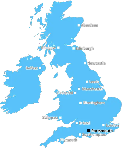
Portsmouth (PO9)
The PO9 postcode area is located in the Portsmouth postcode town region, within the county of Hampshire, and contains a total of 1533 individual postcodes.
There are 28 electoral wards in the PO9 postcode area, including Bembridge, Bognor Regis, Chichester, Cowes, East Cowes, Emsworth, Fareham, Freshwater, Gosport, Havant, Hayling Island, Lee-On-The-Solent, Newport, Portsmouth, Rowland's Castle, Ryde, Sandown, Seaview, Shanklin, Southsea, Totland Bay, Ventnor, Waterlooville, Yarmouth which come under the local authority of the Havant Council.
Combining the whole postcode region, 18% of people in PO9 are classed as having an AB social grade, (i.e. 'white-collar' middle-upper class), compared to 27% across the UK.
This does not mean that the people of PO9 are poorer than other areas, but it may give an indication that there are areas of deprivation.
The PO9 postcode lies within the city of Portsmouth in the South East of England. It is part of the Portsmouth area of interlinked postal districts. It covers a 7.64 square mile area which is mainly residential. The postcode also includes the suburbs of Cosham, Paulsgrove, and Farlington.
Cosham is the largest and an important locality with its own railway station. It is home to 'The Pyramids Shopping Centre' which is popular with shoppers, with plenty of stores and restaurants, handy for locals and visitors alike. Cosham is also a local hub for businesses. Paulsgrove is a bustling residential area and local shopping centre. The area mostly consists of semi-detached Victorian housing, and Farlington is a predominantly affluent residential suburb.
The PO9 postcode area includes Portsmouth Harbour. Here there are marinas, docks, workshops, chandleries, sailing clubs, engineering facilities and a range of other businesses related to the sea. There are also several marina and foreshore developments on the harbour front.
Prime sea fishing is offered around the harbour and Helgoe Spit, and there is a wide range of recreational activities available at the docks. The Portsmouth Harbour, Hilsea Lines and Portsea Island are also part of the PO9 postcode. Hilsea Lines is a series of historical earthworks designed in the 19th century to protect the city. It includes the Hilsea Lines and Barracks, a Scheduled Monument, as well as several other protected sites. It is also home to a variety of wildlife.
Portsea Island is a small island situated close to the centre of Portsmouth. It includes Southsea, Portsmouth and Old Portsmouth, and Gun Wharf Quays. It is connected to the mainland by the Portsea Island Road Tunnel, which carries the A2030 road over the edge of Portsmouth harbour. Old Portsmouth is known for its historic streets, and the city itself is home to many attractions, such as the Portsmouth Historic Dockyard, the D Day Story museum, and the Blue Reef Aquarium. Gun Wharf Quays, meanwhile, is a shopping centre and retail park which overlooks the harbour.
ThePO9 postcode is a vibrant and diverse area, combining residential areas, Thames estuary locations, prime fishing, shopping centres, historical monuments, parks, rivers and recreational facilities to form an exciting and unique locality.

Demographics
Hampshire

PO9 is located in the county of Hampshire, in England.
Hampshire has a total population of 1,829,500, making it the 5th largest county in the UK.
Hampshire has a total area of 1455 square miles, and a population density of 485 people per square kilometre. For comparison, Greater London has a density of 5,618 people/km2.
| Outward Code | PO9 |
| Postal Town | Portsmouth |
| MSOA Name | Havant 014 |
| LSOA Name | Havant 014A |
| County | Hampshire |
| Region | Hampshire |
| Country | England |
| Local Authority | Havant |
| Area Classification | Urban with City and Town |
PO9 Electoral Wards
The postal region of PO9, includes the local towns, villages, electoral wards and stations of:
Dig even deeper into the PO9 postcode by clicking on a postcode below:
Click on an outward postal code below for more information about the area. Each 'outward' postcode give you a comprehensive list of all postcodes within the outward code area (PO) and estimated address.
Click on an 'outward' code for more information. For example, the outward postcode page 'EC2M' will give you an alphabetical list covering all postcodes located in the region, from 'EC2M 1BB' through to 'EC2M 7YA'.
Chris H
Saturday, April 6, 2024
We don't have any views of PO9 right now. If you live in PO9 or have visited it, please help us to help others by telling others what you think of this neighbourhood.
Add your view of PO9
People need your local expertise. If you live in PO9 or have first-hand knowledge of the neighbourhood, please consider sharing your views. It's completely anonymous - all we ask is for your initials.
Please tell us what you like about the PO9 postcode area, what you don't like, and what it's like to live or work here.
| LOCAL AMENITIES | |
| FAMILY FRIENDLY | |
| PARKING | |
| GREEN SPACES |
Local News Hampshire
Winchester man loses 1m claim after motorbike crash in 2019
A WINCHESTER man, who had to have a toe amputated after a motorbike crash, has been unsuccessful in a 1m claim.
Hampshire ChronicleThames Water troubles swell as parent firm defaults
Holding company Kemble has told lenders that it has failed to meet a deadline for interest payments.
BBC NewsLondon Marathon: Winchester man running for the Sailors' Society
A WINCHESTER man is raising money for the Sailors' Society by running the London Marathon.
Hampshire ChronicleWinchester City Council planning decisions
EVERY planning application put before Winchester City Council officers was permitted this week.
Hampshire ChroniclePools receive funding to boost energy efficiency
Three pools on the Isle of Wight will receive the money from Sport England's Swimming Pool Support Fund.
BBC NewsHampshire & Isle of Wight: Friday's Big Picture
Showcasing the best images sent to us from around Hampshire & Isle of Wight.
BBC NewsHow AI is being used to prevent illegal fishing
Illegal fishing remains a huge global problem, but AI is now being used to tackle the issue.
BBC NewsWinchester Taylor Wimpey supports Food Bank with Easter eggs
Taylor Wimpey Southern Counties have given over 700 Easter Eggs to local hospitals and food banks this Easter.
Hampshire ChronicleFrom the Postcode Area blog

Deciphering Crime Rates - a Deep Dive Into UK Postcode Analysis
Ever wondered about the crime rate in your UK postcode? You're not alone. We've dug deep into the data, uncovering trends and patterns that'll make your head spin.

Death of the High Street?
The BBC reports that despite councils' attempts to kurb them, the UK's high streets have seen a huge growth in fast food outlets. Could this mark the death knell for the Great British high street, and what can we do about it to halt its decline?

Discrimination by Postcode
You really couldn't make it up, could you? Some of the country's most vulnerable people are missing out on their weekly £25 Cold Weather Payment, just because the system that's in operation is discriminating against them because payments are based on postcode, rather than geographic location.

The Redesign is Underway
Well, the current website was absolutely in dire need of a good redesign - from the ground up. So I set out to pull it all apart and get it up and running again to become the most comprehensive guide to every postcode in the UK. And it's been a long, tough job from start to finish - and quite possibly the biggest project I've ever undertaken.
SOCIAL GRADES
According to census records, 18% of people here have a social grade of AB (highest), compared to the national average of 27%.