portsmouth PO35 Postcodes
Spending a fortune on conveyancing?

Compare instant, low-cost online quotes from trusted conveyancing solicitors.
Backed by experts, our no-obligation service searches through the best conveyancing quotes on the market to save you time and money.
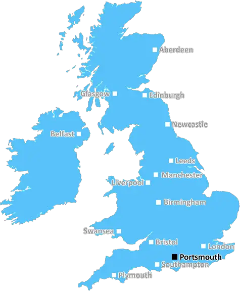
Portsmouth (PO35)
The PO35 postcode area is located in the Portsmouth postcode town region, within the county of Isle of Wight, and contains a total of 193 individual postcodes.
There are 4 electoral wards in the PO35 postcode area, including Bembridge, Bognor Regis, Chichester, Cowes, East Cowes, Emsworth, Fareham, Freshwater, Gosport, Havant, Hayling Island, Lee-On-The-Solent, Newport, Portsmouth, Rowland's Castle, Ryde, Sandown, Seaview, Shanklin, Southsea, Totland Bay, Ventnor, Waterlooville, Yarmouth which come under the local authority of the Isle of Wight Council.
Combining the whole postcode region, 21% of people in PO35 are classed as having an AB social grade, (i.e. 'white-collar' middle-upper class), compared to 27% across the UK.
This does not mean that the people of PO35 are poorer than other areas, but it may give an indication that there are areas of deprivation.
PO35 is a postcode in the UK which is centred around the town of Totland on the Isle of Wight. The postcode covers a large area, stretching from the south-west coast of the island near Freshwater Bay, to the north-east of the island, encompassing the villages of Yarmouth, Shalfleet, Calbourne, Thorley, Mottistone, and Godshill. The postcode is most often used for residential, commercial and rural addresses.
The area is renowned for its stunning natural beauty, including an abundance of open spaces and parks on the island, as well as the expansive coastlines, beautiful shorelines and beaches, and wildlife habitats. The National Trust has preserved much of the area, from ancient woodland in Yarmouth, to bracken-covered hills in Shalfleet. Industrial and agricultural activity also take place in the postcode, with many local businesses involved in arable, dairy, poultry, Equine and livestock farming.
Popular tourist attractions in the area include the Needles Battery at the western tip of the island, Carisbrooke Castle, Appley Beach, Yarmouth Castle, Dinosaur Isle, Alum Bay, the Garlic Farm and Osborne House.
Public transport in the postcode area is relatively good, with regular ferry services operating from the area to the mainland, as well as bus and bus services available. The Isle of Wight Steam Railway operates in the area, and there are also taxis available. The postcode area has a wide range of schools and colleges, from infant and primary schools in the area, to secondary schools. The Isle of Wight College also covers the area, offering further and higher education.
Healthcare in the area is well provided for, with a number of GP surgeries, dentists, pharmacies, private hospitals and NHS services all located in and around the postcode area.
The postcode lies within the parliamentary constituency of The Isle of Wight, and is within the Isle of Wight Council local authority. The area is policed by the Hampshire Constabulary. The postcode is within the Diocese of Portsmouth and the local Archdeacon is the Bishop of (�asterleigh.

Demographics
Isle of Wight

PO35 is located in the county of Isle of Wight, in England.
Isle of Wight has a total population of 139,800, making it the 46th largest county in the UK.
Isle of Wight has a total area of 150 square miles, and a population density of 367 people per square kilometre. For comparison, Greater London has a density of 5,618 people/km2.
| Outward Code | PO35 |
| Postal Town | Portsmouth |
| MSOA Name | Isle of Wight 010 |
| LSOA Name | Isle of Wight 010A |
| County | Isle of Wight |
| Region | Isle of Wight |
| Country | England |
| Local Authority | Isle of Wight |
| Area Classification | Mainly Rural (rural including hub towns >=80%) |
PO35 Electoral Wards
The postal region of PO35, includes the local towns, villages, electoral wards and stations of:
Dig even deeper into the PO35 postcode by clicking on a postcode below:
Click on an outward postal code below for more information about the area. Each 'outward' postcode give you a comprehensive list of all postcodes within the outward code area (PO) and estimated address.
Click on an 'outward' code for more information. For example, the outward postcode page 'EC2M' will give you an alphabetical list covering all postcodes located in the region, from 'EC2M 1BB' through to 'EC2M 7YA'.
Chris H
Wednesday, April 17, 2024
We don't have any views of PO35 right now. If you live in PO35 or have visited it, please help us to help others by telling others what you think of this neighbourhood.
Add your view of PO35
People need your local expertise. If you live in PO35 or have first-hand knowledge of the neighbourhood, please consider sharing your views. It's completely anonymous - all we ask is for your initials.
Please tell us what you like about the PO35 postcode area, what you don't like, and what it's like to live or work here.
| LOCAL AMENITIES | |
| FAMILY FRIENDLY | |
| PARKING | |
| GREEN SPACES |
From the Postcode Area blog

Deciphering Crime Rates - a Deep Dive Into UK Postcode Analysis
Ever wondered about the crime rate in your UK postcode? You're not alone. We've dug deep into the data, uncovering trends and patterns that'll make your head spin.

Death of the High Street?
The BBC reports that despite councils' attempts to kurb them, the UK's high streets have seen a huge growth in fast food outlets. Could this mark the death knell for the Great British high street, and what can we do about it to halt its decline?

Discrimination by Postcode
You really couldn't make it up, could you? Some of the country's most vulnerable people are missing out on their weekly £25 Cold Weather Payment, just because the system that's in operation is discriminating against them because payments are based on postcode, rather than geographic location.

The Redesign is Underway
Well, the current website was absolutely in dire need of a good redesign - from the ground up. So I set out to pull it all apart and get it up and running again to become the most comprehensive guide to every postcode in the UK. And it's been a long, tough job from start to finish - and quite possibly the biggest project I've ever undertaken.
SOCIAL GRADES
According to census records, 21% of people here have a social grade of AB (highest), compared to the national average of 27%.