plymouth PL19 Postcodes
Spending a fortune on conveyancing?

Compare instant, low-cost online quotes from trusted conveyancing solicitors.
Backed by experts, our no-obligation service searches through the best conveyancing quotes on the market to save you time and money.
Plymouth (PL19)
The PL19 postcode area is located in the Plymouth postcode town region, within the county of Devon, and contains a total of 804 individual postcodes.
There are 61 electoral wards in the PL19 postcode area, including Bodmin, Boscastle, Callington, Calstock, Camelford, Delabole, Fowey, Gunnislake, Ivybridge, Launceston, Lifton, Liskeard, Looe, Lostwithiel, Padstow, Par, Plymouth, Port Isaac, Saltash, St Austell, Tavistock, Tintagel, Torpoint, Wadebridge, Yelverton which come under the local authority of the West Devon Council.
Combining the whole postcode region, 27% of people in PL19 are classed as having an AB social grade, (i.e. 'white-collar' middle-upper class), compared to 27% across the UK.
This does not mean that the people of PL19 are wealthier - or higher class - than average, but it can be an indication that the area may be prospering and desirable to live in.
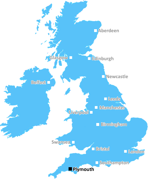
The PL19 postcode is located in the Plymouth district, in the South West of England. It encompasses the Plymouth coastline, from Whitsands in Devon to the Rame Head in Cornwall.
The postcode covers areas including the city centre, Barbican, Sutton and Keyham, these areas offer a variety of residential and commercial opportunities. Amongst these are shops, bars, restaurants, schools, parks and much more.
The area also includes a wealth of natural attractions including Plymouth Sound, Mount Edgcumbe Country Park, Spitbank, Crab Island, and the nearby Deer Park Woods National Nature Reserve.
Popular attractions in the area include the Royal Citadel, Elizabethan Gardens, Plymouth Hoe, the Mayflower Steps, the Barbican and the National Marine Aquarium. The Barbican is a popular cultural centre, with restaurants, pubs, shops and galleries. The Plymouth Hoe provides excellent views of the city and beyond, with the nearby Mayflower Steps providing the perfect spot for a spot of nostalgia, as it was here that the Pilgrim Fathers set sail for America.
PL19 can boast a great selection of education facilities, including several primary schools, secondary schools and colleges. Plymouth University is also located nearby.
It is served by mainline railway stations, the nearest of which is Plymouth Station, while a selection of bus services connects PL19 with nearby towns. There are also ferries (which connect Plymouth with France and Spain) and a heliport at Oreston.
The area is well catered for in terms of transport links, making it perfect for anyone looking to enjoy city living while still having easy access to nature. The area is safe and has a strong sense of community too, making it a great place to live for people of all ages.

Demographics

Devon

PL19 is located in the county of Devon, in England.
Devon has a total population of 1,177,900, making it the 11th largest county in the UK.
Devon has a total area of 2589 square miles, and a population density of 175 people per square kilometre. For comparison, Greater London has a density of 5,618 people/km2.
| Outward Code | PL19 |
| Postal Town | Plymouth |
| MSOA Name | West Devon 005 |
| LSOA Name | West Devon 005A |
| County | Devon |
| Region | Devon |
| Country | England |
| Local Authority | West Devon |
| Area Classification | Mainly Rural (rural including hub towns >=80%) |
PL19 Electoral Wards
The postal region of PL19, includes the local towns, villages, electoral wards and stations of:
Dig even deeper into the PL19 postcode by clicking on a postcode below:
Click on an outward postal code below for more information about the area. Each 'outward' postcode give you a comprehensive list of all postcodes within the outward code area (PL) and estimated address.
Click on an 'outward' code for more information. For example, the outward postcode page 'EC2M' will give you an alphabetical list covering all postcodes located in the region, from 'EC2M 1BB' through to 'EC2M 7YA'.
Chris H
Wednesday, April 17, 2024
We don't have any views of PL19 right now. If you live in PL19 or have visited it, please help us to help others by telling others what you think of this neighbourhood.
Add your view of PL19
People need your local expertise. If you live in PL19 or have first-hand knowledge of the neighbourhood, please consider sharing your views. It's completely anonymous - all we ask is for your initials.
Please tell us what you like about the PL19 postcode area, what you don't like, and what it's like to live or work here.
| LOCAL AMENITIES | |
| FAMILY FRIENDLY | |
| PARKING | |
| GREEN SPACES |
Local News Devon
I tried Turtle Bay's new Reggae Roast and was left wanting to know their secret
Plymouth's Caribbean-themed restaurant's Sunday lunch menu is just perfect for a relaxing afternoon
Plymouth LivePerson fighting for life after falling onto train tracks in Torquay
The incident took place at around 10.18am this morning (April 15)
Devon LiveChanges to Plymouth bus routes begin today
Plymouth Citybus has announced changes to some of its services, which come into effect next month
Plymouth LiveE-bike stolen outside University of Plymouth building
The large black bike had been locked to bike rails but the lock was removed
Plymouth LiveHuge project to expand Sherford will see hundreds of new jobs created
The council has given the green light to a series of plans as part of the freeport project
Plymouth LiveSir Keir Starmer exclusive: 'What I will do for Plymouth if I become Prime Minister'
Sir Keir Starmer has said Labour will back Plymouth's national security credentials
Plymouth LiveBBC Countryfile viewers furious with Top Gear-style part of show
BBC Countryfile viewers were left fuming as they claimed the show was turning into Top Gear after a segment on the programme
Devon LiveCritics slam 20-year Devon plan as hard-hit town 'ignored'
Fresh fears have been raised that Paignton is being overlooked as leaders thrash out a strategy for the future
Devon LiveFrom the Postcode Area blog

Deciphering Crime Rates - a Deep Dive Into UK Postcode Analysis
Ever wondered about the crime rate in your UK postcode? You're not alone. We've dug deep into the data, uncovering trends and patterns that'll make your head spin.

Death of the High Street?
The BBC reports that despite councils' attempts to kurb them, the UK's high streets have seen a huge growth in fast food outlets. Could this mark the death knell for the Great British high street, and what can we do about it to halt its decline?

Discrimination by Postcode
You really couldn't make it up, could you? Some of the country's most vulnerable people are missing out on their weekly £25 Cold Weather Payment, just because the system that's in operation is discriminating against them because payments are based on postcode, rather than geographic location.

The Redesign is Underway
Well, the current website was absolutely in dire need of a good redesign - from the ground up. So I set out to pull it all apart and get it up and running again to become the most comprehensive guide to every postcode in the UK. And it's been a long, tough job from start to finish - and quite possibly the biggest project I've ever undertaken.
SOCIAL GRADES
According to census records, 27% of people here have a social grade of AB (highest), compared to the national average of 27%.