peterborough PE31 Postcodes
Spending a fortune on conveyancing?

Compare instant, low-cost online quotes from trusted conveyancing solicitors.
Backed by experts, our no-obligation service searches through the best conveyancing quotes on the market to save you time and money.
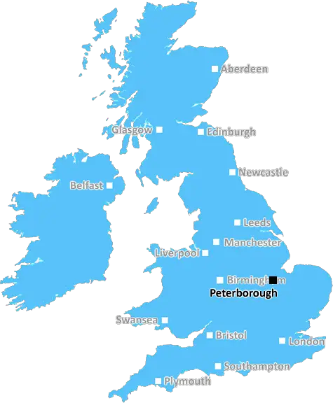
Peterborough (PE31)
The PE31 postcode area is located in the Peterborough postcode town region, within the county of Norfolk, and contains a total of 952 individual postcodes.
There are 66 electoral wards in the PE31 postcode area, including Boston, Bourne, Chatteris, Downham Market, Hunstanton, Huntingdon, King's Lynn, March, Peterborough, Sandringham, Skegness, Spalding, Spilsby, St Ives, St Neots, Stamford, Swaffham, Wisbech which come under the local authority of the King's Lynn and West Norfolk Council.
Combining the whole postcode region, 19% of people in PE31 are classed as having an AB social grade, (i.e. 'white-collar' middle-upper class), compared to 27% across the UK.
This does not mean that the people of PE31 are poorer than other areas, but it may give an indication that there are areas of deprivation.
PE31 is a postcode area within the Peterborough post town, encompassing the towns of Hunstanton, Dersingham, Snettisham, Burnham Market and Ingoldisthorpe. It is located in the English county of Norfolk and has an approximate population of 12,000 people.
The PE31 postcode covers a small coastal area of Norfolk, located on the west coast of the Wash and about 15 miles south of Kings Lynn. It is bordered by the neighbouring postcode of PE36 to the north and the postcodes PE37 and PE32 to the south. The postcode district is relatively quiet with a median house price of �232,500 according to Rightmove in 2020.
The area along the coast is largely rural with small towns and some areas of woodland. There are a number of sandy beaches including Dersingham Bog, Hunstanton Beach, and Heacham Beach. Burnham Overy Staithe is a popular spot for windsurfing, sailing and bird watching and there are a number of walking trails around the seaside village.
PE31 is also home to several popular tourist attractions such as Sandringham Estate, which is owned by the British Royal Family. The historic country house and its gardens attract thousands of visitors every year, as do the nearby Hunstanton Sea Life Sanctuary and National Trust properties.
There are several large villages within the PE31 postcode, including Dersingham, Hunstanton, Snettisham and Ingoldisthorpe. Dersingham is the largest of these with a population of 4,097. The village has several shops, pubs and a public library, as well as a golf course and a community centre. Hunstanton is an historic seaside resort, with a pier, an amusement park and a lighthouse. Snettisham is a rural village, with a church dating back to the 11th century. Ingoldisthorpe is a traditional rural estate, offering a country manor house, stables and riding hall.
The area is served by the King's Lynn and West Norfolk, Breckland and North Norfolk local authorities. Services such as schools, doctors and libraries are provided by these authorities in the local towns and villages.

Demographics

Norfolk

PE31 is located in the county of Norfolk, in England.
Norfolk has a total population of 892,900, making it the 25th largest county in the UK.
Norfolk has a total area of 2080 square miles, and a population density of 165 people per square kilometre. For comparison, Greater London has a density of 5,618 people/km2.
| Outward Code | PE31 |
| Postal Town | Peterborough |
| MSOA Name | King's Lynn and West Norfolk 005 |
| LSOA Name | King's Lynn and West Norfolk 005E |
| County | Norfolk |
| Region | Norfolk |
| Country | England |
| Local Authority | King's Lynn and West Norfolk |
| Area Classification | Largely Rural (rural including hub towns 50-79%) |
PE31 Electoral Wards
The postal region of PE31, includes the local towns, villages, electoral wards and stations of:
Dig even deeper into the PE31 postcode by clicking on a postcode below:
Click on an outward postal code below for more information about the area. Each 'outward' postcode give you a comprehensive list of all postcodes within the outward code area (PE) and estimated address.
Click on an 'outward' code for more information. For example, the outward postcode page 'EC2M' will give you an alphabetical list covering all postcodes located in the region, from 'EC2M 1BB' through to 'EC2M 7YA'.
PHFR, Peterborough
Wednesday, April 15, 2020
I am trying to locate hprevious house owner of Church House,Burnham Overy
Add your view of PE31
People need your local expertise. If you live in PE31 or have first-hand knowledge of the neighbourhood, please consider sharing your views. It's completely anonymous - all we ask is for your initials.
Please tell us what you like about the PE31 postcode area, what you don't like, and what it's like to live or work here.
| LOCAL AMENITIES | |
| FAMILY FRIENDLY | |
| PARKING | |
| GREEN SPACES |
Local News Norfolk
Seven charged or cautioned after East Anglian derby
Charges include possessing pyrotechnics, throwing a missile and being drunk and disorderly.
BBC NewsCoroner concerned after death of mentally ill man
The coroner says opportunities to provide appropriate care to Christopher Sidle were missed.
BBC NewsCromer boasts Pier of the Year 2024' title
Cromer Pier has been announced as Pier of the Year 2024'
BBC NewsNorwich beat Ipswich in East Anglian derby
Ipswich Town are overtaken by Leicester at the top of the Championship following defeat by Norwich City in the East Anglian derby.
BBC NewsSunken boats on The Broads more than doubles
The Broads Authority says recent extreme weather conditions led to the rise in the number of wrecks.
BBC NewsTourism director urges people to use regional airport
Company is encouraging travellers to visit the East of England via a "hop over the North Sea"
BBC NewsFootball club given permission to expand stadium
Downham Town FC is told it can begin work to install 50 more seats for supporters in its ground.
BBC NewsTruck crashes through level crossing barrier
Dashcam video shows the moment a vehicle smashed through the closed barrier at high speed.
BBC NewsFrom the Postcode Area blog

Deciphering Crime Rates - a Deep Dive Into UK Postcode Analysis
Ever wondered about the crime rate in your UK postcode? You're not alone. We've dug deep into the data, uncovering trends and patterns that'll make your head spin.

Death of the High Street?
The BBC reports that despite councils' attempts to kurb them, the UK's high streets have seen a huge growth in fast food outlets. Could this mark the death knell for the Great British high street, and what can we do about it to halt its decline?

Discrimination by Postcode
You really couldn't make it up, could you? Some of the country's most vulnerable people are missing out on their weekly £25 Cold Weather Payment, just because the system that's in operation is discriminating against them because payments are based on postcode, rather than geographic location.

The Redesign is Underway
Well, the current website was absolutely in dire need of a good redesign - from the ground up. So I set out to pull it all apart and get it up and running again to become the most comprehensive guide to every postcode in the UK. And it's been a long, tough job from start to finish - and quite possibly the biggest project I've ever undertaken.
SOCIAL GRADES
According to census records, 19% of people here have a social grade of AB (highest), compared to the national average of 27%.