oxford OX39 Postcodes
Spending a fortune on conveyancing?

Compare instant, low-cost online quotes from trusted conveyancing solicitors.
Backed by experts, our no-obligation service searches through the best conveyancing quotes on the market to save you time and money.
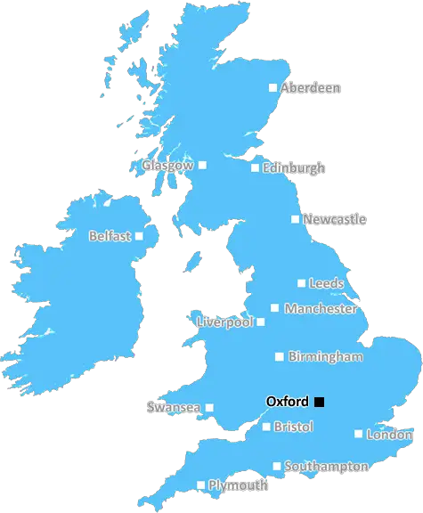
Oxford (OX39)
The OX39 postcode area is located in the Oxford postcode town region, within the county of Oxfordshire, and contains a total of 289 individual postcodes.
There are 19 electoral wards in the OX39 postcode area, including Abingdon, Bampton, Banbury, Bicester, Burford, Carterton, Chinnor, Chipping Norton, Didcot, Kidlington, Oxford, Thame, Wallingford, Wantage, Watlington, Witney, Woodstock which come under the local authority of the South Oxfordshire Council.
Combining the whole postcode region, 35% of people in OX39 are classed as having an AB social grade, (i.e. 'white-collar' middle-upper class), compared to 27% across the UK.
This does not mean that the people of OX39 are wealthier - or higher class - than average, but it can be an indication that the area may be prospering and desirable to live in.
The OX39 postcode is within the Oxford district in the United Kingdom. Covering a small 32 square kilometre area, it includes Thame, Sydenham, Worminghall, and Haddenham and is mostly comprised of villages and towns.
Thame, the largest community in the OX39 postcode area, is a historic market town and the site of a Saxon minster church and remains of a mid-13th century abbey. Famous landmarks include the Market House, the eccentric timber-framed houses, and the 12th century Corn Market.
Symeham, a small village near Thame, is home to the beautiful 16th century Perrott's Hill Cottage. It's also known for its cricket club and hunting tradition, which dates back to the first half of the 19th century.
Worminghall is a small village where some of the most ancient residences and monuments from the Medieval era are located, such as Worminghall Manor House, St Nicholas Church which has been a place of worship since the 12th century, and St Peter's Church, which was built in the 16th century. This village is part of the Parish of Ickford.
Haddenham, the most densely populated settlement in the OX39 area, is a large rural parish and the birthplace of the Haddenham Hoard, a collection of treasured coins, jewellery and other artifacts dating back to the Iron Age. The village also contains two ancient monuments: St Mary's Church and the Maude Jenkins Library.
Other places within the OX39 postcode area include Cuddington, Long Crendon, Brill, and Chearsley, which all contain historically significant buildings and other notable local amenities.
The OX39 area has retained its rural charm, while at the same time being conveniently located to the amenities and attractions of both Oxford and Aylesbury, which are both within easy reach. Although this area falls within the Chilterns Area of Outstanding Natural Beauty, modern day development and housing projects are also underway.

Demographics

Oxfordshire

OX39 is located in the county of Oxfordshire, in England.
Oxfordshire has a total population of 683,200, making it the 35th largest county in the UK.
Oxfordshire has a total area of 1005 square miles, and a population density of 262 people per square kilometre. For comparison, Greater London has a density of 5,618 people/km2.
| Outward Code | OX39 |
| Postal Town | Oxford |
| MSOA Name | South Oxfordshire 005 |
| LSOA Name | South Oxfordshire 005D |
| County | Oxfordshire |
| Region | Oxfordshire |
| Country | England |
| Local Authority | South Oxfordshire |
| Area Classification | Mainly Rural (rural including hub towns >=80%) |
OX39 Electoral Wards
The postal region of OX39, includes the local towns, villages, electoral wards and stations of:
Dig even deeper into the OX39 postcode by clicking on a postcode below:
Click on an outward postal code below for more information about the area. Each 'outward' postcode give you a comprehensive list of all postcodes within the outward code area (OX) and estimated address.
Click on an 'outward' code for more information. For example, the outward postcode page 'EC2M' will give you an alphabetical list covering all postcodes located in the region, from 'EC2M 1BB' through to 'EC2M 7YA'.
Chris H
Sunday, April 7, 2024
We don't have any views of OX39 right now. If you live in OX39 or have visited it, please help us to help others by telling others what you think of this neighbourhood.
Add your view of OX39
People need your local expertise. If you live in OX39 or have first-hand knowledge of the neighbourhood, please consider sharing your views. It's completely anonymous - all we ask is for your initials.
Please tell us what you like about the OX39 postcode area, what you don't like, and what it's like to live or work here.
| LOCAL AMENITIES | |
| FAMILY FRIENDLY | |
| PARKING | |
| GREEN SPACES |
Local News Oxfordshire
Crawley's The Create Building lands British Airways Holidays as tenant
The company has signed a lease for the top floor of the nine-storey tower.
Property WeekApproval granted for village pub to become homes
Councillors voted to allow the Horse and Harrow in West Hagbourne to be converted into two houses.
BBC NewsQuadrant gets green light for residential-led scheme in Kent
The project will also include the development of more than 376,700 sq ft of grade-A commercial space.
Property WeekOxfam: Working safely 'next to impossible' in Gaza
The charity says its staff have still found ways to deliver aid "despite all the complexities".
BBC NewsWomen's football team helps inspire bullied girls
The young girls, who had been bullied for playing football, met with Oxford United Women players.
BBC NewsMirabaud buys Virgin Atlantic HQ in UK debut
Swiss investor snaps up grade-A office scheme let to Virgin Atlantic until 2032.
Property WeekRegal London signs Epson UK for 30,000 sq ft pre-let at Watford scheme
The grade-A The Clarendon Works office scheme will open in Q3.
Property WeekGreencore secures 30m investment to support sustainable development
The funding will support the developer's plans to build up to 10,000 low-carbon homes.
Property WeekFrom the Postcode Area blog

Deciphering Crime Rates - a Deep Dive Into UK Postcode Analysis
Ever wondered about the crime rate in your UK postcode? You're not alone. We've dug deep into the data, uncovering trends and patterns that'll make your head spin.

Death of the High Street?
The BBC reports that despite councils' attempts to kurb them, the UK's high streets have seen a huge growth in fast food outlets. Could this mark the death knell for the Great British high street, and what can we do about it to halt its decline?

Discrimination by Postcode
You really couldn't make it up, could you? Some of the country's most vulnerable people are missing out on their weekly £25 Cold Weather Payment, just because the system that's in operation is discriminating against them because payments are based on postcode, rather than geographic location.

The Redesign is Underway
Well, the current website was absolutely in dire need of a good redesign - from the ground up. So I set out to pull it all apart and get it up and running again to become the most comprehensive guide to every postcode in the UK. And it's been a long, tough job from start to finish - and quite possibly the biggest project I've ever undertaken.
SOCIAL GRADES
According to census records, 35% of people here have a social grade of AB (highest), compared to the national average of 27%.