oxford OX14 Postcodes
Spending a fortune on conveyancing?

Compare instant, low-cost online quotes from trusted conveyancing solicitors.
Backed by experts, our no-obligation service searches through the best conveyancing quotes on the market to save you time and money.
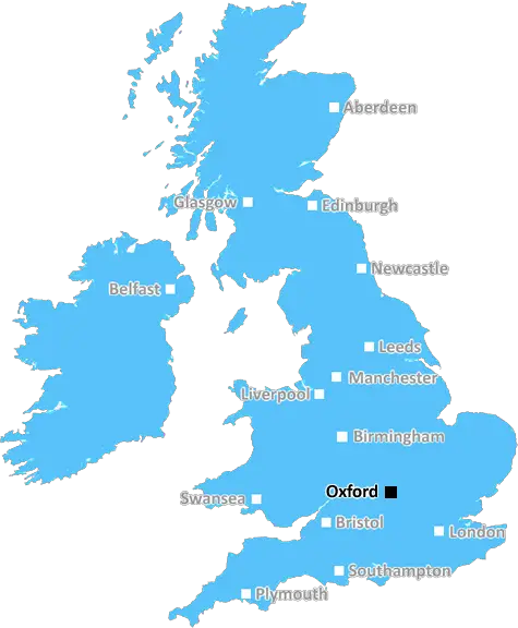
Oxford (OX14)
The OX14 postcode area is located in the Oxford postcode town region, within the county of Oxfordshire, and contains a total of 1872 individual postcodes.
There are 37 electoral wards in the OX14 postcode area, including Abingdon, Bampton, Banbury, Bicester, Burford, Carterton, Chinnor, Chipping Norton, Didcot, Kidlington, Oxford, Thame, Wallingford, Wantage, Watlington, Witney, Woodstock which come under the local authority of the Vale of White Horse Council.
Combining the whole postcode region, 35% of people in OX14 are classed as having an AB social grade, (i.e. 'white-collar' middle-upper class), compared to 27% across the UK.
This does not mean that the people of OX14 are wealthier - or higher class - than average, but it can be an indication that the area may be prospering and desirable to live in.
OX14 is a postcode district in the UK, located around the town of Abingdon in Oxfordshire. It covers parts of the Vale of White Horse and South Oxfordshire districts, which are south-west of Oxford.
Within the postcode district there are many towns and villages, including Abingdon, Drayton, Marcham, Milton and Milton Hill, Clifton Hampden, North Hinksey, South Hinksey, Radley, Sutton Courtenay, Fyfield, Ardington, Goosey, Garsington, Sunningwell, Nuneham Courtenay, Longworth, Drayton, Steventon, Harwell and Upton.
The postcode district covers an area of 83 square kilometres, stretching from the A34 in the south to the B4015 in the north, and from the A415 in the west to the B4017 in the east. In the centre is the market town of Abingdon, home to many shops, restaurants and caf�s.
It is home to some of the best schools in the area, with Abingdon School being the most notable. The area also has a large sports centre, tennis courts, rugby, hockey and squash clubs as well as several golf courses. There are also some popular sights such as the Wild Place Project and the OX14 Trail.
There are plenty of other amenities located within the postcode district, including a range of convenience stores, pubs, banks, post offices and petrol stations. Businesses can benefit from the local business parks, as well as connections to Oxford, Reading and London. It is also well served by transport, with regular railway services and a number of bus routes connecting it to other places.
OX14 is a diverse area, offering everything from quaint rural villages to modern developments and a bustling market town. With its excellent transport links and range of amenities, it is a great place to live, work and visit.

Demographics

Oxfordshire

OX14 is located in the county of Oxfordshire, in England.
Oxfordshire has a total population of 683,200, making it the 35th largest county in the UK.
Oxfordshire has a total area of 1005 square miles, and a population density of 262 people per square kilometre. For comparison, Greater London has a density of 5,618 people/km2.
| Outward Code | OX14 |
| Postal Town | Oxford |
| MSOA Name | Vale of White Horse 006 |
| LSOA Name | Vale of White Horse 006F |
| County | Oxfordshire |
| Region | Oxfordshire |
| Country | England |
| Local Authority | Vale of White Horse |
| Area Classification | Largely Rural (rural including hub towns 50-79%) |
OX14 Electoral Wards
The postal region of OX14, includes the local towns, villages, electoral wards and stations of:
Dig even deeper into the OX14 postcode by clicking on a postcode below:
Click on an outward postal code below for more information about the area. Each 'outward' postcode give you a comprehensive list of all postcodes within the outward code area (OX) and estimated address.
Click on an 'outward' code for more information. For example, the outward postcode page 'EC2M' will give you an alphabetical list covering all postcodes located in the region, from 'EC2M 1BB' through to 'EC2M 7YA'.
Chris H
Monday, April 8, 2024
We don't have any views of OX14 right now. If you live in OX14 or have visited it, please help us to help others by telling others what you think of this neighbourhood.
Add your view of OX14
People need your local expertise. If you live in OX14 or have first-hand knowledge of the neighbourhood, please consider sharing your views. It's completely anonymous - all we ask is for your initials.
Please tell us what you like about the OX14 postcode area, what you don't like, and what it's like to live or work here.
| LOCAL AMENITIES | |
| FAMILY FRIENDLY | |
| PARKING | |
| GREEN SPACES |
Local News Berkshire
Bolton Wanderers 5-2 Reading
Aaron Collins scores his first Bolton hat-trick as Wanderers beat Reading 5-2 to revive their automatic promotion hopes.
BBC NewsPlaces for People acquires Rosewood Housing
The affordable homes provider was previously owned by housing developer Inland Homes.
Property WeekL&G acquires Cambridgeshire BTR scheme from Stonebond
The 41-unit development comprises 10 flats and 31 houses.
Property WeekFlats plan for shopping centre amended
The proposed height of two towers containing hundreds of flats has been amended.
BBC News'Soon we won't be able to cope with any more'
A look back to a week to forget for Reading fans with the proposed sale of Bearwood Park.
BBC NewsLuton Airport operating company buys hangars of collapsed airline Monarch
Hangars can accommodate wide body jets up to the size of a Boeing 767.
Property WeekWhen and how often should I walk my dog as spring arrives?
With spring here and better weather upon us, a dog behaviourist has revealed how often you should walk your four-legged friend.
Local Berkshiremydentist Tilehurst three year wait list according to patients
mydentist at Meadway Precincthas allegedly been telling patients that their waiting list is over three years long.
Local BerkshireFrom the Postcode Area blog

Deciphering Crime Rates - a Deep Dive Into UK Postcode Analysis
Ever wondered about the crime rate in your UK postcode? You're not alone. We've dug deep into the data, uncovering trends and patterns that'll make your head spin.

Death of the High Street?
The BBC reports that despite councils' attempts to kurb them, the UK's high streets have seen a huge growth in fast food outlets. Could this mark the death knell for the Great British high street, and what can we do about it to halt its decline?

Discrimination by Postcode
You really couldn't make it up, could you? Some of the country's most vulnerable people are missing out on their weekly £25 Cold Weather Payment, just because the system that's in operation is discriminating against them because payments are based on postcode, rather than geographic location.

The Redesign is Underway
Well, the current website was absolutely in dire need of a good redesign - from the ground up. So I set out to pull it all apart and get it up and running again to become the most comprehensive guide to every postcode in the UK. And it's been a long, tough job from start to finish - and quite possibly the biggest project I've ever undertaken.
SOCIAL GRADES
According to census records, 35% of people here have a social grade of AB (highest), compared to the national average of 27%.