oldham OL15 Postcodes
Spending a fortune on conveyancing?

Compare instant, low-cost online quotes from trusted conveyancing solicitors.
Backed by experts, our no-obligation service searches through the best conveyancing quotes on the market to save you time and money.
Oldham (OL15)
The OL15 postcode area is located in the Oldham postcode town region, within the county of Greater Manchester, and contains a total of 615 individual postcodes.
There are 13 electoral wards in the OL15 postcode area, including Ashton-Under-Lyne, Bacup, Heywood, Littleborough, Oldham, Rochdale, Todmorden which come under the local authority of the Rochdale Council.
Combining the whole postcode region, 18% of people in OL15 are classed as having an AB social grade, (i.e. 'white-collar' middle-upper class), compared to 27% across the UK.
This does not mean that the people of OL15 are poorer than other areas, but it may give an indication that there are areas of deprivation.
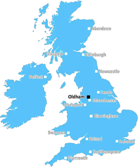
The OL15 postcode is in the Oldham district of Greater Manchester, in the North West of England. It is part of the Oldham post town and covers several areas of the town including Moorside and Greenacres. It is bounded by the OL13 postcode to the east, the OL16 postcode to the south, and the OL9 postcode to the west.
The population of the OL15 postcode area is around 13,150 and the area is home to a large number of industry and manufacturing businesses. The majority of these businesses are located in the parts of Oldham enclosed by OL15, such as Moorside, and many are family owned.
The area is served well by public transport, with Cedar Park Metrolink station providing quick and easy access into Manchester city centre. The Oldham loop of the M60 is also close by, providing quick access into Manchester, Stockport and further afield.
Though historically a centre for industry, there has been more recent investment into the OL15 area, resulting in new housing developments, business parks and leisure facilities, making it an attractive residential area for those commuting into Manchester. The area is also well linked with nearby towns and cities due to the presence of the M60 and its good public transport links.
The area is home to numerous places of worship, including St Paul's Church and the Guru Har Rai Gurdwara, as well as a number of schools, including Broughton CE Primary School, Carr Hill Primary School and Oldham Hulme Grammar School.
The area is surrounded by picturesque countryside and there is a range of leisure amenities and outdoor activities to be enjoyed in the area, with a wealth of green space, parks and cycle routes around the OL15 postcode. There are also a number of shops, pubs and restaurants scattered around the area to enjoy.

Demographics
Greater Manchester

OL15 is located in the county of Greater Manchester, in England.
Greater Manchester has a total population of 2,782,100, making it the 3rd largest county in the UK.
Greater Manchester has a total area of 492 square miles, and a population density of 2180 people per square kilometre. For comparison, Greater London has a density of 5,618 people/km2.
| Outward Code | OL15 |
| Postal Town | Oldham |
| MSOA Name | Rochdale 014 |
| LSOA Name | Rochdale 014A |
| County | Greater Manchester |
| Region | Greater Manchester |
| Country | England |
| Local Authority | Rochdale |
| Area Classification | Urban with Major Conurbation |
OL15 Electoral Wards
The postal region of OL15, includes the local towns, villages, electoral wards and stations of:
Dig even deeper into the OL15 postcode by clicking on a postcode below:
Click on an outward postal code below for more information about the area. Each 'outward' postcode give you a comprehensive list of all postcodes within the outward code area (OL) and estimated address.
Click on an 'outward' code for more information. For example, the outward postcode page 'EC2M' will give you an alphabetical list covering all postcodes located in the region, from 'EC2M 1BB' through to 'EC2M 7YA'.
Chris H
Monday, May 13, 2024
We don't have any views of OL15 right now. If you live in OL15 or have visited it, please help us to help others by telling others what you think of this neighbourhood.
Add your view of OL15
People need your local expertise. If you live in OL15 or have first-hand knowledge of the neighbourhood, please consider sharing your views. It's completely anonymous - all we ask is for your initials.
Please tell us what you like about the OL15 postcode area, what you don't like, and what it's like to live or work here.
| LOCAL AMENITIES | |
| FAMILY FRIENDLY | |
| PARKING | |
| GREEN SPACES |
Local News Lancashire
Anderson on retirement, the future & his send-off
England bowler James Anderson says he is "happy" after announcing he will retire this summer, adding that "it feels like a good time".
BBC NewsCouncil to spend extra 4m on potholes after 'cry for help'
Lancashire County Council says residents have made it "abundantly clear" they want road improvements.
BBC NewsQuad bike rider killed in crash with car
Police say a man in his 50s who was riding the quad bike died at the scene.
BBC NewsBlind dancers say ballroom contest was a dream
Taking part in an international dance competition was "like a breath of fresh air", one dancer says.
BBC NewsPlans for seaside homes come with conditions
A developer has been told it can build the houses if it provides cash for extra local services.
BBC NewsSunday 1 bus fares to be introduced in Lancashire
Cheaper tickets for young people are also set to be launched later this year.
BBC NewsHameed hits 247 as Notts close on win over Lancs
Haseeb Hameed hits a career-best 247 not out against former club Lancashire as Notts take control of the County Championship Division One match.
BBC NewsDirector of football Broughton set to leave Blackburn
Blackburn Rovers' sporting director Gregg Broughton is set to leave the Championship club.
BBC NewsFrom the Postcode Area blog

Deciphering Crime Rates - a Deep Dive Into UK Postcode Analysis
Ever wondered about the crime rate in your UK postcode? You're not alone. We've dug deep into the data, uncovering trends and patterns that'll make your head spin.

Death of the High Street?
The BBC reports that despite councils' attempts to kurb them, the UK's high streets have seen a huge growth in fast food outlets. Could this mark the death knell for the Great British high street, and what can we do about it to halt its decline?

Discrimination by Postcode
You really couldn't make it up, could you? Some of the country's most vulnerable people are missing out on their weekly £25 Cold Weather Payment, just because the system that's in operation is discriminating against them because payments are based on postcode, rather than geographic location.

The Redesign is Underway
Well, the current website was absolutely in dire need of a good redesign - from the ground up. So I set out to pull it all apart and get it up and running again to become the most comprehensive guide to every postcode in the UK. And it's been a long, tough job from start to finish - and quite possibly the biggest project I've ever undertaken.
SOCIAL GRADES
According to census records, 18% of people here have a social grade of AB (highest), compared to the national average of 27%.