nottingham NG32 Postcodes
Spending a fortune on conveyancing?

Compare instant, low-cost online quotes from trusted conveyancing solicitors.
Backed by experts, our no-obligation service searches through the best conveyancing quotes on the market to save you time and money.
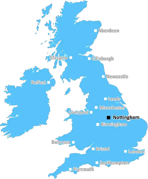
Nottingham (NG32)
The NG32 postcode area is located in the Nottingham postcode town region, within the county of Lincolnshire, and contains a total of 704 individual postcodes.
There are 104 electoral wards in the NG32 postcode area, including Grantham, Mansfield, Newark, Nottingham, Sleaford, Southwell, Sutton-In-Ashfield which come under the local authority of the South Kesteven Council.
Combining the whole postcode region, 29% of people in NG32 are classed as having an AB social grade, (i.e. 'white-collar' middle-upper class), compared to 27% across the UK.
This does not mean that the people of NG32 are wealthier - or higher class - than average, but it can be an indication that the area may be prospering and desirable to live in.
The NG32 postcode is an area in Nottinghamshire, England. It covers towns and villages such as Long Bennington, Grantham, Harlaxton, Great Ponton, Great Gonerby, Sedgebrook, Harby, Leadenham, Osbournby, and Welby.
NG32 is located in the East Midlands region of England and is home to a population of approximately 14,000 people. It is close to the M1 motorway, as well as major cities such as Nottingham, Leicester, and Derby. It is a popular location for residents who enjoy the tranquil surrounding countryside.
The postcode is typically used to describe the A1 corridor which runs through it, from Grantham to Newark-on-Trent, and is often referred to as �the A1 postcode.� This corridor includes some of the most well-known attractions and landmarks in the area, including Belton House, the National Trust property, and Belvoir Castle.
The area is serviced by a good transport network, including three train stations at Long Bennington, Grantham, and Newark North Gate. The local Stratford-on-Avon railway line also runs through the postcode, connecting Grantham and Newark-on-Trent to places such as Leicester and Birmingham.
The NG32 postcode area is well known for its schools, with several grammars in the area as well as Long Bennington Primary and, Leadenham Primary. There are also excellent educational facilities in long bennington, Harby, and Sedgebrook, as well as a range of further and higher education institutions across the area.
In terms of leisure facilities, NG32 postcode has plenty to offer, with a wide range of parks, gardens, museums, golf courses, and other attractions. The area is known for its rich heritage, with many sites of historic and archaeological interest, such as Castor church and Laxton castle. There are also plenty of local shops, pubs, restaurants, and other businesses.

Demographics

Lincolnshire

NG32 is located in the county of Lincolnshire, in England.
Lincolnshire has a total population of 1,073,300, making it the 18th largest county in the UK.
Lincolnshire has a total area of 2693 square miles, and a population density of 153 people per square kilometre. For comparison, Greater London has a density of 5,618 people/km2.
| Outward Code | NG32 |
| Postal Town | Nottingham |
| MSOA Name | South Kesteven 009 |
| LSOA Name | South Kesteven 009A |
| County | Lincolnshire |
| Region | Lincolnshire |
| Country | England |
| Local Authority | South Kesteven |
| Area Classification | Largely Rural (rural including hub towns 50-79%) |
NG32 Electoral Wards
The postal region of NG32, includes the local towns, villages, electoral wards and stations of:
Dig even deeper into the NG32 postcode by clicking on a postcode below:
Click on an outward postal code below for more information about the area. Each 'outward' postcode give you a comprehensive list of all postcodes within the outward code area (NG) and estimated address.
Click on an 'outward' code for more information. For example, the outward postcode page 'EC2M' will give you an alphabetical list covering all postcodes located in the region, from 'EC2M 1BB' through to 'EC2M 7YA'.
Chris H
Sunday, April 7, 2024
We don't have any views of NG32 right now. If you live in NG32 or have visited it, please help us to help others by telling others what you think of this neighbourhood.
Add your view of NG32
People need your local expertise. If you live in NG32 or have first-hand knowledge of the neighbourhood, please consider sharing your views. It's completely anonymous - all we ask is for your initials.
Please tell us what you like about the NG32 postcode area, what you don't like, and what it's like to live or work here.
| LOCAL AMENITIES | |
| FAMILY FRIENDLY | |
| PARKING | |
| GREEN SPACES |
Local News Lincolnshire
Investigations ongoing after former deputy crime commissioner resigns over pub 'fight'
Lincolnshire Police arrested a man in his 50s
Lincolnshire LiveIs this Bourne dog Britain's loneliest pooch?
Bentley's spent seven years at the rescue shelter.
BBC NewsLincoln Glory Hole finally reopens after 'challenging' repairs completed
"We got there in the end"
Lincolnshire LiveCollection of famous autographs to be auctioned
Stars including Paul McCartney, Elton John and George Best signed the book during the 1960s.
BBC NewsLincoln's historic Glory Hole footpath to reopen
A local business says it has spent the past year in a "survival process".
BBC NewsLincolnshire weather forecast as highs of 21C expected over weekend
Warmer weather is on its way after a wet start to the year
Lincolnshire LiveCarlisle United 1-3 Lincoln City
Lincoln continue their late play-off charge with a 3-1 victory over relegation-threatened Carlisle.
BBC NewsDinosaur trail organisers slam 'mindless' vandals
Officials say CCTV footage is being studied and Lincolnshire Police are investigating
BBC NewsFrom the Postcode Area blog

Deciphering Crime Rates - a Deep Dive Into UK Postcode Analysis
Ever wondered about the crime rate in your UK postcode? You're not alone. We've dug deep into the data, uncovering trends and patterns that'll make your head spin.

Death of the High Street?
The BBC reports that despite councils' attempts to kurb them, the UK's high streets have seen a huge growth in fast food outlets. Could this mark the death knell for the Great British high street, and what can we do about it to halt its decline?

Discrimination by Postcode
You really couldn't make it up, could you? Some of the country's most vulnerable people are missing out on their weekly £25 Cold Weather Payment, just because the system that's in operation is discriminating against them because payments are based on postcode, rather than geographic location.

The Redesign is Underway
Well, the current website was absolutely in dire need of a good redesign - from the ground up. So I set out to pull it all apart and get it up and running again to become the most comprehensive guide to every postcode in the UK. And it's been a long, tough job from start to finish - and quite possibly the biggest project I've ever undertaken.
SOCIAL GRADES
According to census records, 29% of people here have a social grade of AB (highest), compared to the national average of 27%.