nottingham NG18 Postcodes
Spending a fortune on conveyancing?

Compare instant, low-cost online quotes from trusted conveyancing solicitors.
Backed by experts, our no-obligation service searches through the best conveyancing quotes on the market to save you time and money.
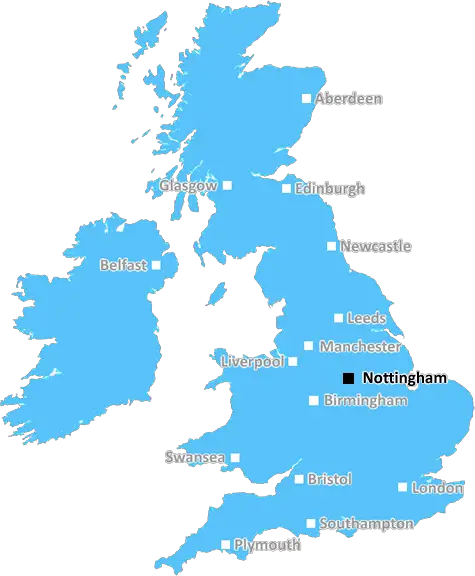
Nottingham (NG18)
The NG18 postcode area is located in the Nottingham postcode town region, within the county of Nottinghamshire, and contains a total of 1575 individual postcodes.
There are 4 electoral wards in the NG18 postcode area, including Grantham, Mansfield, Newark, Nottingham, Sleaford, Southwell, Sutton-In-Ashfield which come under the local authority of the Mansfield Council.
Combining the whole postcode region, 15% of people in NG18 are classed as having an AB social grade, (i.e. 'white-collar' middle-upper class), compared to 27% across the UK.
This does not mean that the people of NG18 are poorer than other areas, but it may give an indication that there are areas of deprivation.
The NG18 postcode is located in the Nottingham district in the East Midlands of England. It includes parts of Mansfield, Sutton-in-Ashfield, Kirkby-in-Ashfield and Teversal in Nottinghamshire. It is a principally urban area and is within easy commuting distance of Nottingham.
The postcode covers the main town of Mansfield and the surrounding towns and villages, including the popular West Nottinghamshire village of Teversal. The area has a collection of small and medium-sized towns and villages that are popular with commuters, families, and tourists. Residents enjoy the easy access to a wide range of services and amenities throughout the district.
The postcode is home to several large employers, including the Kirkby-in-Ashfield shopping centre, Notts Fire and Rescue Service, and major distribution centres. It also includes areas of mixed-use development, with a mix of residential and retail accommodation. There is an explosion of small-scale and independent black-owned businesses popping up across the area, offering a great range of services to locals.
The area is well served by transport links, with buses providing access to Nottingham, Derby and Sheffield from Kirkby-in-Ashfield, Sutton-in-Ashfield, and Mansfield. The Midland Main Line rail service stops at both Mansfield and Sutton-in-Ashfield, providing a regular and fast link to major towns and cities.
In terms of education, the area offers a broad range of nurseries, primary, and secondary schools, as well as a large and well-rated sixth form college.
The area has strong traditions and a vibrant community, with events and activities taking place throughout the year. The main town of Mansfield has its own annual festival and numerous cultural venues, as well as an active nightlife. In the nearby villages, there are a range of pubs, cafes, and restaurants.
NG18 is a great postcode for locals and visitors alike. It is a vibrant, bustling district that is well-placed for access to major cities, as well as being a great place to call home.

Demographics

Nottinghamshire

NG18 is located in the county of Nottinghamshire, in England.
Nottinghamshire has a total population of 1,136,000, making it the 15th largest county in the UK.
Nottinghamshire has a total area of 834 square miles, and a population density of 526 people per square kilometre. For comparison, Greater London has a density of 5,618 people/km2.
| Outward Code | NG18 |
| Postal Town | Nottingham |
| MSOA Name | Mansfield 008 |
| LSOA Name | Mansfield 008D |
| County | Nottinghamshire |
| Region | Nottinghamshire |
| Country | England |
| Local Authority | Mansfield |
| Area Classification | Urban with City and Town |
NG18 Electoral Wards
The postal region of NG18, includes the local towns, villages, electoral wards and stations of:
Dig even deeper into the NG18 postcode by clicking on a postcode below:
Click on an outward postal code below for more information about the area. Each 'outward' postcode give you a comprehensive list of all postcodes within the outward code area (NG) and estimated address.
Click on an 'outward' code for more information. For example, the outward postcode page 'EC2M' will give you an alphabetical list covering all postcodes located in the region, from 'EC2M 1BB' through to 'EC2M 7YA'.
Chris H
Saturday, April 6, 2024
We don't have any views of NG18 right now. If you live in NG18 or have visited it, please help us to help others by telling others what you think of this neighbourhood.
Add your view of NG18
People need your local expertise. If you live in NG18 or have first-hand knowledge of the neighbourhood, please consider sharing your views. It's completely anonymous - all we ask is for your initials.
Please tell us what you like about the NG18 postcode area, what you don't like, and what it's like to live or work here.
| LOCAL AMENITIES | |
| FAMILY FRIENDLY | |
| PARKING | |
| GREEN SPACES |
Local News Nottinghamshire
Nottingham City Council spending 700,000 putting up scaffolding every day on ageing energy building
Nottingham City Council says there is a risk of the Enviroenergy network shutting down if the building is not maintained
Nottingham PostPoundland unveils major makeover of Nottingham city centre store as part of 'significant investment'
The revamp brings changes such as new floors and signs, but also a wider range of baby and children's clothing
Nottingham PostWorker diverted council cash into her own pocket
Sinead Johnson took funds from 61 accounts for vulnerable people over four years, a court hears.
BBC NewsCatcallers could be fined under new council plans
The proposal is intended to protect women and girls from inappropriate behaviour.
BBC NewsMansfield defender Hewitt 'buzzing' to be back
Mansfield Town defender Elliott Hewitt says he is "buzzing" to be back fit again after 11 months out.
BBC News'Beautiful' beach you'll have to yourself and it's less than two hours away from Nottingham
The beach is next to a large nature reserve with tidal sand and mudflats, salt and freshwater marshes, and sand dunes
Nottingham PostI tried Nottingham's International Market where the food was 'heavenly'
It has a little something for everyone and is a must-visit
Nottingham PostUniversity student flats plan approved by council
Four buildings will be demolished to make way for the six-storey apartment block.
BBC NewsFrom the Postcode Area blog

Deciphering Crime Rates - a Deep Dive Into UK Postcode Analysis
Ever wondered about the crime rate in your UK postcode? You're not alone. We've dug deep into the data, uncovering trends and patterns that'll make your head spin.

Death of the High Street?
The BBC reports that despite councils' attempts to kurb them, the UK's high streets have seen a huge growth in fast food outlets. Could this mark the death knell for the Great British high street, and what can we do about it to halt its decline?

Discrimination by Postcode
You really couldn't make it up, could you? Some of the country's most vulnerable people are missing out on their weekly £25 Cold Weather Payment, just because the system that's in operation is discriminating against them because payments are based on postcode, rather than geographic location.

The Redesign is Underway
Well, the current website was absolutely in dire need of a good redesign - from the ground up. So I set out to pull it all apart and get it up and running again to become the most comprehensive guide to every postcode in the UK. And it's been a long, tough job from start to finish - and quite possibly the biggest project I've ever undertaken.
SOCIAL GRADES
According to census records, 15% of people here have a social grade of AB (highest), compared to the national average of 27%.