norwich NR11 Postcodes
Spending a fortune on conveyancing?

Compare instant, low-cost online quotes from trusted conveyancing solicitors.
Backed by experts, our no-obligation service searches through the best conveyancing quotes on the market to save you time and money.
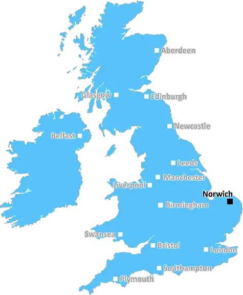
Norwich (NR11)
The NR11 postcode area is located in the Norwich postcode town region, within the county of Norfolk, and contains a total of 822 individual postcodes.
There are 109 electoral wards in the NR11 postcode area, including Attleborough, Beccles, Bungay, Cromer, Dereham, Fakenham, Great Yarmouth, Holt, Lowestoft, Melton Constable, North Walsham, Norwich, Sheringham, Walsingham, Wells-Next-The-Sea, Wymondham which come under the local authority of the Broadland Council.
Combining the whole postcode region, 20% of people in NR11 are classed as having an AB social grade, (i.e. 'white-collar' middle-upper class), compared to 27% across the UK.
This does not mean that the people of NR11 are poorer than other areas, but it may give an indication that there are areas of deprivation.
NR11 is a postcode district located in the north of England, specifically within the county of Norfolk. It covers an area which includes the market towns of Cromer and North Walsham, as well as numerous villages, hamlets and outlying rural areas. The post town for the district is Aylsham.
The northern portion of the district is largely rural, with its settlements predominantly scattered amongst its rolling landscape. To the south, this gives way to a more densely populated area, with the two market towns of Cromer and North Walsham being main centres of population. Other sizeable settlements within the postcode area are the villages of Roughton, Felmingham and Southrepps.
NR11 has a long and fascinating history which dates back to the days when the area was part of the historic �Palace Round', an administrative perimeter of the estate of King Henry VIII. Cromer is home to a pier opened in 1901, while North Walsham was the birthplace of the 15th century scholar Nicholas Udall, who went on to become the master of Eton College and the first headmaster of Westminster School.
The area is well connected by road, Newtown Road running through to well-serviced A12, offering excellent accessibility to East Anglia, and providing access to London and beyond. Rail routes, including the Bittern Line, traverse the area and present links to major cities and airports including Norwich, Cambridge, Stansted and Birmingham.
In terms of leisure activities, the postcode area is well endowed. The beautiful Norfolk Coast, a designated Area of Outstanding Natural Beauty, is a popular place to visit with its white sands, sand dunes, boat trips, bird-watching and Cromer's famous famous lifeboat and pier theatre, offering a wide range of entertainment. These activities also provide visitors with the opportunity to also visit many of the historic houses and churches dotted throughout the area.
It is also possible to take advantage of the many walks and cycle trails available, and to explore the area's diverse flora and fauna. Other attractions include Bewilderwood Adventure Park and the Cromer museum, where you can learn more about the area's rich heritage.
NR11 is an area with a great deal to offer both residents and visitors, boasting an array of beautiful countryside, varied historic heritage and leisure activities. It is no surprise that it has become a popular destination for those looking to take a break away from the hustle and bustle of city life.

Demographics

Norfolk

NR11 is located in the county of Norfolk, in England.
Norfolk has a total population of 892,900, making it the 25th largest county in the UK.
Norfolk has a total area of 2080 square miles, and a population density of 165 people per square kilometre. For comparison, Greater London has a density of 5,618 people/km2.
| Outward Code | NR11 |
| Postal Town | Norwich |
| MSOA Name | Broadland 001 |
| LSOA Name | Broadland 001A |
| County | Norfolk |
| Region | Norfolk |
| Country | England |
| Local Authority | Broadland |
| Area Classification | Urban with Significant Rural (rural including hub towns 26-49%) |
NR11 Electoral Wards
The postal region of NR11, includes the local towns, villages, electoral wards and stations of:
Dig even deeper into the NR11 postcode by clicking on a postcode below:
Click on an outward postal code below for more information about the area. Each 'outward' postcode give you a comprehensive list of all postcodes within the outward code area (NR) and estimated address.
Click on an 'outward' code for more information. For example, the outward postcode page 'EC2M' will give you an alphabetical list covering all postcodes located in the region, from 'EC2M 1BB' through to 'EC2M 7YA'.
Chris H
Thursday, April 11, 2024
We don't have any views of NR11 right now. If you live in NR11 or have visited it, please help us to help others by telling others what you think of this neighbourhood.
Add your view of NR11
People need your local expertise. If you live in NR11 or have first-hand knowledge of the neighbourhood, please consider sharing your views. It's completely anonymous - all we ask is for your initials.
Please tell us what you like about the NR11 postcode area, what you don't like, and what it's like to live or work here.
| LOCAL AMENITIES | |
| FAMILY FRIENDLY | |
| PARKING | |
| GREEN SPACES |
Local News Norfolk
Driver aged in 70s killed in A47 crash
Police say the victim died at the scene of the crash, which saw the road closed for three hours.
BBC NewsFinal pylon consultation gets under way
National Grid seeks the public's views again on its plans after making some changes.
BBC NewsLocal elections 2024: Is there an election in my area?
Use our lookup to see if there is an election in your area and who you can vote for on 2 May
BBC NewsSeven charged or cautioned after East Anglian derby
Charges include possessing pyrotechnics, throwing a missile and being drunk and disorderly.
BBC NewsCromer boasts Pier of the Year 2024' title
Cromer Pier has been announced as Pier of the Year 2024'
BBC NewsNorwich beat Ipswich in East Anglian derby
Ipswich Town are overtaken by Leicester at the top of the Championship following defeat by Norwich City in the East Anglian derby.
BBC NewsPhoto of dad stuck in Wembley turnstile goes viral
"Win, lose or draw. Don't care. Saw my dad get stuck in a turnstile so all worth it," says son.
BBC NewsWednesday stun Norwich with late comeback
Sheffield Wednesday come from two goals down to deny high-flying Norwich at Hillsborough in the Championship.
BBC NewsFrom the Postcode Area blog

Deciphering Crime Rates - a Deep Dive Into UK Postcode Analysis
Ever wondered about the crime rate in your UK postcode? You're not alone. We've dug deep into the data, uncovering trends and patterns that'll make your head spin.

Death of the High Street?
The BBC reports that despite councils' attempts to kurb them, the UK's high streets have seen a huge growth in fast food outlets. Could this mark the death knell for the Great British high street, and what can we do about it to halt its decline?

Discrimination by Postcode
You really couldn't make it up, could you? Some of the country's most vulnerable people are missing out on their weekly £25 Cold Weather Payment, just because the system that's in operation is discriminating against them because payments are based on postcode, rather than geographic location.

The Redesign is Underway
Well, the current website was absolutely in dire need of a good redesign - from the ground up. So I set out to pull it all apart and get it up and running again to become the most comprehensive guide to every postcode in the UK. And it's been a long, tough job from start to finish - and quite possibly the biggest project I've ever undertaken.
SOCIAL GRADES
According to census records, 20% of people here have a social grade of AB (highest), compared to the national average of 27%.