northampton NN16 Postcodes
Spending a fortune on conveyancing?

Compare instant, low-cost online quotes from trusted conveyancing solicitors.
Backed by experts, our no-obligation service searches through the best conveyancing quotes on the market to save you time and money.
Northampton (NN16)
The NN16 postcode area is located in the Northampton postcode town region, within the county of Northamptonshire, and contains a total of 1184 individual postcodes.
There are 9 electoral wards in the NN16 postcode area, including Brackley, Corby, Daventry, Kettering, Northampton, Rushden, Towcester, Wellingborough which come under the local authority of the Kettering Council.
Combining the whole postcode region, 19% of people in NN16 are classed as having an AB social grade, (i.e. 'white-collar' middle-upper class), compared to 27% across the UK.
This does not mean that the people of NN16 are poorer than other areas, but it may give an indication that there are areas of deprivation.
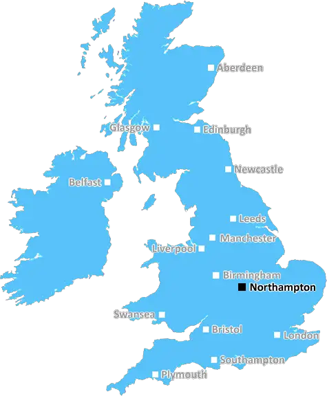
The NN16 postcode is situated in Northamptonshire in the East Midlands region of England, UK. The area is a mixture of urban and rural locations and has a population of around 85,000 people.
The NN16 postcode stretches from the Northampton and Corby Borough Council boundary in the north, to the Outer Ring Road which circles Kettering in the south. The east-west boundary lies between the Kettering and Corby boroughs, with the former forming the eastern edge and the latter forming the western boundary.
Places in the NN16 area include Desborough, Rothwell, Gretton, Stanion, Kerrisdale, Harrington and Little Harrowden. Some of these hamlets, villages and larger towns are within easy travelling distance to major towns and cities like Leicester and Corby, which signals a great potential for development in the area.
The postcode is well connected to Northampton via the A43, and to the industrial zones of Corby, Kettering, and Rushden. There are several primary and secondary schools in the NN16 area; meanwhile, further education is catered for at Northampton College, situated just off the A43, and De Montfort University in Leicester.
For leisure, the area is well served by Brampton Valley Way, Kettering Golf Club and Rushton Hall. There are also numerous small rural pubs and restaurants located in villages throughout the region. Additionally, the area has several large shopping centres such as Rushden Lakes, located in Rushden itself, and Corby's Corby Cube, both offering plenty of retail and leisure opportunities.
NN16 is a thriving area offering both rural and urban living and excellent connections to the neighbouring towns and cities.

Demographics

Northamptonshire

NN16 is located in the county of Northamptonshire, in England.
Northamptonshire has a total population of 733,100, making it the 33rd largest county in the UK.
Northamptonshire has a total area of 913 square miles, and a population density of 310 people per square kilometre. For comparison, Greater London has a density of 5,618 people/km2.
| Outward Code | NN16 |
| Postal Town | Northampton |
| MSOA Name | Kettering 007 |
| LSOA Name | Kettering 007B |
| County | Northamptonshire |
| Region | Northamptonshire |
| Country | England |
| Local Authority | Kettering |
| Area Classification | Urban with City and Town |
NN16 Electoral Wards
The postal region of NN16, includes the local towns, villages, electoral wards and stations of:
Dig even deeper into the NN16 postcode by clicking on a postcode below:
Click on an outward postal code below for more information about the area. Each 'outward' postcode give you a comprehensive list of all postcodes within the outward code area (NN) and estimated address.
Click on an 'outward' code for more information. For example, the outward postcode page 'EC2M' will give you an alphabetical list covering all postcodes located in the region, from 'EC2M 1BB' through to 'EC2M 7YA'.
Chris H
Sunday, April 7, 2024
We don't have any views of NN16 right now. If you live in NN16 or have visited it, please help us to help others by telling others what you think of this neighbourhood.
Add your view of NN16
People need your local expertise. If you live in NN16 or have first-hand knowledge of the neighbourhood, please consider sharing your views. It's completely anonymous - all we ask is for your initials.
Please tell us what you like about the NN16 postcode area, what you don't like, and what it's like to live or work here.
| LOCAL AMENITIES | |
| FAMILY FRIENDLY | |
| PARKING | |
| GREEN SPACES |
Local News Northamptonshire
Northampton Town 2-0 Port Vale
Mitch Pinnock and Shaun McWilliams score for Northampton as they beat struggling Port Vale 2-0 at Sixfields.
BBC NewsCouncil posts song lyric response to pothole signs
The authority replies to "Daventry Banksie" with mock-up of protester's sign on social media.
BBC NewsCarlisle relegated after defeat at Northampton
Carlisle United's defeat at Northampton confirms their relegation from League One.
BBC NewsMan jailed for terrifying assault' on ex-partner
The woman woke to find Lewis Bland trying to suffocate her at their shared flat.
BBC NewsNorthampton Great Escaper left us this treasure...
A 'swagger stick' owned by Marcel Zillessen who escaped Stalag Luft III is up for auction
BBC NewsDerek from Northants: 'I lived with armed bandits'
Northampton born Derek Adams has spent his life trekking the world for charity
BBC NewsPart of new road to open this month despite delays
A section of new road in Northampton was planned to open on 1 April, but work is still ongoing.
BBC News'Daventry Banksie' shares inspiration for campaign
A mysterious anti-pothole protester says she is fighting against "an accident waiting to happen".
BBC NewsFrom the Postcode Area blog

Deciphering Crime Rates - a Deep Dive Into UK Postcode Analysis
Ever wondered about the crime rate in your UK postcode? You're not alone. We've dug deep into the data, uncovering trends and patterns that'll make your head spin.

Death of the High Street?
The BBC reports that despite councils' attempts to kurb them, the UK's high streets have seen a huge growth in fast food outlets. Could this mark the death knell for the Great British high street, and what can we do about it to halt its decline?

Discrimination by Postcode
You really couldn't make it up, could you? Some of the country's most vulnerable people are missing out on their weekly £25 Cold Weather Payment, just because the system that's in operation is discriminating against them because payments are based on postcode, rather than geographic location.

The Redesign is Underway
Well, the current website was absolutely in dire need of a good redesign - from the ground up. So I set out to pull it all apart and get it up and running again to become the most comprehensive guide to every postcode in the UK. And it's been a long, tough job from start to finish - and quite possibly the biggest project I've ever undertaken.
SOCIAL GRADES
According to census records, 19% of people here have a social grade of AB (highest), compared to the national average of 27%.