newcastle-upon-tyne NE4 Postcodes
Spending a fortune on conveyancing?

Compare instant, low-cost online quotes from trusted conveyancing solicitors.
Backed by experts, our no-obligation service searches through the best conveyancing quotes on the market to save you time and money.
Newcastle Upon Tyne (NE4)
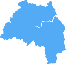
The NE4 postcode area is located in the Newcastle Upon Tyne postcode town region, within the county of Tyne and Wear, and contains a total of 1041 individual postcodes.
There are 4 electoral wards in the NE4 postcode area, including Alnwick, Ashington, Bamburgh, Bedlington, Belford, Blaydon-On-Tyne, Blyth, Boldon Colliery, Chathill, Choppington, Corbridge, Cramlington, East Boldon, Gateshead, Haltwhistle, Hebburn, Hexham, Jarrow, Morpeth, Newbiggin-By-The-Sea, Newcastle Upon Tyne, North Shields, Prudhoe, Riding Mill, Rowlands Gill, Ryton, Seahouses, South Shields, Stocksfield, Wallsend, Washington, Whitley Bay, Wooler, Wylam which come under the local authority of the Newcastle upon Tyne Council.
Combining the whole postcode region, 14% of people in NE4 are classed as having an AB social grade, (i.e. 'white-collar' middle-upper class), compared to 27% across the UK.
This does not mean that the people of NE4 are poorer than other areas, but it may give an indication that there are areas of deprivation.
The NE4 postcode is located in the Newcastle upon Tyne district in the UK. It covers the east side of the city, including Elswick, Benwell, Arthur's Hill, Scotswood, Chapel House, West Denton, and Fawdon.
The area of NE4 is known for its local pubs and bars, such as The Stag & Tannery, The Tanners Arms, and The Quay. They offer a variety of beers, wines, and spirits. The many local restaurants and takeaways are also popular spots, serving up dishes ranging from Indian cuisine to traditional British fare.
NE4 is also home to a number of attractions, including The Biscuit Factory, an art gallery and event space in Stoddart Street. It houses more than 300 artworks and provides workshops, lectures, and events throughout the year. Another standout attraction in NE4 is the multi-purpose Walkergate Community Park. This 38-acre public park, located on Eden Street, features a large artificial lake, a playground, and areas for sports and fitness.
The area of NE4 also has a variety of recreational facilities open to the public. These include swimming pools, tennis courts, squash courts, and a golf course. Other places of interest in the area include Newcastle's Formula 1 Grand Prix circuit, St. James' Park Stadium, and Newcastle Castle.
Public transportation in NE4 is also convenient, with multiple bus routes passing through the area. The Tyne and Wear Metro, the train line that connects Newcastle and the North East, also passes through the area.
In addition to its numerous attractions, NE4 is the location of the Royal Grammar School, one of England's oldest schools. This prestigious institution was founded in 1265 and has since become one of the most highly selective schools in the country.

Demographics

Tyne and Wear
NE4 is located in the county of Tyne and Wear, in England.
Tyne and Wear has a total population of 1,128,800, making it the 16th largest county in the UK.
Tyne and Wear has a total area of 210 square miles, and a population density of 2090 people per square kilometre. For comparison, Greater London has a density of 5,618 people/km2.

| Outward Code | NE4 |
| Postal Town | Newcastle Upon Tyne |
| MSOA Name | Newcastle upon Tyne 022 |
| LSOA Name | Newcastle upon Tyne 022D |
| County | Tyne and Wear |
| Region | Tyne and Wear |
| Country | England |
| Local Authority | Newcastle upon Tyne |
| Area Classification | Urban with Major Conurbation |
NE4 Electoral Wards
The postal region of NE4, includes the local towns, villages, electoral wards and stations of:
Dig even deeper into the NE4 postcode by clicking on a postcode below:
Click on an outward postal code below for more information about the area. Each 'outward' postcode give you a comprehensive list of all postcodes within the outward code area (NE) and estimated address.
Click on an 'outward' code for more information. For example, the outward postcode page 'EC2M' will give you an alphabetical list covering all postcodes located in the region, from 'EC2M 1BB' through to 'EC2M 7YA'.
Chris H
Sunday, April 7, 2024
We don't have any views of NE4 right now. If you live in NE4 or have visited it, please help us to help others by telling others what you think of this neighbourhood.
Add your view of NE4
People need your local expertise. If you live in NE4 or have first-hand knowledge of the neighbourhood, please consider sharing your views. It's completely anonymous - all we ask is for your initials.
Please tell us what you like about the NE4 postcode area, what you don't like, and what it's like to live or work here.
| LOCAL AMENITIES | |
| FAMILY FRIENDLY | |
| PARKING | |
| GREEN SPACES |
Local News Northumberland
Inquiry clears Teesworks scheme of corruption despite lack of transparency'
No evidence of illegality found at government-backed regeneration scheme.
Property WeekFresh plans submitted for former Colgate-Palmolive factory
The Soapworksproposals include450 new homes and more than 145,000 sq ft ofoffice space.
Property WeekGateshead plans urban community' around Metrocentre
The shopping centre, the largest in the North East, has 400 stores and 2.1m sq ft of lettable space.
Property WeekMetrocentre posts 17% profit rise as recovery from pandemic continues
Footfall and occupancy are up at UK's second largest shopping destination.
Property WeekBeal Homes secures planning approval to complete 210m development
Housebuilder Beal Homes has secured full planning permission to complete a 210m development for 600 homes in Goole, East Yorkshire.
Property WeekLeonardo Hotel in Newcastle hits the market for 31.8m
Knight Frank has been appointed to sell the 274-bedroom Leonardo Hotel in St James' Gate, Newcastle, for31.8m on behalf of an unnamed UK investment fund.
Property WeekAvant Homes acquires Durham site for 40m resi development
Housebuilder Avant Homes has acquired a site in Willington, Durham, for the development of a 43.6m residential scheme with 200 new homes.
Property WeekEY in talks with other interested parties' over fresh takeover of Britishvolt
The company's administrators are still chasing money from selected Australian buyer Recharge Industries.
Property WeekFrom the Postcode Area blog

Deciphering Crime Rates - a Deep Dive Into UK Postcode Analysis
Ever wondered about the crime rate in your UK postcode? You're not alone. We've dug deep into the data, uncovering trends and patterns that'll make your head spin.

Death of the High Street?
The BBC reports that despite councils' attempts to kurb them, the UK's high streets have seen a huge growth in fast food outlets. Could this mark the death knell for the Great British high street, and what can we do about it to halt its decline?

Discrimination by Postcode
You really couldn't make it up, could you? Some of the country's most vulnerable people are missing out on their weekly £25 Cold Weather Payment, just because the system that's in operation is discriminating against them because payments are based on postcode, rather than geographic location.

The Redesign is Underway
Well, the current website was absolutely in dire need of a good redesign - from the ground up. So I set out to pull it all apart and get it up and running again to become the most comprehensive guide to every postcode in the UK. And it's been a long, tough job from start to finish - and quite possibly the biggest project I've ever undertaken.
SOCIAL GRADES
According to census records, 14% of people here have a social grade of AB (highest), compared to the national average of 27%.