newcastle-upon-tyne NE32 Postcodes
Spending a fortune on conveyancing?

Compare instant, low-cost online quotes from trusted conveyancing solicitors.
Backed by experts, our no-obligation service searches through the best conveyancing quotes on the market to save you time and money.
Newcastle Upon Tyne (NE32)
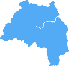
The NE32 postcode area is located in the Newcastle Upon Tyne postcode town region, within the county of Tyne and Wear, and contains a total of 859 individual postcodes.
There are 7 electoral wards in the NE32 postcode area, including Alnwick, Ashington, Bamburgh, Bedlington, Belford, Blaydon-On-Tyne, Blyth, Boldon Colliery, Chathill, Choppington, Corbridge, Cramlington, East Boldon, Gateshead, Haltwhistle, Hebburn, Hexham, Jarrow, Morpeth, Newbiggin-By-The-Sea, Newcastle Upon Tyne, North Shields, Prudhoe, Riding Mill, Rowlands Gill, Ryton, Seahouses, South Shields, Stocksfield, Wallsend, Washington, Whitley Bay, Wooler, Wylam which come under the local authority of the South Tyneside Council.
Combining the whole postcode region, 11% of people in NE32 are classed as having an AB social grade, (i.e. 'white-collar' middle-upper class), compared to 27% across the UK.
This does not mean that the people of NE32 are poorer than other areas, but it may give an indication that there are areas of deprivation.
NE32 is a postcode district located in the Newcastle upon Tyne metropolitan borough region. It covers Wallsend and part of Hadrian Park. The main roads that pass through the district are the A184 and A193. It is served by Wallsend Metro Station, providing connections to the wider Tyne and Wear Metro system. The district has excellent bus links as well, including the 8, 8A, 10, 34 and 35.
The NE32 postcode district has a wide range of amenities, including two large supermarkets, several banks, large chain stores and a range of independent stores. It is home to Wallsend Sport Centre, and various leisure activities can be found in and around the area. There is an abundance of green spaces, including Hadrian Park, which acts as a meeting point for the community, with its outdoor picnic area and children's play area. The area is served by Wallsend Library and an eSports centre.
The NE32 postcode district is well-suited to families, with several primary and secondary schools located in and around the district. These include Whitehouse Primary School and Rift House Primary School, and Hadrian Park Academy for secondary education. These are popularly chosen by parents and students alike, with the latest Ofsted reports highlighting �good� to �outstanding� results across the board.
The nearby River Tyne provides an excellent opportunity to enjoy a range of watersports, with several sailing clubs and rowing clubs providing tuition and boat hire. It is also popular with anglers due to the abundance of fish in the local area.
The NE32 district saw considerable development in recent times, particularly with the Hadrian Park development. This includes a private health centre, a range of residential dwellings, a hotel, and restaurants. This development has provided a much-needed boost to the local economy, creating new jobs and a new nightlife for local people and visitors alike.
The NE32 postcode district is an ideal place to live due to its excellent transport links and varied amenities. Its close proximity to the city centre makes commuting easy, and its wide range of educational and leisure activities provides something for everyone.

Demographics

Tyne and Wear
NE32 is located in the county of Tyne and Wear, in England.
Tyne and Wear has a total population of 1,128,800, making it the 16th largest county in the UK.
Tyne and Wear has a total area of 210 square miles, and a population density of 2090 people per square kilometre. For comparison, Greater London has a density of 5,618 people/km2.

| Outward Code | NE32 |
| Postal Town | Newcastle Upon Tyne |
| MSOA Name | South Tyneside 007 |
| LSOA Name | South Tyneside 007B |
| County | Tyne and Wear |
| Region | Tyne and Wear |
| Country | England |
| Local Authority | South Tyneside |
| Area Classification | Urban with Major Conurbation |
NE32 Electoral Wards
The postal region of NE32, includes the local towns, villages, electoral wards and stations of:
Dig even deeper into the NE32 postcode by clicking on a postcode below:
Click on an outward postal code below for more information about the area. Each 'outward' postcode give you a comprehensive list of all postcodes within the outward code area (NE) and estimated address.
Click on an 'outward' code for more information. For example, the outward postcode page 'EC2M' will give you an alphabetical list covering all postcodes located in the region, from 'EC2M 1BB' through to 'EC2M 7YA'.
Chris H
Wednesday, April 10, 2024
We don't have any views of NE32 right now. If you live in NE32 or have visited it, please help us to help others by telling others what you think of this neighbourhood.
Add your view of NE32
People need your local expertise. If you live in NE32 or have first-hand knowledge of the neighbourhood, please consider sharing your views. It's completely anonymous - all we ask is for your initials.
Please tell us what you like about the NE32 postcode area, what you don't like, and what it's like to live or work here.
| LOCAL AMENITIES | |
| FAMILY FRIENDLY | |
| PARKING | |
| GREEN SPACES |
Local News County Durham
Strictly Come Dancing star lands role on new BBC dating show
A Strictly Come Dancing finalist has 'landed' a role on a brand new BBC dating show after finding love with a co-star Dianne Buswell.
Northern EchoConvicted Burnhope businessman 'in denial' over child sexual offences
A wealthy businessman who ran a successful family roofing and construction company has been jailed after being convicted of grooming and sexually assaulting a teenage girl.
Northern EchoLast call for Kynren volunteers for summer, Bishop Auckland
Would-be volunteers to join the cast and crew of what is billed as the UK's biggest live-action show have a final chance to throw their hat into the ring.
Northern EchoNorth Beach Coffee Seaham boss worry over car park charges
The owner of North Beach Coffee Bar in Seaham has expressed concern over new parking charges which are set to come into force next week.
Northern EchoDan Buettner reveals the superfoods to eat for a longer life
Dan Buettner has become well known for his research into five "blue" zones acrossthe world where inhabitantsregularly live well into their old age
Northern EchoDrug figurehead influenced Aycliffe and Spennymoor pair
Two people under the influence of a drug ring spearhead' have been spared immediate prison sentences for helping him launder thousands of pounds of suspected ill-gotten gains.
Northern EchoLucy Pittaway creates woodland in memory of Sycamore Gap
North Yorkshire artist Lucy Pittaway has helped create a woodland following print sales of her Sycamore Gap painting.
Northern EchoTips to stay safe in heavy rain during a weather warning
Storms can bring about plenty of heavy rain, so here are some tips to help keep you safe in such circumstances
Northern EchoFrom the Postcode Area blog

Deciphering Crime Rates - a Deep Dive Into UK Postcode Analysis
Ever wondered about the crime rate in your UK postcode? You're not alone. We've dug deep into the data, uncovering trends and patterns that'll make your head spin.

Death of the High Street?
The BBC reports that despite councils' attempts to kurb them, the UK's high streets have seen a huge growth in fast food outlets. Could this mark the death knell for the Great British high street, and what can we do about it to halt its decline?

Discrimination by Postcode
You really couldn't make it up, could you? Some of the country's most vulnerable people are missing out on their weekly £25 Cold Weather Payment, just because the system that's in operation is discriminating against them because payments are based on postcode, rather than geographic location.

The Redesign is Underway
Well, the current website was absolutely in dire need of a good redesign - from the ground up. So I set out to pull it all apart and get it up and running again to become the most comprehensive guide to every postcode in the UK. And it's been a long, tough job from start to finish - and quite possibly the biggest project I've ever undertaken.
SOCIAL GRADES
According to census records, 11% of people here have a social grade of AB (highest), compared to the national average of 27%.