newcastle-upon-tyne NE31 Postcodes
Spending a fortune on conveyancing?

Compare instant, low-cost online quotes from trusted conveyancing solicitors.
Backed by experts, our no-obligation service searches through the best conveyancing quotes on the market to save you time and money.
Newcastle Upon Tyne (NE31)
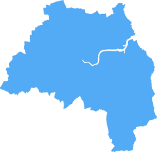
The NE31 postcode area is located in the Newcastle Upon Tyne postcode town region, within the county of Tyne and Wear, and contains a total of 597 individual postcodes.
There are 6 electoral wards in the NE31 postcode area, including Alnwick, Ashington, Bamburgh, Bedlington, Belford, Blaydon-On-Tyne, Blyth, Boldon Colliery, Chathill, Choppington, Corbridge, Cramlington, East Boldon, Gateshead, Haltwhistle, Hebburn, Hexham, Jarrow, Morpeth, Newbiggin-By-The-Sea, Newcastle Upon Tyne, North Shields, Prudhoe, Riding Mill, Rowlands Gill, Ryton, Seahouses, South Shields, Stocksfield, Wallsend, Washington, Whitley Bay, Wooler, Wylam which come under the local authority of the South Tyneside Council.
Combining the whole postcode region, 12% of people in NE31 are classed as having an AB social grade, (i.e. 'white-collar' middle-upper class), compared to 27% across the UK.
This does not mean that the people of NE31 are poorer than other areas, but it may give an indication that there are areas of deprivation.
The NE31 postcode covers the residential area in the southwest of Hebburn, South Tyneside, which is located in the county of Tyne and Wear and in the North East region of England. It includes areas like Warden Law, Riverside and Waterloo, popular with families and young people.
There are a variety of service providers in the area, ranging from utility companies to financial institutions. HEbburn Town Centre is a large shopping area located just off the A194. Similarly, there is a range of local independent shops, fast-food chains and pubs in the centre of town.
Residents in the area have good transport links, with train connections to Newcastle and Sunderland via Jarrow and Bedlington stations. Hebburn bus station is also nearby, serving all the local area with regular services.
The local area provides many recreational activities for the community. Hebburn Sports Centre has a full range of activities and facilities such as tennis courts, basketball courts, a professional football pitch, a fitness suite and a multi-sport hall. The Riverside area also provides excellent outdoor activities, featuring a woodland park, a children's play area and a skate park as well as a lake.
Schools in the NE31 postcode range from primary schools, such as Hebburn Central, to secondary schools, such as Hebburn Comprehensive. Additionally, a range of tertiary educational institutions, such as South Tyneside College, are nearby.
Parents in the local area have many of childcare options, such as nurseries, day care and after-school clubs. There is also a wide range of health care facilities, such as Dr Giridhar's GP practice, Hebburn Health Centres and Jarrow Walk In Centre.
The NE31 postcode can also be found on the Royal Mail website.

Demographics

Tyne and Wear
NE31 is located in the county of Tyne and Wear, in England.
Tyne and Wear has a total population of 1,128,800, making it the 16th largest county in the UK.
Tyne and Wear has a total area of 210 square miles, and a population density of 2090 people per square kilometre. For comparison, Greater London has a density of 5,618 people/km2.

| Outward Code | NE31 |
| Postal Town | Newcastle Upon Tyne |
| MSOA Name | South Tyneside 010 |
| LSOA Name | South Tyneside 010C |
| County | Tyne and Wear |
| Region | Tyne and Wear |
| Country | England |
| Local Authority | South Tyneside |
| Area Classification | Urban with Major Conurbation |
NE31 Electoral Wards
The postal region of NE31, includes the local towns, villages, electoral wards and stations of:
Dig even deeper into the NE31 postcode by clicking on a postcode below:
Click on an outward postal code below for more information about the area. Each 'outward' postcode give you a comprehensive list of all postcodes within the outward code area (NE) and estimated address.
Click on an 'outward' code for more information. For example, the outward postcode page 'EC2M' will give you an alphabetical list covering all postcodes located in the region, from 'EC2M 1BB' through to 'EC2M 7YA'.
Chris H
Saturday, April 6, 2024
We don't have any views of NE31 right now. If you live in NE31 or have visited it, please help us to help others by telling others what you think of this neighbourhood.
Add your view of NE31
People need your local expertise. If you live in NE31 or have first-hand knowledge of the neighbourhood, please consider sharing your views. It's completely anonymous - all we ask is for your initials.
Please tell us what you like about the NE31 postcode area, what you don't like, and what it's like to live or work here.
| LOCAL AMENITIES | |
| FAMILY FRIENDLY | |
| PARKING | |
| GREEN SPACES |
Local News County Durham
Dental services to return to Firthmoor Community Centre in Darlington
Dental services are poised to return to a Darlington community after residents faced over a year without treatment.
Northern EchoGreggs to open new store at Bishop Auckland retail park
Greggs has confirmed it will open a new store at Bishop Auckland's new retail park next week.
Northern EchoA171 Guisborough LIVE: Birk Brow Road closed due to medical incident
The A171 Birk Brow Road in Guisborough has been closed in both directions due to a 'fuel spillage'
Northern EchoFormer Transport Secretaries call on PM to help save Hitachi
Two former Conservative Transport Secretaries have called on the Prime Minister to save the Hitachi train manufacturing plant in Newton Aycliffe
Northern EchoScarce spring bulb found in Darlington's North Lodge Park
A SCARCE plant has surprisingly been discovered growing in a town centre park, and pictures in last week's mega-Memories springtime special may explain to botanists why it is doing so well.
Northern EchoCouncil criticised for support to fix Darlington dental crisis
A council has been criticised for not doing enough to improve the ongoing dental crisis in Darlington.
Northern EchoFull list of Stockton, Yarm and Billingham resurfacing works
Stockton Borough Council have released a full list of resurfacing works planned to take place across Stockton, Yarm and Billingham until March 2025
Northern EchoA19 slip road to be closed until summer for improvement works
A busy A19 exit slip road onto the B1404 Seaton Lane, near Seaham, will close from Thursday 18 April and reopen in the summer.
Northern EchoFrom the Postcode Area blog

Deciphering Crime Rates - a Deep Dive Into UK Postcode Analysis
Ever wondered about the crime rate in your UK postcode? You're not alone. We've dug deep into the data, uncovering trends and patterns that'll make your head spin.

Death of the High Street?
The BBC reports that despite councils' attempts to kurb them, the UK's high streets have seen a huge growth in fast food outlets. Could this mark the death knell for the Great British high street, and what can we do about it to halt its decline?

Discrimination by Postcode
You really couldn't make it up, could you? Some of the country's most vulnerable people are missing out on their weekly £25 Cold Weather Payment, just because the system that's in operation is discriminating against them because payments are based on postcode, rather than geographic location.

The Redesign is Underway
Well, the current website was absolutely in dire need of a good redesign - from the ground up. So I set out to pull it all apart and get it up and running again to become the most comprehensive guide to every postcode in the UK. And it's been a long, tough job from start to finish - and quite possibly the biggest project I've ever undertaken.
SOCIAL GRADES
According to census records, 12% of people here have a social grade of AB (highest), compared to the national average of 27%.