nottingham NG22 Postcodes
Spending a fortune on conveyancing?

Compare instant, low-cost online quotes from trusted conveyancing solicitors.
Backed by experts, our no-obligation service searches through the best conveyancing quotes on the market to save you time and money.
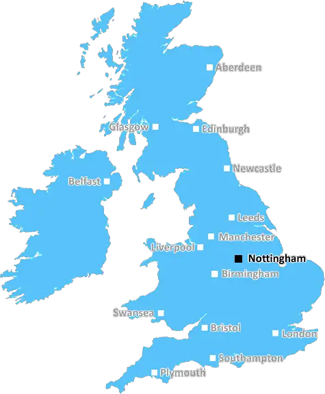
Nottingham (NG22)
The NG22 postcode area is located in the Nottingham postcode town region, within the county of Nottinghamshire, and contains a total of 948 individual postcodes.
There are 94 electoral wards in the NG22 postcode area, including Grantham, Mansfield, Newark, Nottingham, Sleaford, Southwell, Sutton-In-Ashfield which come under the local authority of the Newark and Sherwood Council.
Combining the whole postcode region, 21% of people in NG22 are classed as having an AB social grade, (i.e. 'white-collar' middle-upper class), compared to 27% across the UK.
This does not mean that the people of NG22 are poorer than other areas, but it may give an indication that there are areas of deprivation.
The NG22 postcode area is located in the Nottingham district of Nottinghamshire, in the East Midlands of England. The area covers the towns of Boughton, Boughton Vale, Bole, Beckingham, Sturton Leys, Kelham, Caunton, Norwell, Balderton, and North Leverton, as well as a number of villages, hamlets and rural locations.
The postcode district is served by a number of local services and amenities, including primary and secondary education, leisure facilities, and a range of local shops. There are three train stations within the NG22 postcode area: Newark-On-Trent, Rolleston and East Midlands Parkway.
The M1 motorway, a major north-south route, also runs through the area. The town of Newark-On-Trent sits at the heart of the postcode area, and provides a range of cultural and historical attractions, including Newark Castle, the Civil War Centre, and Newark Market Place.
In terms of travel times, the area is well-connected to Nottingham city centre, with a direct route taking around 40 minutes. It's similarly easy to access the nearby towns of Southwell, Retford and Mansfield, with journey times of around 15-20 minutes.
The population of the NG22 postcode area totals just over 32,000 people, with the majority (85%) of them identifying as White British. Newark-On-Trent has a wide selection of independent retailers, small businesses, and food and drink outlets, making it an attractive place to visit. There is also a range of leisure activities to enjoy, including an outdoor climbing centre, golf courses, a bowling alley, and a selection of museums.
The area is also home to two National Nature Reserves: Attenborough Nature Reserve and Newark Warrens. Both reserves offer rich biodiversity, and are great opportunities for bird watching and nature exploration. The Southwell Ploughing Match is also held in the NG22 postcode area annually.

Demographics

Nottinghamshire

NG22 is located in the county of Nottinghamshire, in England.
Nottinghamshire has a total population of 1,136,000, making it the 15th largest county in the UK.
Nottinghamshire has a total area of 834 square miles, and a population density of 526 people per square kilometre. For comparison, Greater London has a density of 5,618 people/km2.
| Outward Code | NG22 |
| Postal Town | Nottingham |
| MSOA Name | Newark and Sherwood 003 |
| LSOA Name | Newark and Sherwood 003B |
| County | Nottinghamshire |
| Region | Nottinghamshire |
| Country | England |
| Local Authority | Newark and Sherwood |
| Area Classification | Largely Rural (rural including hub towns 50-79%) |
NG22 Electoral Wards
The postal region of NG22, includes the local towns, villages, electoral wards and stations of:
Dig even deeper into the NG22 postcode by clicking on a postcode below:
Click on an outward postal code below for more information about the area. Each 'outward' postcode give you a comprehensive list of all postcodes within the outward code area (NG) and estimated address.
Click on an 'outward' code for more information. For example, the outward postcode page 'EC2M' will give you an alphabetical list covering all postcodes located in the region, from 'EC2M 1BB' through to 'EC2M 7YA'.
Chris H
Tuesday, May 7, 2024
We don't have any views of NG22 right now. If you live in NG22 or have visited it, please help us to help others by telling others what you think of this neighbourhood.
Add your view of NG22
People need your local expertise. If you live in NG22 or have first-hand knowledge of the neighbourhood, please consider sharing your views. It's completely anonymous - all we ask is for your initials.
Please tell us what you like about the NG22 postcode area, what you don't like, and what it's like to live or work here.
| LOCAL AMENITIES | |
| FAMILY FRIENDLY | |
| PARKING | |
| GREEN SPACES |
Local News Nottinghamshire
DWP confirms new evaluation of cost of living payments after query from MP
The DWP has confirmed that an 'evaluation of the Cost of Living Payments is underway'
Nottingham PostStunning listed building in Newark town centre with fascinating history becomes available
The former coaching inn was used for retail purposes in the 19th Century
Nottingham PostMet Office issues Bank Holiday thunderstorm weather warning for Nottinghamshire
The yellow warning is in place between 1pm and 9pm on Monday, May 6
Nottingham PostDrivers of diesel cars warned they face paying 250 a year extra
A motoring group branded diesel surcharges a 'cash grab' by councils, but environmental campaigners backed them as a tool to cut air pollution
Nottingham PostKate Garraway's bittersweet birthday without Derek as ITV co-stars support her
Kate Garraway celebrated her 57th birthday over the weekend, marking another 'first' for the Good Morning Britain presenter following the death of her husband Derek Draper
Nottingham Post'Mind-blowing' hack shows we've been poaching eggs wrong - with no saucepan or boiling water
A TikTok user has shared a revolutionary method for poaching eggs that has left viewers astonished - and it doesn't involve a saucepan or boiling water
Nottingham PostForest boost survival chances as Blades concede 100th goal
Callum Hudson-Odoi scores twice as Nottingham Forest take a big step towards Premier League survival by beating already-relegated Sheffield United.
BBC NewsRare Pokmon card collection could sell for 25k
The sets include some which feature not only every card but every variant of every card.
BBC NewsFrom the Postcode Area blog

Deciphering Crime Rates - a Deep Dive Into UK Postcode Analysis
Ever wondered about the crime rate in your UK postcode? You're not alone. We've dug deep into the data, uncovering trends and patterns that'll make your head spin.

Death of the High Street?
The BBC reports that despite councils' attempts to kurb them, the UK's high streets have seen a huge growth in fast food outlets. Could this mark the death knell for the Great British high street, and what can we do about it to halt its decline?

Discrimination by Postcode
You really couldn't make it up, could you? Some of the country's most vulnerable people are missing out on their weekly £25 Cold Weather Payment, just because the system that's in operation is discriminating against them because payments are based on postcode, rather than geographic location.

The Redesign is Underway
Well, the current website was absolutely in dire need of a good redesign - from the ground up. So I set out to pull it all apart and get it up and running again to become the most comprehensive guide to every postcode in the UK. And it's been a long, tough job from start to finish - and quite possibly the biggest project I've ever undertaken.
SOCIAL GRADES
According to census records, 21% of people here have a social grade of AB (highest), compared to the national average of 27%.