milton-keynes MK17 Postcodes
Spending a fortune on conveyancing?

Compare instant, low-cost online quotes from trusted conveyancing solicitors.
Backed by experts, our no-obligation service searches through the best conveyancing quotes on the market to save you time and money.
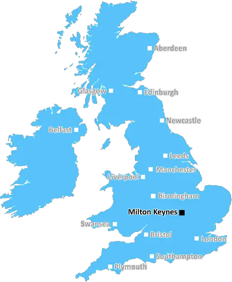
Milton Keynes (MK17)
The MK17 postcode area is located in the Milton Keynes postcode town region, within the county of Buckinghamshire, and contains a total of 901 individual postcodes.
There are 150 electoral wards in the MK17 postcode area, including Bedford, Buckingham, Milton Keynes, Newport Pagnell, Olney which come under the local authority of the Aylesbury Vale Council.
Combining the whole postcode region, 35% of people in MK17 are classed as having an AB social grade, (i.e. 'white-collar' middle-upper class), compared to 27% across the UK.
This does not mean that the people of MK17 are wealthier - or higher class - than average, but it can be an indication that the area may be prospering and desirable to live in.
The MK17 postcode is a postcode district located in Buckinghamshire, England, within the Aylesbury Vale post town. It covers the areas near and in Winslow, Great Horwood and Granborough. The area is predominantly rural, with rolling hills and countryside and areas of woodland spread across the landscape.
The postcode district is served by two primary schools, The Granborough Church of England Primary School and Winslow Church of England School, as well as the Sir Henry Floyd Grammar School in Aylesbury. The area surrounding the district contains a variety of local attractions including the Silverstone Circuit, Stowe Gardens and The National Motor Museum.
The area has a number of local pubs, restaurants and shops as well as popular local attractions and a variety of outdoor activities. These include Roydon Marina Village, which offers a range of activities such as rowing, kayaking and windsurfing. The district also has its own Golf Club, offering both golf and Pitch & Putt facilities.
Residents of the MK17 postcode district benefit from a reasonable average house price, with semi-detached homes in the area being sold at an average price of �374,829. There are some smaller houses on the outskirts of the postcode district and the local authority has granted permission for limited new development at Chesterton Close.
The area is well served by local public transport, with regular buses running to and from the district, as well as train services from nearby Aylesbury and Bicester North stations. Neighbouring postcodes surrounding the MK17 postcode district are HP17, HP18, HP19, NN13, PE28 and OX27.

Demographics
Buckinghamshire

MK17 is located in the county of Buckinghamshire, in England.
Buckinghamshire has a total population of 799,200, making it the 30th largest county in the UK.
Buckinghamshire has a total area of 723 square miles, and a population density of 426 people per square kilometre. For comparison, Greater London has a density of 5,618 people/km2.
| Outward Code | MK17 |
| Postal Town | Milton Keynes |
| MSOA Name | Aylesbury Vale 003 |
| LSOA Name | Aylesbury Vale 003C |
| County | Buckinghamshire |
| Region | Buckinghamshire |
| Country | England |
| Local Authority | Aylesbury Vale |
| Area Classification | Largely Rural (rural including hub towns 50-79%) |
MK17 Electoral Wards
The postal region of MK17, includes the local towns, villages, electoral wards and stations of:
Dig even deeper into the MK17 postcode by clicking on a postcode below:
Click on an outward postal code below for more information about the area. Each 'outward' postcode give you a comprehensive list of all postcodes within the outward code area (MK) and estimated address.
Click on an 'outward' code for more information. For example, the outward postcode page 'EC2M' will give you an alphabetical list covering all postcodes located in the region, from 'EC2M 1BB' through to 'EC2M 7YA'.
Chris H
Sunday, April 7, 2024
We don't have any views of MK17 right now. If you live in MK17 or have visited it, please help us to help others by telling others what you think of this neighbourhood.
Add your view of MK17
People need your local expertise. If you live in MK17 or have first-hand knowledge of the neighbourhood, please consider sharing your views. It's completely anonymous - all we ask is for your initials.
Please tell us what you like about the MK17 postcode area, what you don't like, and what it's like to live or work here.
| LOCAL AMENITIES | |
| FAMILY FRIENDLY | |
| PARKING | |
| GREEN SPACES |
Local News Buckinghamshire
Boreham Wood 4-0 Wealdstone
Boreham Wood thump Wealdstone in a huge match at the bottom of the National League table.
BBC NewsSpanish funeral cancelled after UK passport mishap
Keith Rudd had five months left on his passport, but was not allowed to fly out of a UK airport.
BBC NewsTT Group sells BT's old Southampton offices to consortium
BT's former Friary House office building has permission for residential conversion under permitted development rights.
Property WeekHow a hard-boiled egg could determine Wembley glory
Kevin Chapman is going to be egging on Peterborough United in the EFL Trophy final on Sunday.
BBC NewsBruntwood SciTech gets go ahead for 250m revamp of Cambridgeshire life science park
The masterplan for the site includes nearly 400,000 sq ft of space and six new buildings.
Property WeekJohnson & Johnson signs lease at Tempo in Maidenhead
The pharmaceuticals giantwill move staff from its Thames Valley campuses in High Wycombe and Pinewood to the L&G-owned building.
Property WeekEdmond de Rothschild REIM acquires Newbury resi scheme for 34m
The affordable housing project has already seen the development of almost 120 new homes.
Property WeekExeter City 1-0 Stevenage
Exeter move into the top half of the League One table with a 1-0 win that dented Stevenage's hopes of making the play-offs.
BBC NewsFrom the Postcode Area blog

Deciphering Crime Rates - a Deep Dive Into UK Postcode Analysis
Ever wondered about the crime rate in your UK postcode? You're not alone. We've dug deep into the data, uncovering trends and patterns that'll make your head spin.

Death of the High Street?
The BBC reports that despite councils' attempts to kurb them, the UK's high streets have seen a huge growth in fast food outlets. Could this mark the death knell for the Great British high street, and what can we do about it to halt its decline?

Discrimination by Postcode
You really couldn't make it up, could you? Some of the country's most vulnerable people are missing out on their weekly £25 Cold Weather Payment, just because the system that's in operation is discriminating against them because payments are based on postcode, rather than geographic location.

The Redesign is Underway
Well, the current website was absolutely in dire need of a good redesign - from the ground up. So I set out to pull it all apart and get it up and running again to become the most comprehensive guide to every postcode in the UK. And it's been a long, tough job from start to finish - and quite possibly the biggest project I've ever undertaken.
SOCIAL GRADES
According to census records, 35% of people here have a social grade of AB (highest), compared to the national average of 27%.