milton-keynes MK1 Postcodes
Spending a fortune on conveyancing?

Compare instant, low-cost online quotes from trusted conveyancing solicitors.
Backed by experts, our no-obligation service searches through the best conveyancing quotes on the market to save you time and money.
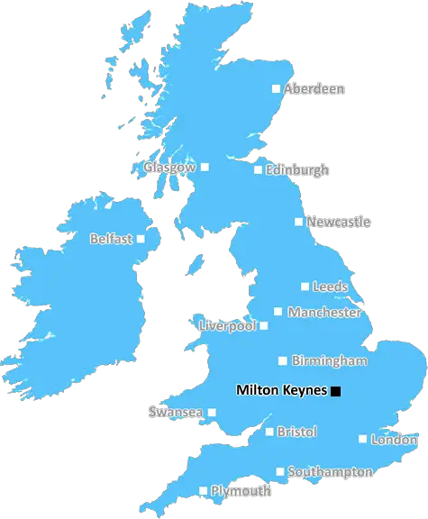
Milton Keynes (MK1)
The MK1 postcode area is located in the Milton Keynes postcode town region, within the county of Buckinghamshire, and contains a total of 405 individual postcodes.
There are 3 electoral wards in the MK1 postcode area, including Bedford, Buckingham, Milton Keynes, Newport Pagnell, Olney which come under the local authority of the Milton Keynes Council.
Combining the whole postcode region, 22% of people in MK1 are classed as having an AB social grade, (i.e. 'white-collar' middle-upper class), compared to 27% across the UK.
This does not mean that the people of MK1 are poorer than other areas, but it may give an indication that there are areas of deprivation.
The MK1 postcode area in the Milton Keynes district is approximately 11 miles north-east of the county town of Buckinghamshire's county council, Buckingham. The postcode is adherent to the larger MK postcode district, and is one of the formative postcode districts to have been established in the area. The postcode stretches over four wards namely: Newport Pagnell North, Olney, Shenley Brook End and Wolverton, each of which have a local council body dedicated to the policies of the respective area.
The area has experienced a period of marked economic growth since the early 60's with the settlement of the new town of Milton Keynes. The expansion of Milton Keynes and its continued growth has helped facilitate economic prospects for the residents of the MK1 postcode, with numerous projects under way to continue the ongoing improvement of public services and opportunities for the local population.
MK1 covers an area of roughly fifty square miles, composed of the residential towns of Newport Pagnell, Olney, Ravenstone and the village of Tyringham. A relatively large area, the postcode has relatively low population density (4,090 people per square mile), with a total population of 205,124 persons according to the 2011 census.
The main industries revolve around retail, ICT and utilities services with Amazon, Sage Group, Specsavers and Marston Gas Heating all major employers within the locality. Furthermore, the area's close proximity to London makes it an ideal place to commute to the capital on a daily basis, boasting excellent local transport links and well developed road and rail networks to other major cities and the surrounding countryside.
Comprised of various town localities, the MK1 postcode is renowned for its balanced living experience, with a variety of outdoor and recreational activities accessible nearby. Popular amenities within the postcode include the Bradwell Abbey Country Park, Caldecotte Lake, Stowe Gardens and even the National Bowl for music events. There's a strong sense of community in the MK1 postcode, with various local schools and clubs catering to the community's sporting and educational needs.

Demographics
Buckinghamshire

MK1 is located in the county of Buckinghamshire, in England.
Buckinghamshire has a total population of 799,200, making it the 30th largest county in the UK.
Buckinghamshire has a total area of 723 square miles, and a population density of 426 people per square kilometre. For comparison, Greater London has a density of 5,618 people/km2.
| Outward Code | MK1 |
| Postal Town | Milton Keynes |
| MSOA Name | Milton Keynes 023 |
| LSOA Name | Milton Keynes 023E |
| County | Buckinghamshire |
| Region | Buckinghamshire |
| Country | England |
| Local Authority | Milton Keynes |
| Area Classification | Urban with City and Town |
MK1 Electoral Wards
The postal region of MK1, includes the local towns, villages, electoral wards and stations of:
Dig even deeper into the MK1 postcode by clicking on a postcode below:
Click on an outward postal code below for more information about the area. Each 'outward' postcode give you a comprehensive list of all postcodes within the outward code area (MK) and estimated address.
Click on an 'outward' code for more information. For example, the outward postcode page 'EC2M' will give you an alphabetical list covering all postcodes located in the region, from 'EC2M 1BB' through to 'EC2M 7YA'.
Chris H
Tuesday, May 7, 2024
We don't have any views of MK1 right now. If you live in MK1 or have visited it, please help us to help others by telling others what you think of this neighbourhood.
Add your view of MK1
People need your local expertise. If you live in MK1 or have first-hand knowledge of the neighbourhood, please consider sharing your views. It's completely anonymous - all we ask is for your initials.
Please tell us what you like about the MK1 postcode area, what you don't like, and what it's like to live or work here.
| LOCAL AMENITIES | |
| FAMILY FRIENDLY | |
| PARKING | |
| GREEN SPACES |
Local News Buckinghamshire
Savills bolsters Chelmsford office with return of senior development director
Kibblewhite originally joined the agency in 1990 and spent 16 years working there.
Property WeekL&G acquires Cambridgeshire BTR scheme from Stonebond
The 41-unit development comprises 10 flats and 31 houses.
Property WeekBedfordshire elects first Labour PCC in eight years
John Tizard becomes police and crime commissioner, beating Conservative Festus Akinbusoye.
BBC NewsPlaces for People acquires Rosewood Housing
The affordable homes provider was previously owned by housing developer Inland Homes.
Property WeekSix by Nico to open restaurant at Oxford's Westgate
Six by Nico is to let a 4,300 sq ft space in Oxford's Westgate shopping centre as it opens its 15th restaurant.
Property WeekIs that a goat?' On a lead in Milton Keynes
David Hughes takes Boo, his pet goat, on walks every day.
BBC NewsFoundation and Deer Capital acquire Hartford Care for 100m
The deal will back Harford Care's plans to double the size of its portfolio by 2026.
Property WeekKazakhstan billionaire takes over League One Wycombe
Wycombe Wanderers are taken over by Kazakhstan billionaire Mikheil Lomtadze, whose company buys a 90% stake in the club.
BBC NewsFrom the Postcode Area blog

Deciphering Crime Rates - a Deep Dive Into UK Postcode Analysis
Ever wondered about the crime rate in your UK postcode? You're not alone. We've dug deep into the data, uncovering trends and patterns that'll make your head spin.

Death of the High Street?
The BBC reports that despite councils' attempts to kurb them, the UK's high streets have seen a huge growth in fast food outlets. Could this mark the death knell for the Great British high street, and what can we do about it to halt its decline?

Discrimination by Postcode
You really couldn't make it up, could you? Some of the country's most vulnerable people are missing out on their weekly £25 Cold Weather Payment, just because the system that's in operation is discriminating against them because payments are based on postcode, rather than geographic location.

The Redesign is Underway
Well, the current website was absolutely in dire need of a good redesign - from the ground up. So I set out to pull it all apart and get it up and running again to become the most comprehensive guide to every postcode in the UK. And it's been a long, tough job from start to finish - and quite possibly the biggest project I've ever undertaken.
SOCIAL GRADES
According to census records, 22% of people here have a social grade of AB (highest), compared to the national average of 27%.