medway ME19 Postcodes
Spending a fortune on conveyancing?

Compare instant, low-cost online quotes from trusted conveyancing solicitors.
Backed by experts, our no-obligation service searches through the best conveyancing quotes on the market to save you time and money.
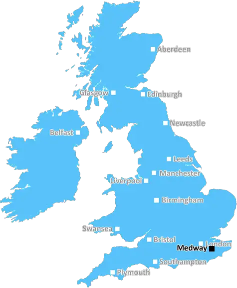
Medway (ME19)
The ME19 postcode area is located in the Medway postcode town region, within the county of Kent, and contains a total of 882 individual postcodes.
There are 28 electoral wards in the ME19 postcode area, including Aylesford, Chatham, Faversham, Gillingham, Maidstone, Queenborough, Rochester, Sheerness, Sittingbourne, Snodland, West Malling which come under the local authority of the Tonbridge and Malling Council.
Combining the whole postcode region, 30% of people in ME19 are classed as having an AB social grade, (i.e. 'white-collar' middle-upper class), compared to 27% across the UK.
This does not mean that the people of ME19 are wealthier - or higher class - than average, but it can be an indication that the area may be prospering and desirable to live in.
ME19 postcode is located in the Medway district in the South-East region of England, and falls under the jurisdiction of the Medway Council.
The ME19 postcode area generally covers western parts of the borough of Medway, including the town of West Malling, East Malling, Snodland, Kings Hill, Aylesford, East Peckham and Larkfield. The area is generally characterised by a mix of rural and suburban residential development interspersed with areas of farmland and woodland.
The postcode area has excellent links to central London via the M2, M20 and M25 motorways. Travellers can also take frequent rail services from two local stations � Snodland and New Hythe. A number of bus routes operate into and around the area.
The postcode area offers a range of community and leisure facilities, including parks, pubs, restaurants, shops, libraries and a cinema. The area is also home to a number of high-performing secondary schools, including St Margaret's Grammar School, which is rated �Outstanding' by Ofsted.
The ME19 postcode area has a vibrant housing market. In recent years, property prices have risen steadily and rental yields are higher than the UK average. The area offers a selection of housing options, ranging from urban apartments to spacious rural homes.
The ME19 postcode area is home to a number of businesses in the creative industries, manufacturing, engineering, IT, and finance, while the Ebbsfleet Eurostar Terminal is just a short drive away and offers travelers direct access to mainland Europe.
The postcode area boasts a diverse population, with a mix of different ages and cultures, and is an increasingly popular destination for both native and non-native English-speakers. There are also good medical facilities in the area.

Demographics

Kent

ME19 is located in the county of Kent, in England.
Kent has a total population of 1,820,400, making it the 6th largest county in the UK.
Kent has a total area of 1443 square miles, and a population density of 486 people per square kilometre. For comparison, Greater London has a density of 5,618 people/km2.
| Outward Code | ME19 |
| Postal Town | Medway |
| MSOA Name | Tonbridge and Malling 007 |
| LSOA Name | Tonbridge and Malling 007E |
| County | Kent |
| Region | Kent |
| Country | England |
| Local Authority | Tonbridge and Malling |
| Area Classification | Urban with Significant Rural (rural including hub towns 26-49%) |
ME19 Electoral Wards
The postal region of ME19, includes the local towns, villages, electoral wards and stations of:
Dig even deeper into the ME19 postcode by clicking on a postcode below:
Click on an outward postal code below for more information about the area. Each 'outward' postcode give you a comprehensive list of all postcodes within the outward code area (ME) and estimated address.
Click on an 'outward' code for more information. For example, the outward postcode page 'EC2M' will give you an alphabetical list covering all postcodes located in the region, from 'EC2M 1BB' through to 'EC2M 7YA'.
Chris H
Wednesday, April 10, 2024
We don't have any views of ME19 right now. If you live in ME19 or have visited it, please help us to help others by telling others what you think of this neighbourhood.
Add your view of ME19
People need your local expertise. If you live in ME19 or have first-hand knowledge of the neighbourhood, please consider sharing your views. It's completely anonymous - all we ask is for your initials.
Please tell us what you like about the ME19 postcode area, what you don't like, and what it's like to live or work here.
| LOCAL AMENITIES | |
| FAMILY FRIENDLY | |
| PARKING | |
| GREEN SPACES |
Local News Kent
Concerns over 2500 home Duchy development
Campaigners say plans for 2,500 homes near Faversham will have a negative impact on the area.
BBC NewsBruntwood SciTech gets go ahead for 250m revamp of Cambridgeshire life science park
The masterplan for the site includes nearly 400,000 sq ft of space and six new buildings.
Property WeekQuadrant gets green light for residential-led scheme in Kent
The project will also include the development of more than 376,700 sq ft of grade-A commercial space.
Property WeekSolihull Moors 3-0 Ebbsfleet United
Solihull all but confirm their place in the National League play-offs with a home win over Ebbsfleet.
BBC NewsPortsmouth NHS trust takes offices at Lakeside North Harbour
The trust has signed a 10-year lease for space at the business park.
Property WeekFirst-time buyers account for record third of all housing sales
Hamptons' research also showsthe most popular area to a buy home for first-time buyers is Slough.
Property WeekPair charged over alleged 5m gambling scam
Two suspects have been charged in connection with an alleged £5 million gambling investment scam with a suspected 130 victims.
Kent OnlineFire crews tackle garage fire
Firefighters urged residents to close windows and doors as they tackled a garage fire.
Kent OnlineFrom the Postcode Area blog

Deciphering Crime Rates - a Deep Dive Into UK Postcode Analysis
Ever wondered about the crime rate in your UK postcode? You're not alone. We've dug deep into the data, uncovering trends and patterns that'll make your head spin.

Death of the High Street?
The BBC reports that despite councils' attempts to kurb them, the UK's high streets have seen a huge growth in fast food outlets. Could this mark the death knell for the Great British high street, and what can we do about it to halt its decline?

Discrimination by Postcode
You really couldn't make it up, could you? Some of the country's most vulnerable people are missing out on their weekly £25 Cold Weather Payment, just because the system that's in operation is discriminating against them because payments are based on postcode, rather than geographic location.

The Redesign is Underway
Well, the current website was absolutely in dire need of a good redesign - from the ground up. So I set out to pull it all apart and get it up and running again to become the most comprehensive guide to every postcode in the UK. And it's been a long, tough job from start to finish - and quite possibly the biggest project I've ever undertaken.
SOCIAL GRADES
According to census records, 30% of people here have a social grade of AB (highest), compared to the national average of 27%.