manchester M6 Postcodes
Spending a fortune on conveyancing?

Compare instant, low-cost online quotes from trusted conveyancing solicitors.
Backed by experts, our no-obligation service searches through the best conveyancing quotes on the market to save you time and money.
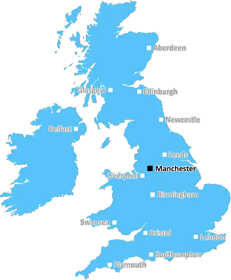
Manchester (M6)
The M6 postcode area is located in the Manchester postcode town region, within the county of Greater Manchester, and contains a total of 1159 individual postcodes.
There are 6 electoral wards in the M6 postcode area, including Manchester, Sale, Salford which come under the local authority of the Salford Council.
Combining the whole postcode region, 14% of people in M6 are classed as having an AB social grade, (i.e. 'white-collar' middle-upper class), compared to 27% across the UK.
This does not mean that the people of M6 are poorer than other areas, but it may give an indication that there are areas of deprivation.
The M6 postcode area is situated in the North West of England and includes Greater Manchester, Lancashire, Merseyside, and parts of Cumbria and Cheshire. It covers the post towns of Bolton, Bury, Preston, and Wigan as well as the metropolitan boroughs of Salford and Warrington.
The area is predominately urban, with a population of around 1.2 million people. The most densely populated area is Warrington, which is home to 240,100 people within its 23.94 square miles. It should be noted that these figures include the nearby towns and villages.
The M6 postcode provides easy access to the motorway network of England. The main motorway in the area is the M6, which is a major route linking the North West of England with the West Midlands. This is complemented by the M61, M62, and M58, alongside a number of main roads. The largest airport in the area is Manchester, with Liverpool John Lennon Airport also within easy reach.
The area is home to a number of towns and cities of cultural and historical significance. The historic Roman fort, the Ribchester Roman Museum, and the Turpie Roman Villa are in Lancashire, while the ancient village of Cheshire, the City of Liverpool, and the City of Manchester are all situated nearby.
The M6 postcode is known for its lively nightlife, thanks to its many nearby towns and cities, and there are also a number of large shopping centres, theatres and other entertainment venues throughout the area. There are also many leisure attractions, including parks, gardens, lakes, and cycle paths that link the various cities in the postcode.
In terms of education, there are numerous universities and colleges located within the M6 postcode area, including the University of Bolton, Manchester Metropolitan University, and Liverpool John Moores University. Primary and secondary schools can be found throughout the local area, some of which rank highly in international league tables.
Finally, the M6 postcode area is home to a number of great sporting venues, including the Emirates Old Trafford cricket ground in Manchester, the home of Old Trafford Football Club, and Anfield, home of Liverpool Football Club.

Demographics

Greater Manchester

M6 is located in the county of Greater Manchester, in England.
Greater Manchester has a total population of 2,782,100, making it the 3rd largest county in the UK.
Greater Manchester has a total area of 492 square miles, and a population density of 2180 people per square kilometre. For comparison, Greater London has a density of 5,618 people/km2.
| Outward Code | M6 |
| Postal Town | Manchester |
| MSOA Name | Salford 024 |
| LSOA Name | Salford 024B |
| County | Greater Manchester |
| Region | Greater Manchester |
| Country | England |
| Local Authority | Salford |
| Area Classification | Urban with Major Conurbation |
M6 Electoral Wards
The postal region of M6, includes the local towns, villages, electoral wards and stations of:
Dig even deeper into the M6 postcode by clicking on a postcode below:
Click on an outward postal code below for more information about the area. Each 'outward' postcode give you a comprehensive list of all postcodes within the outward code area (M) and estimated address.
Click on an 'outward' code for more information. For example, the outward postcode page 'EC2M' will give you an alphabetical list covering all postcodes located in the region, from 'EC2M 1BB' through to 'EC2M 7YA'.
K F, manchester
Monday, January 7, 2019
Easy access to shops,schools,gyms,salford precinct local, good bus links,train,salford quays local for good food,wine bars,. Manchester united FG..15mins away.
Add your view of M6
People need your local expertise. If you live in M6 or have first-hand knowledge of the neighbourhood, please consider sharing your views. It's completely anonymous - all we ask is for your initials.
Please tell us what you like about the M6 postcode area, what you don't like, and what it's like to live or work here.
| LOCAL AMENITIES | |
| FAMILY FRIENDLY | |
| PARKING | |
| GREEN SPACES |
Local News Lancashire
Man arrested in small boats investigation
A Preston house is raided by officers investigating gangs organising small boat Channel crossings.
BBC NewsLabour wins Hyndburn and unseats Chorley opposition leader
Labour also retains control of Preston, Rossendale, Chorley and Blackburn with Darwen.
BBC News'Embarrassing' Burnley 'doomed' after heavy loss
Burnley's 12th defeat at home this season means they are five points adrift of 17th-placed Nottingham Forest with two games remaining.
BBC NewsLabour wins back Lancashire PCC role from Tories
Labour's Clive Grunshaw has won his old job back three years after losing it.
BBC NewsMotorcyclist suffers 'life-changing' injuries
The rider was injured crashing into the central reservation on the M65 in Lancashire, police say.
BBC NewsBurnley opens safe standing for Premier League clash
More than one-and-a-half thousand stations have been installed in the stadium, the club said.
BBC NewsCouncil moves to buy up houses for 65m uni site
Support is being offered to anyone who is displaced by the redevelopment plans.
BBC NewsThunder edge to one-wicket win over Blaze
Seren Smale's half-century helps Thunder edge to a one-wicket win over The Blaze in the Rachael Heyhoe Flint Trophy.
BBC NewsFrom the Postcode Area blog

Deciphering Crime Rates - a Deep Dive Into UK Postcode Analysis
Ever wondered about the crime rate in your UK postcode? You're not alone. We've dug deep into the data, uncovering trends and patterns that'll make your head spin.

Death of the High Street?
The BBC reports that despite councils' attempts to kurb them, the UK's high streets have seen a huge growth in fast food outlets. Could this mark the death knell for the Great British high street, and what can we do about it to halt its decline?

Discrimination by Postcode
You really couldn't make it up, could you? Some of the country's most vulnerable people are missing out on their weekly £25 Cold Weather Payment, just because the system that's in operation is discriminating against them because payments are based on postcode, rather than geographic location.

The Redesign is Underway
Well, the current website was absolutely in dire need of a good redesign - from the ground up. So I set out to pull it all apart and get it up and running again to become the most comprehensive guide to every postcode in the UK. And it's been a long, tough job from start to finish - and quite possibly the biggest project I've ever undertaken.
SOCIAL GRADES
According to census records, 14% of people here have a social grade of AB (highest), compared to the national average of 27%.