manchester M34 Postcodes
Spending a fortune on conveyancing?

Compare instant, low-cost online quotes from trusted conveyancing solicitors.
Backed by experts, our no-obligation service searches through the best conveyancing quotes on the market to save you time and money.
Manchester (M34)
The M34 postcode area is located in the Manchester postcode town region, within the county of , and contains a total of 1822 individual postcodes.
There are 19 electoral wards in the M34 postcode area, including Manchester, Sale, Salford which come under the local authority of the Council.
Combining the whole postcode region, 13% of people in M34 are classed as having an AB social grade, (i.e. 'white-collar' middle-upper class), compared to 27% across the UK.
This does not mean that the people of M34 are poorer than other areas, but it may give an indication that there are areas of deprivation.
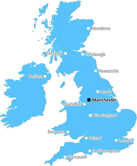
M34 is a postcode area located in the Manchester district of Greater Manchester, England. It covers Droylsden, Audenshaw, and Denton, amongst other areas.
The postcode is initially allocated to the Metropolitan Borough of Tameside in 1974, and its geographical area extends to the River Tame and the Cheshire border.
There are numerous housing estates located in the M34 postcode area, ranging from council housing to mid-level executive homes. There is a mix of terraced housing, apartments and semi-detached housing, and the area is surrounded by greenery and woodlands.
Education facilities in the M34 postcode area are varied and well-maintained. Schools include Fairfield School and The Droylsden Academy, both of which are maintained by Tameside Council. Further education facilities include Pennine Manor College, as well as Manchester Revolution Language School.
The main economy of the M34 postcode area is constructed around local businesses, many of which are retailers and hospitality, while the larger employers include LaFarge Cement Ash and Tameside Council.
Transport links to the M34 postcode area are relatively good, with Manchester Piccadilly railway station and Manchester Victoria railway station being easily accessible. Bus routes serve the neighbouring settlements of Ashton-under-Lyne, Oldham, and Clayton South. Manchester Airport and the Manchester Orbital motorway can be easily reached using local motorways, as can the city centre of Manchester itself.
Lastly, the nearby Peak District National Park and the Pennine Hills lend themselves to plenty of outdoor activities, with the area being popular with walkers, climbers and cyclists.

Demographics


M34 is located in the county of , in .
has a total population of 0, making it the largest county in the UK.
has a total area of square miles, and a population density of people per square kilometre. For comparison, Greater London has a density of 5,618 people/km2.
| Outward Code | M34 |
| Postal Town | Manchester |
| MSOA Name | |
| LSOA Name | |
| County | |
| Region | |
| Country | |
| Local Authority | |
| Area Classification | Unclassified |
M34 Electoral Wards
The postal region of M34, includes the local towns, villages, electoral wards and stations of:
Dig even deeper into the M34 postcode by clicking on a postcode below:
Click on an outward postal code below for more information about the area. Each 'outward' postcode give you a comprehensive list of all postcodes within the outward code area (M) and estimated address.
Click on an 'outward' code for more information. For example, the outward postcode page 'EC2M' will give you an alphabetical list covering all postcodes located in the region, from 'EC2M 1BB' through to 'EC2M 7YA'.
Chris H
Saturday, April 6, 2024
We don't have any views of M34 right now. If you live in M34 or have visited it, please help us to help others by telling others what you think of this neighbourhood.
Add your view of M34
People need your local expertise. If you live in M34 or have first-hand knowledge of the neighbourhood, please consider sharing your views. It's completely anonymous - all we ask is for your initials.
Please tell us what you like about the M34 postcode area, what you don't like, and what it's like to live or work here.
| LOCAL AMENITIES | |
| FAMILY FRIENDLY | |
| PARKING | |
| GREEN SPACES |
From the Postcode Area blog

Deciphering Crime Rates - a Deep Dive Into UK Postcode Analysis
Ever wondered about the crime rate in your UK postcode? You're not alone. We've dug deep into the data, uncovering trends and patterns that'll make your head spin.

Death of the High Street?
The BBC reports that despite councils' attempts to kurb them, the UK's high streets have seen a huge growth in fast food outlets. Could this mark the death knell for the Great British high street, and what can we do about it to halt its decline?

Discrimination by Postcode
You really couldn't make it up, could you? Some of the country's most vulnerable people are missing out on their weekly £25 Cold Weather Payment, just because the system that's in operation is discriminating against them because payments are based on postcode, rather than geographic location.

The Redesign is Underway
Well, the current website was absolutely in dire need of a good redesign - from the ground up. So I set out to pull it all apart and get it up and running again to become the most comprehensive guide to every postcode in the UK. And it's been a long, tough job from start to finish - and quite possibly the biggest project I've ever undertaken.
SOCIAL GRADES
According to census records, 13% of people here have a social grade of AB (highest), compared to the national average of 27%.