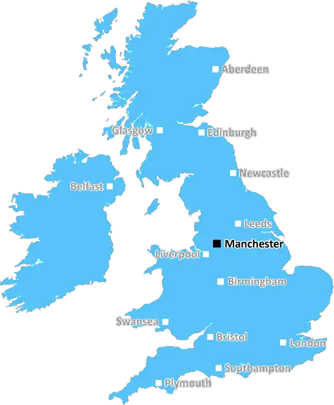
manchester M3 Postcodes
Spending a fortune on conveyancing?

Compare instant, low-cost online quotes from trusted conveyancing solicitors.
Backed by experts, our no-obligation service searches through the best conveyancing quotes on the market to save you time and money.
Manchester (M3)
The M3 postcode area is located in the Manchester postcode town region, within the county of Greater Manchester, and contains a total of 1057 individual postcodes.
There are 4 electoral wards in the M3 postcode area, including Manchester, Sale, Salford which come under the local authority of the Salford Council.
Combining the whole postcode region, 33% of people in M3 are classed as having an AB social grade, (i.e. 'white-collar' middle-upper class), compared to 27% across the UK.
This does not mean that the people of M3 are wealthier - or higher class - than average, but it can be an indication that the area may be prospering and desirable to live in.
M3 is an area and postcode district of Greater Manchester in the United Kingdom, covering the south east part of the city. It includes parts of Manchester City Centre, the areas of Lower Etherstone, Higher Broughton, the Manchester City Centre, and the area of Chorlton-cum-Hardy. The postcode district is located between M1 and M2 postcodes and is generally bordered by the A56, Oxford Road and Great Ancoats Street.
The area itself is home to many businesses, attractions and landmarks. Notable parts of the district include Manchester's University district, Oxford Road and Piccadilly Station, one of the busiest railway stations in the UK. Other popular landmarks in the area include The Village, the Royal Northern College of Music, The Palace Theatre, Manchester Central Library, Manchester Art Gallery and Manchester Conference Centre.
The district also houses a variety of residential and commercial properties, including residential homes, office buildings, shops, schools and universities. The district is served by multiple bus routes, allowing easy access to all areas within the district.
The area is full of cultural and entertainment venues, with many of these venues catering to a variety of cultures and tastes. The district contains a number of restaurants, pubs, music venues, clubs and bars, enabling residents and visitors to indulge in a range of activities and experiences.
The district is also home to the Museum of Science and Industry, which houses a large collection of interactive exhibitions and displays. The museum is home to more than 50,000 artifacts, demonstrating the history of science and technology, making it a must-see for anyone interested in the development of science and industry.
M3 is an area offering something for everyone, with a diverse range of businesses, attractions and residential areas, all in one convenient location. It combines the heritage and culture of Manchester with a vibrant and exciting atmosphere, making it an ideal destination for both locals and visitors alike.

Demographics

Greater Manchester

M3 is located in the county of Greater Manchester, in England.
Greater Manchester has a total population of 2,782,100, making it the 3rd largest county in the UK.
Greater Manchester has a total area of 492 square miles, and a population density of 2180 people per square kilometre. For comparison, Greater London has a density of 5,618 people/km2.
| Outward Code | M3 |
| Postal Town | Manchester |
| MSOA Name | Salford 022 |
| LSOA Name | Salford 022I |
| County | Greater Manchester |
| Region | Greater Manchester |
| Country | England |
| Local Authority | Salford |
| Area Classification | Urban with Major Conurbation |
M3 Electoral Wards
The postal region of M3, includes the local towns, villages, electoral wards and stations of:
Dig even deeper into the M3 postcode by clicking on a postcode below:
Click on an outward postal code below for more information about the area. Each 'outward' postcode give you a comprehensive list of all postcodes within the outward code area (M) and estimated address.
Click on an 'outward' code for more information. For example, the outward postcode page 'EC2M' will give you an alphabetical list covering all postcodes located in the region, from 'EC2M 1BB' through to 'EC2M 7YA'.
AA, manchester
Thursday, November 1, 2018
The national and international cuisines in nearby restaurants is immensely delicious. People over here are way too helpful than expected. I visited there for an exam and the staff was very supportive and cooperative. The surroundings and friendly environment adds an extra flavour of sweetness to this area. Overall, the experience of being there is fulfilling and unforgettable.
Add your view of M3
People need your local expertise. If you live in M3 or have first-hand knowledge of the neighbourhood, please consider sharing your views. It's completely anonymous - all we ask is for your initials.
Please tell us what you like about the M3 postcode area, what you don't like, and what it's like to live or work here.
| LOCAL AMENITIES | |
| FAMILY FRIENDLY | |
| PARKING | |
| GREEN SPACES |
Local News Lancashire
Britain's loudest birds are booming once again
The RSPB reports ten "booming" males at Leighton Moss - the most on the reserve since the 1990s.
BBC NewsG4 superfan changes her name in honour of singers
Christine Christie Ansell Duncan Jai Martin changed her name in tribute to the X Factor finalists.
BBC NewsEverton beat Burnley to boost survival hopes
Dominic Calvert-Lewin capitalises on an Arijanet Muric error to score his second goal in as many games and help Everton to a priceless win over fellow strugglers Burnley.
BBC NewsCampaigners call for cemetery to be protected
They are urging a bishop to keep the site as a cemetery and stop it being redeveloped.
BBC NewsWhere in the UK can you see Monday's solar eclipse?
People in the UK can also see the solar eclipse happening in the US next week
BBC NewsVolunteer groups at 'crisis point' over NHS referrals
Organisations in Lancashire say they are under pressure due to a rapid increase in "social prescribing".
BBC NewsBoy held after police officer struck by stolen car
A stolen mobility car was "deliberately driven" at an officer as he approached it, police say.
BBC NewsCritically ill boy fulfils soldier dream for a day
Noah, who is from Leyland, loves tanks and wished to be a soldier for a day.
BBC NewsFrom the Postcode Area blog

Deciphering Crime Rates - a Deep Dive Into UK Postcode Analysis
Ever wondered about the crime rate in your UK postcode? You're not alone. We've dug deep into the data, uncovering trends and patterns that'll make your head spin.

Death of the High Street?
The BBC reports that despite councils' attempts to kurb them, the UK's high streets have seen a huge growth in fast food outlets. Could this mark the death knell for the Great British high street, and what can we do about it to halt its decline?

Discrimination by Postcode
You really couldn't make it up, could you? Some of the country's most vulnerable people are missing out on their weekly £25 Cold Weather Payment, just because the system that's in operation is discriminating against them because payments are based on postcode, rather than geographic location.

The Redesign is Underway
Well, the current website was absolutely in dire need of a good redesign - from the ground up. So I set out to pull it all apart and get it up and running again to become the most comprehensive guide to every postcode in the UK. And it's been a long, tough job from start to finish - and quite possibly the biggest project I've ever undertaken.
SOCIAL GRADES
According to census records, 33% of people here have a social grade of AB (highest), compared to the national average of 27%.