worcester WR13 Postcodes
Spending a fortune on conveyancing?

Compare instant, low-cost online quotes from trusted conveyancing solicitors.
Backed by experts, our no-obligation service searches through the best conveyancing quotes on the market to save you time and money.
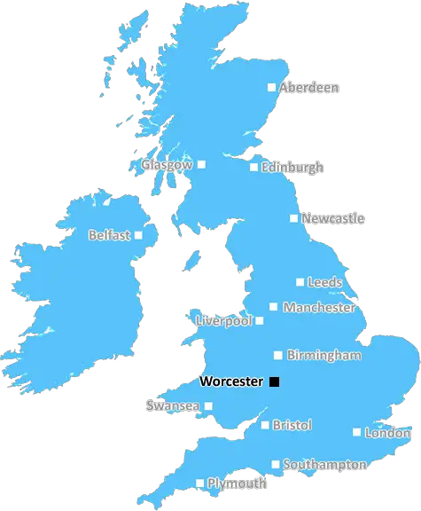
Worcester (WR13)
The WR13 postcode area is located in the Worcester postcode town region, within the county of Worcestershire, and contains a total of 426 individual postcodes.
There are 146 electoral wards in the WR13 postcode area, including Broadway, Droitwich, Evesham, Malvern, Pershore, Tenbury Wells, Worcester which come under the local authority of the Malvern Hills Council.
Combining the whole postcode region, 34% of people in WR13 are classed as having an AB social grade, (i.e. 'white-collar' middle-upper class), compared to 27% across the UK.
This does not mean that the people of WR13 are wealthier - or higher class - than average, but it can be an indication that the area may be prospering and desirable to live in.
The WR13 postcode is located in Worcestershire in the West Midlands region of England. It covers part of the Malvern Hills District, including the town of Great Malvern and the surrounding rural areas. The WR13 postcode also includes the villages of Rushwick, Poolbrook, Madresfield, Cheney Longville, Malvern Wells, Leigh, Norton, Hanley Swan, Alfrick, Cotheridge, Chantry, North Malvern, Bank Street, Hibberson, Callow End and Walcot.
The WR13 postcode is renowned for its stunning scenery, with the picturesque Malvern Hills providing beautiful views over the Severn Valley, its rolling hills offering a natural playground for outdoor enthusiasts. There are plenty of activities on offer near the area, such as hill walking, cycling, horse riding, hang gliding, golf, and plenty more.
Education wise, students in the area have access to primary and secondary schools, along with further education facilities, such as Malvern Hills College.
In terms of transport links, the WR13 postcode is served by Great Malvern railway station, making it easy to access nearby towns and cities, with regular connections to Birmingham, Worcester and London. There are also links to Manchester via Worcester and Birmingham, and Bristol via Cheltenham. The A449 connects the area with the M5 motorway and, in turn, all major UK cities.
Shopping wise, Wildwood and the historical Malvern Town centre are two of the biggest retail spots, which offer an array of high street shops and independent stores to pick from. The Morgan Quarter, a friendly shopping area with an array of unique independent stores, cafes and restaurants, can also be found in the area.
In terms of social events and culture, the area has plenty of historical attractions, such as the Royal Worcester Porcelain factory, the Great Malvern Priory Church, and Malvern Theatre. The Malvern Festival of Arts, a music and arts festival that takes over the town each summer, is also pretty popular, as are the local farmers markets and food festivals. All in all, the WR13 postcode is a great place to settle down and make a home.

Demographics

Worcestershire

WR13 is located in the county of Worcestershire, in England.
Worcestershire has a total population of 583,100, making it the 38th largest county in the UK.
Worcestershire has a total area of 670 square miles, and a population density of 334 people per square kilometre. For comparison, Greater London has a density of 5,618 people/km2.
| Outward Code | WR13 |
| Postal Town | Worcester |
| MSOA Name | Malvern Hills 005 |
| LSOA Name | Malvern Hills 005A |
| County | Worcestershire |
| Region | Worcestershire |
| Country | England |
| Local Authority | Malvern Hills |
| Area Classification | Largely Rural (rural including hub towns 50-79%) |
WR13 Electoral Wards
The postal region of WR13, includes the local towns, villages, electoral wards and stations of:
Dig even deeper into the WR13 postcode by clicking on a postcode below:
Click on an outward postal code below for more information about the area. Each 'outward' postcode give you a comprehensive list of all postcodes within the outward code area (WR) and estimated address.
Click on an 'outward' code for more information. For example, the outward postcode page 'EC2M' will give you an alphabetical list covering all postcodes located in the region, from 'EC2M 1BB' through to 'EC2M 7YA'.
Chris H
Wednesday, April 10, 2024
We don't have any views of WR13 right now. If you live in WR13 or have visited it, please help us to help others by telling others what you think of this neighbourhood.
Add your view of WR13
People need your local expertise. If you live in WR13 or have first-hand knowledge of the neighbourhood, please consider sharing your views. It's completely anonymous - all we ask is for your initials.
Please tell us what you like about the WR13 postcode area, what you don't like, and what it's like to live or work here.
| LOCAL AMENITIES | |
| FAMILY FRIENDLY | |
| PARKING | |
| GREEN SPACES |
Local News Worcestershire
Football club investigates alleged racist incident
Anyone involved in the disturbances will be banned from future fixtures, Worcester City FC says.
BBC NewsWorcester's green-fingered social media superstar
Meet Ben, whose exploits on social media as Worcester Terrariums are seen by millions!
BBC NewsHow to deal with ratflation'
Rat-catcher Phil Martin shares tips on how to spot tell-tale signs of infestations.
BBC NewsSwimmer Richards will 'have every chance' in Paris
Following the British trials, BBC Radio 5 live pundits Karen Pickering and Steve Parry debate Team GB's swimming medal chances at the Paris Olympics.
BBC NewsCampaigner secures defibrillator in friend's memory
The device is to be fitted near to the scene where student paramedic Amy Shadbolt's friend died.
BBC NewsWhy is it still raining?
Jim Dale from British Weather Services explains why everywhere is so waterlogged.
BBC NewsTwo men jailed for footballer's nightclub murder
Remy Gordon and Kami Carpenter attacked Cody Fisher at the Crane club in Birmingham.
BBC NewsWatch: The Dancefloor Murder
The story of footballer Cody Fisher who was stabbed to death in a nightclub in Birmingham.
BBC NewsFrom the Postcode Area blog

Deciphering Crime Rates - a Deep Dive Into UK Postcode Analysis
Ever wondered about the crime rate in your UK postcode? You're not alone. We've dug deep into the data, uncovering trends and patterns that'll make your head spin.

Death of the High Street?
The BBC reports that despite councils' attempts to kurb them, the UK's high streets have seen a huge growth in fast food outlets. Could this mark the death knell for the Great British high street, and what can we do about it to halt its decline?

Discrimination by Postcode
You really couldn't make it up, could you? Some of the country's most vulnerable people are missing out on their weekly £25 Cold Weather Payment, just because the system that's in operation is discriminating against them because payments are based on postcode, rather than geographic location.

The Redesign is Underway
Well, the current website was absolutely in dire need of a good redesign - from the ground up. So I set out to pull it all apart and get it up and running again to become the most comprehensive guide to every postcode in the UK. And it's been a long, tough job from start to finish - and quite possibly the biggest project I've ever undertaken.
SOCIAL GRADES
According to census records, 34% of people here have a social grade of AB (highest), compared to the national average of 27%.