swindon SN16 Postcodes
Spending a fortune on conveyancing?

Compare instant, low-cost online quotes from trusted conveyancing solicitors.
Backed by experts, our no-obligation service searches through the best conveyancing quotes on the market to save you time and money.
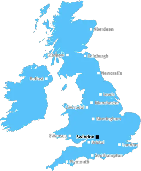
Swindon (SN16)
The SN16 postcode area is located in the Swindon postcode town region, within the county of Wiltshire, and contains a total of 662 individual postcodes.
There are 60 electoral wards in the SN16 postcode area, including Calne, Chippenham, Corsham, Devizes, Faringdon, Malmesbury, Marlborough, Melksham, Pewsey, Swindon which come under the local authority of the Wiltshire Council.
Combining the whole postcode region, 38% of people in SN16 are classed as having an AB social grade, (i.e. 'white-collar' middle-upper class), compared to 27% across the UK.
This does not mean that the people of SN16 are wealthier - or higher class - than average, but it can be an indication that the area may be prospering and desirable to live in.
The SN16 postcode is located in South Gloucestershire, England. The central part of the postcode district is approximately 8 miles north of Bristol city centre, and it includes the town of Malmesbury as well as some smaller villages.
The area includes the Cotswold hills, parts of the Thames-Severn and Cotswold Water Park and provides access to the M4 motorway making it a popular stop-off point for those travelling to the Cotswolds.
SN16 has a variety of schools both primary and secondary, including St Aldhem's Primary School, Ashcroft CoE Primary School, Malmesbury Primary School, Southrop Primary School, Malmesbury CofE Primary School, St Joseph's Catholic Primary School, Malmesbury School, Stroud High School, Marling School and Stroud Sixth Form.
The district has a variety of shops and services, with supermarkets such as Sainsburys, Tesco, Asda, Morrison's, Waitrose and Co-Op in Malmesbury, while larger outlets can be found in nearby Cirencester, Swindon and Cheltenham. Other local amenities include a cinema, library, leisure centre, banks and pubs. There are plenty of places of historic interest, such as the Malmesbury Abbey, Abbey House Gardens, and St Aldhelm's Roman Catholic Church.
The location is popular for its convenient access to the beautiful Cotswolds, as well as the nearby cities of Bristol, Gloucester and Bath. It is also well connected to other towns in the region via regular train services from Kemble, Swindon and Chippenham.
Popular destinations for days out nearby include Westonbirt Arboretum, Bowood House and Garden, and Longleat Safari Park, while for outdoor pursuits there are plenty of courses for fishing, golf and tennis.
SN16 is an area of mixed urban and rural environments, providing plenty of opportunity to live and socialise in either setting, and it is highly sought-after by those looking for a quiet place to raise a family. The idyllic villages and surrounding countryside make for an attractive place to call home, or an ideal spot for a weekend getaway.

Demographics

Wiltshire

SN16 is located in the county of Wiltshire, in England.
Wiltshire has a total population of 706,300, making it the 34th largest county in the UK.
Wiltshire has a total area of 1346 square miles, and a population density of 202 people per square kilometre. For comparison, Greater London has a density of 5,618 people/km2.
| Outward Code | SN16 |
| Postal Town | Swindon |
| MSOA Name | Wiltshire 002 |
| LSOA Name | Wiltshire 002D |
| County | Wiltshire |
| Region | Wiltshire |
| Country | England |
| Local Authority | Wiltshire |
| Area Classification | Largely Rural (rural including hub towns 50-79%) |
SN16 Electoral Wards
The postal region of SN16, includes the local towns, villages, electoral wards and stations of:
Dig even deeper into the SN16 postcode by clicking on a postcode below:
Click on an outward postal code below for more information about the area. Each 'outward' postcode give you a comprehensive list of all postcodes within the outward code area (SN) and estimated address.
Click on an 'outward' code for more information. For example, the outward postcode page 'EC2M' will give you an alphabetical list covering all postcodes located in the region, from 'EC2M 1BB' through to 'EC2M 7YA'.
Chris H
Wednesday, April 10, 2024
We don't have any views of SN16 right now. If you live in SN16 or have visited it, please help us to help others by telling others what you think of this neighbourhood.
Add your view of SN16
People need your local expertise. If you live in SN16 or have first-hand knowledge of the neighbourhood, please consider sharing your views. It's completely anonymous - all we ask is for your initials.
Please tell us what you like about the SN16 postcode area, what you don't like, and what it's like to live or work here.
| LOCAL AMENITIES | |
| FAMILY FRIENDLY | |
| PARKING | |
| GREEN SPACES |
Local News Wiltshire
Sutton United 3-1 Swindon Town
Sutton make it four wins in a row by beating Swindon as they move out of the League Two relegation places.
BBC NewsCouncil's email to pay-dispute staff ruled unlawful
Wiltshire Council broke an industrial relations law by emailing staff on the eve of a strike ballot.
BBC NewsRelive Monday's League One & Two action
Aaron Collins scores a hat-trick for Bolton and Carlisle move closer to relegation - relive Monday's games in League One and League Two.
BBC NewsFamilies encouraged to access free school meals
The council says schools receive extra funding to ensure "all children have the best start in life".
BBC NewsArnott & Kidson earn GB boccia quota spots
Boccia players Will Arnott and Sally Kidson secure places for Great Britain in the BC3 events at the Paris Paralympics.
BBC NewsSwindon Town 2-1 Notts County
Swindon break a four-match winless streak as they beat Notts County thanks to two pieces of comedic defending.
BBC NewsBarrow 0-2 Swindon Town
Paul Glatzel continues his fine recent goalscoring form as Swindon stun League Two promotion-chasers Barrow with a 2-0 victory.
BBC NewsRobber who held Tesco staff at knifepoint jailed
Bradley Stacey, 21, is jailed for robbery as well as making verbal threats to police officers.
BBC NewsFrom the Postcode Area blog

Deciphering Crime Rates - a Deep Dive Into UK Postcode Analysis
Ever wondered about the crime rate in your UK postcode? You're not alone. We've dug deep into the data, uncovering trends and patterns that'll make your head spin.

Death of the High Street?
The BBC reports that despite councils' attempts to kurb them, the UK's high streets have seen a huge growth in fast food outlets. Could this mark the death knell for the Great British high street, and what can we do about it to halt its decline?

Discrimination by Postcode
You really couldn't make it up, could you? Some of the country's most vulnerable people are missing out on their weekly £25 Cold Weather Payment, just because the system that's in operation is discriminating against them because payments are based on postcode, rather than geographic location.

The Redesign is Underway
Well, the current website was absolutely in dire need of a good redesign - from the ground up. So I set out to pull it all apart and get it up and running again to become the most comprehensive guide to every postcode in the UK. And it's been a long, tough job from start to finish - and quite possibly the biggest project I've ever undertaken.
SOCIAL GRADES
According to census records, 38% of people here have a social grade of AB (highest), compared to the national average of 27%.