slough SL6 Postcodes
Spending a fortune on conveyancing?

Compare instant, low-cost online quotes from trusted conveyancing solicitors.
Backed by experts, our no-obligation service searches through the best conveyancing quotes on the market to save you time and money.
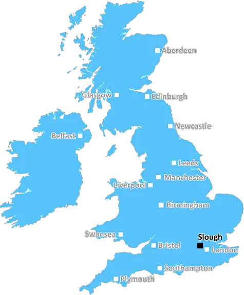
Slough (SL6)
The SL6 postcode area is located in the Slough postcode town region, within the county of Buckinghamshire, and contains a total of 3431 individual postcodes.
There are 67 electoral wards in the SL6 postcode area, including Ascot, Bourne End, Gerrards Cross, Iver, Maidenhead, Marlow, Slough, Windsor which come under the local authority of the South Bucks Council.
Combining the whole postcode region, 38% of people in SL6 are classed as having an AB social grade, (i.e. 'white-collar' middle-upper class), compared to 27% across the UK.
This does not mean that the people of SL6 are wealthier - or higher class - than average, but it can be an indication that the area may be prospering and desirable to live in.
SL6 is a postcode district within the SL postcode area, covering parts of the Slough region in Berkshire, England. SL6 covers areas including Cippenham, Burnham, Knotty Green, Beaconsfield, and Taplow. Cippenham is home to the Slough Ice Arena and the Slough Town Football Club training ground, while to the west, Burnham is renowned for its elegant Georgian Buildings.
Knotty Green is home to several independent shops, like Sainsbury's local and Beavers Garden Centre. Towards the east part of SL6 lies the affluent village of Taplow, which contains historic landmarks such as the Grade II listed Taplow Court, and is known for its picturesque views of the Thames and its bridge.
Also located in the area is Slough Trading Estate, a highly successful industrial area, home to several household names including KFC and Costa Coffee. As well as this, the area is dotted with shopping centres such as Slough Shopping Centre and The Centre.
In terms of transport, the area is well-connected; Burnham railway station, located off College Avenue, provides direct access to London Paddington station, and there are also two bus stations, located in the town centre. The M4 motorway is just a stone's throw away, providing easy access to London, Reading, and the rest of the country.
When it comes to leisure and entertainment, the area has plenty to offer, and is one of the region's most popular with visitors. Highlights include the historic Burnham Beeches woods, Black Park Country Park, and Windsor Great Park on the outskirts of the region, all of which offer excellent walking and cycling trails for all ages. For families, there are activities such as canoeing and boating in the area, and a variety of themed restaurants, pubs, and nightlife locations in and around Slough.
Education-wise, there are several reputable schools and colleges in the area, including Slough and Eton Church of England Business and Enterprise College, Windsor Girls' School, and St. Bernard's Catholic Grammar School, to name a few.
All in all, the SL6 postcode offers a great variety of activities, attractions, and services, making it an ideal place to live in. From the ancient monuments to modern amenities, there is something to suit all tastes in this bustling district.

Demographics

Buckinghamshire

SL6 is located in the county of Buckinghamshire, in England.
Buckinghamshire has a total population of 799,200, making it the 30th largest county in the UK.
Buckinghamshire has a total area of 723 square miles, and a population density of 426 people per square kilometre. For comparison, Greater London has a density of 5,618 people/km2.
| Outward Code | SL6 |
| Postal Town | Slough |
| MSOA Name | South Bucks 006 |
| LSOA Name | South Bucks 006D |
| County | Buckinghamshire |
| Region | Buckinghamshire |
| Country | England |
| Local Authority | South Bucks |
| Area Classification | Urban with Significant Rural (rural including hub towns 26-49%) |
SL6 Electoral Wards
The postal region of SL6, includes the local towns, villages, electoral wards and stations of:
Dig even deeper into the SL6 postcode by clicking on a postcode below:
Click on an outward postal code below for more information about the area. Each 'outward' postcode give you a comprehensive list of all postcodes within the outward code area (SL) and estimated address.
Click on an 'outward' code for more information. For example, the outward postcode page 'EC2M' will give you an alphabetical list covering all postcodes located in the region, from 'EC2M 1BB' through to 'EC2M 7YA'.
P J , Slough
Friday, March 18, 2022
I live in SL2, but can confidently tell you that SL6 is not in Buckinghamshire but in Berkshire and the local authority is Royal Borough of Windsor & Maidenhead, not the now obsolete South Bucks. It covers the Maidenhead part of the Royal Borough.
Add your view of SL6
People need your local expertise. If you live in SL6 or have first-hand knowledge of the neighbourhood, please consider sharing your views. It's completely anonymous - all we ask is for your initials.
Please tell us what you like about the SL6 postcode area, what you don't like, and what it's like to live or work here.
| LOCAL AMENITIES | |
| FAMILY FRIENDLY | |
| PARKING | |
| GREEN SPACES |
Local News Berkshire
Readings cyclists benefit from repairs at town centre stall
Cyclists can benefit from repairs and assistance in the heart of the town centre as part of an initiative that has been launched recently.
Local BerkshirePassengers face delays after freight train derails
Great Western Railway (GWR), Elizabeth line and Heathrow Express passengers' journeys are affected.
BBC NewsSavills bolsters Chelmsford office with return of senior development director
Kibblewhite originally joined the agency in 1990 and spent 16 years working there.
Property WeekDesperate plea to find son's motocross bike following burglary
A distraught Reading mum has released a plea for information of the whereabouts of her sons motocross bike after it was stolen from their home in Tilehurst.
Local BerkshireConservatives slammed for 'lawlessness' in Woodley
The Conservatives have been accused of presiding over lawlessness' in Woodley, with complaints of open drug dealing and anti-social behaviour.
Local BerkshireTortilla offers free burritos on World Burrito Day
The UK's most loved Mexican restaurant Tortilla is celebrating World Burrito Day in style with the biggest ever FREE burrito giveaway in UK history!
Local BerkshirePolice appeal after man has foot ran over and robbed
Police are appealing for witnesses after a man was robbed and had his foot ran over.
Local BerkshireFire tears through Union Street on Easter Sunday
Fire services were called to Union Street Mobiles this Easter Sunday March 31 after a worried member of the public saw large billows of smoke coming out of the building. A nearby business owner said &hellip
Local BerkshireFrom the Postcode Area blog

Deciphering Crime Rates - a Deep Dive Into UK Postcode Analysis
Ever wondered about the crime rate in your UK postcode? You're not alone. We've dug deep into the data, uncovering trends and patterns that'll make your head spin.

Death of the High Street?
The BBC reports that despite councils' attempts to kurb them, the UK's high streets have seen a huge growth in fast food outlets. Could this mark the death knell for the Great British high street, and what can we do about it to halt its decline?

Discrimination by Postcode
You really couldn't make it up, could you? Some of the country's most vulnerable people are missing out on their weekly £25 Cold Weather Payment, just because the system that's in operation is discriminating against them because payments are based on postcode, rather than geographic location.

The Redesign is Underway
Well, the current website was absolutely in dire need of a good redesign - from the ground up. So I set out to pull it all apart and get it up and running again to become the most comprehensive guide to every postcode in the UK. And it's been a long, tough job from start to finish - and quite possibly the biggest project I've ever undertaken.
SOCIAL GRADES
According to census records, 38% of people here have a social grade of AB (highest), compared to the national average of 27%.