llandudno LL45 Postcodes
Spending a fortune on conveyancing?

Compare instant, low-cost online quotes from trusted conveyancing solicitors.
Backed by experts, our no-obligation service searches through the best conveyancing quotes on the market to save you time and money.
Llandudno (LL45)
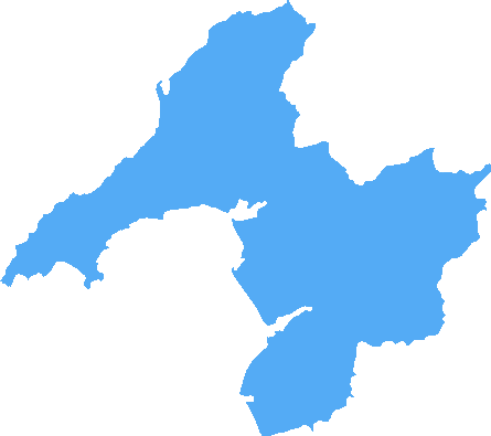
The LL45 postcode area is located in the Llandudno postcode town region, within the county of Gwynedd, and contains a total of 58 individual postcodes.
There are 6 electoral wards in the LL45 postcode area, including Aberdovey, Abergele, Amlwch, Arthog, Bala, Bangor, Barmouth, Beaumaris, Betws-Y-Coed, Blaenau Ffestiniog, Bodorgan, Brynteg, Caernarfon, Cemaes Bay, Colwyn Bay, Conwy, Corwen, Criccieth, Denbigh, Dolgellau, Dolwyddelan, Dulas, Dyffryn Ardudwy, Fairbourne, Gaerwen, Garndolbenmaen, Harlech, Holyhead, Llanbedr, Llanbedrgoch, Llandudno, Llandudno Junction, Llanerchymedd, Llanfairfechan, Llanfairpwllgwyngyll, Llangefni,Llangollen, Llanrwst, Llwyngwril, Marianglas, Menai Bridge, Moelfre, Penmaenmawr, Penrhyndeudraeth, Pentraeth, Penysarn, Porthmadog, Prestatyn, Pwllheli, Rhosgoch, Rhosneigr, Rhyl, Ruthin, St Asaph, Talsarnau, Talybont, Trefriw, Ty Croes, Tyn-Y-Gongl, Tywyn, Wrexham, Y Felinheli which come under the local authority of the Gwynedd Council.
Combining the whole postcode region, 15% of people in LL45 are classed as having an AB social grade, (i.e. 'white-collar' middle-upper class), compared to 27% across the UK.
This does not mean that the people of LL45 are poorer than other areas, but it may give an indication that there are areas of deprivation.
The LL45 postcode lies within the area of Conwy County Borough in North West Wales, and refers to the district of Llandudno. It is a popular tourist destination due to its famous seaside attractions, shopping and historical sites.
Llandudno is home to the Great Orme, a large hill made from limestone, that rises 679 feet above sea level. This impressive landform is home to many rare species of plants, and has numerous paths and trails leading to its summit. Visitors can take a ride on the Great Orme Tramway or take part in the �Summit Walk' challenge, which involves walking along the top of the Great Orme.
The postcode is also close to the historic town of Conwy, which is renowned for its castle dating back to the 13th century. The town also boasts a number of traditional buildings, including its historic harbour, quays and city walls.
The LL45 postcode also includes the town centre of Llandudno which is a popular shopping location. Visitors can find a range of independent shops, cafes and restaurants as well as a theatre, cinema, pier and two shopping arcades. The iconic Victorian promenade stretches the length of the town with grand views of the Great Orme, along with a number of traditional seaside attractions such as donkey rides and an ice cream parlour.
Llandudno is a thriving and vibrant town, that hosts a number of traditional events, including food festivals, flower shows and regular markets. Each year it also hosts Wales' largest Victorian Extravaganza which sees thousands of people flock to the town for the weekend celebration.
The LL45 postcode area is also recognised for its outdoor activities such as sailing, dolphin and whale watching, mountain biking, climbing and paragliding, making it a perfect day trip for those looking for an outdoor adventure.

Demographics

Gwynedd
LL45 is located in the county of Gwynedd, in Wales.
Gwynedd has a total population of 123,600, making it the 14th largest county in the UK.
Gwynedd has a total area of 984 square miles, and a population density of 48 people per square kilometre. For comparison, Greater London has a density of 5,618 people/km2.

| Outward Code | LL45 |
| Postal Town | Llandudno |
| MSOA Name | Gwynedd 013 |
| LSOA Name | Gwynedd 013C |
| County | Gwynedd |
| Region | Gwynedd |
| Country | Wales |
| Local Authority | Gwynedd |
| Area Classification | Unclassified |
LL45 Electoral Wards
The postal region of LL45, includes the local towns, villages, electoral wards and stations of:
Dig even deeper into the LL45 postcode by clicking on a postcode below:
Click on an outward postal code below for more information about the area. Each 'outward' postcode give you a comprehensive list of all postcodes within the outward code area (LL) and estimated address.
Click on an 'outward' code for more information. For example, the outward postcode page 'EC2M' will give you an alphabetical list covering all postcodes located in the region, from 'EC2M 1BB' through to 'EC2M 7YA'.
Chris H
Wednesday, April 17, 2024
We don't have any views of LL45 right now. If you live in LL45 or have visited it, please help us to help others by telling others what you think of this neighbourhood.
Add your view of LL45
People need your local expertise. If you live in LL45 or have first-hand knowledge of the neighbourhood, please consider sharing your views. It's completely anonymous - all we ask is for your initials.
Please tell us what you like about the LL45 postcode area, what you don't like, and what it's like to live or work here.
| LOCAL AMENITIES | |
| FAMILY FRIENDLY | |
| PARKING | |
| GREEN SPACES |
From the Postcode Area blog

Deciphering Crime Rates - a Deep Dive Into UK Postcode Analysis
Ever wondered about the crime rate in your UK postcode? You're not alone. We've dug deep into the data, uncovering trends and patterns that'll make your head spin.

Death of the High Street?
The BBC reports that despite councils' attempts to kurb them, the UK's high streets have seen a huge growth in fast food outlets. Could this mark the death knell for the Great British high street, and what can we do about it to halt its decline?

Discrimination by Postcode
You really couldn't make it up, could you? Some of the country's most vulnerable people are missing out on their weekly £25 Cold Weather Payment, just because the system that's in operation is discriminating against them because payments are based on postcode, rather than geographic location.

The Redesign is Underway
Well, the current website was absolutely in dire need of a good redesign - from the ground up. So I set out to pull it all apart and get it up and running again to become the most comprehensive guide to every postcode in the UK. And it's been a long, tough job from start to finish - and quite possibly the biggest project I've ever undertaken.
SOCIAL GRADES
According to census records, 15% of people here have a social grade of AB (highest), compared to the national average of 27%.