llandudno LL44 Postcodes
Spending a fortune on conveyancing?

Compare instant, low-cost online quotes from trusted conveyancing solicitors.
Backed by experts, our no-obligation service searches through the best conveyancing quotes on the market to save you time and money.
Llandudno (LL44)
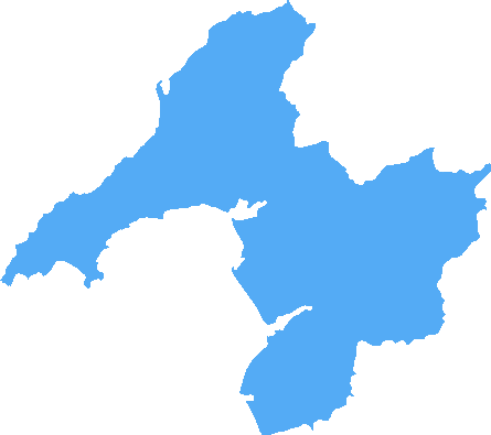
The LL44 postcode area is located in the Llandudno postcode town region, within the county of Gwynedd, and contains a total of 58 individual postcodes.
There are 2 electoral wards in the LL44 postcode area, including Aberdovey, Abergele, Amlwch, Arthog, Bala, Bangor, Barmouth, Beaumaris, Betws-Y-Coed, Blaenau Ffestiniog, Bodorgan, Brynteg, Caernarfon, Cemaes Bay, Colwyn Bay, Conwy, Corwen, Criccieth, Denbigh, Dolgellau, Dolwyddelan, Dulas, Dyffryn Ardudwy, Fairbourne, Gaerwen, Garndolbenmaen, Harlech, Holyhead, Llanbedr, Llanbedrgoch, Llandudno, Llandudno Junction, Llanerchymedd, Llanfairfechan, Llanfairpwllgwyngyll, Llangefni,Llangollen, Llanrwst, Llwyngwril, Marianglas, Menai Bridge, Moelfre, Penmaenmawr, Penrhyndeudraeth, Pentraeth, Penysarn, Porthmadog, Prestatyn, Pwllheli, Rhosgoch, Rhosneigr, Rhyl, Ruthin, St Asaph, Talsarnau, Talybont, Trefriw, Ty Croes, Tyn-Y-Gongl, Tywyn, Wrexham, Y Felinheli which come under the local authority of the Gwynedd Council.
Combining the whole postcode region, 11% of people in LL44 are classed as having an AB social grade, (i.e. 'white-collar' middle-upper class), compared to 27% across the UK.
This does not mean that the people of LL44 are poorer than other areas, but it may give an indication that there are areas of deprivation.
The LL44 postcode is situated in the seaside town of Llandudno in Conwy, North Wales. It stands for Llandudno, the second largest settlement in Wales, and the numerals 44 which are followed by letters of the alphabet, indicating its individual position in the postcode district. The area within the LL44 postcode district is mainly residential and includes the promenade and west shore, as well as the suburb of West Shore.
The promenade of Llandudno is a highlight within the LL44 postcode area and offers a range of shops and restaurants, as well as an amusement arcade and pier. It is also home to the largest Winter Gardens in Wales, as well as the Welsh Mountain Zoo. Popular resorts on the West Shore such as Bodafon Farm Park, Great Orme Cable Car and the Happy Valley Outdoor Adventure Park are also situated in the LL44 postcode regions.
Llandudno is known for its two beautiful sandy beaches � the North Shore and the smaller West Shore. The former, which neighbours the LL44 postcode district, has been awarded a prestigious Blue Flag status, and is the perfect place to relax and unwind. It has a children's playground, two beach bars, and a delightful Victorian promenade to stroll down. The West Shore is quieter, its golden sands backed by a delightful array of holiday chalets and cosy cafe, making it the ideal spot for a romantic picnic or adventure.
The LL44 postcode district is well connected to the rest of Llandudno and to the rest of the North Wales region. It is served by several bus routes into the town, as well as to nearby towns including Colwyn Bay, Rhos-on-Sea and Deganwy. It is also within easy reach of the A55 North Wales Expressway and the A55 Conwy Tunnel, making it easy to access the rest of North Wales. Furthermore, the nearby Llandudno Junction railway station provides direct services to Manchester, Chester and Holyhead.
Llandudno is a major tourist destination in North Wales and the LL44 postcode district is a hub of activity. With its sandy beaches, celebrated promenade and numerous attractions, it's a great spot to spend time with family and friends. From the lively amusement arcades and flower gardens to the tranquil strolls along the North Shore, this area is an exciting and memorable part of this lovely seaside town.

Demographics

Gwynedd
LL44 is located in the county of Gwynedd, in Wales.
Gwynedd has a total population of 123,600, making it the 14th largest county in the UK.
Gwynedd has a total area of 984 square miles, and a population density of 48 people per square kilometre. For comparison, Greater London has a density of 5,618 people/km2.

| Outward Code | LL44 |
| Postal Town | Llandudno |
| MSOA Name | Gwynedd 013 |
| LSOA Name | Gwynedd 013A |
| County | Gwynedd |
| Region | Gwynedd |
| Country | Wales |
| Local Authority | Gwynedd |
| Area Classification | Unclassified |
LL44 Electoral Wards
The postal region of LL44, includes the local towns, villages, electoral wards and stations of:
Dig even deeper into the LL44 postcode by clicking on a postcode below:
Click on an outward postal code below for more information about the area. Each 'outward' postcode give you a comprehensive list of all postcodes within the outward code area (LL) and estimated address.
Click on an 'outward' code for more information. For example, the outward postcode page 'EC2M' will give you an alphabetical list covering all postcodes located in the region, from 'EC2M 1BB' through to 'EC2M 7YA'.
Chris H
Thursday, April 25, 2024
We don't have any views of LL44 right now. If you live in LL44 or have visited it, please help us to help others by telling others what you think of this neighbourhood.
Add your view of LL44
People need your local expertise. If you live in LL44 or have first-hand knowledge of the neighbourhood, please consider sharing your views. It's completely anonymous - all we ask is for your initials.
Please tell us what you like about the LL44 postcode area, what you don't like, and what it's like to live or work here.
| LOCAL AMENITIES | |
| FAMILY FRIENDLY | |
| PARKING | |
| GREEN SPACES |
From the Postcode Area blog

Deciphering Crime Rates - a Deep Dive Into UK Postcode Analysis
Ever wondered about the crime rate in your UK postcode? You're not alone. We've dug deep into the data, uncovering trends and patterns that'll make your head spin.

Death of the High Street?
The BBC reports that despite councils' attempts to kurb them, the UK's high streets have seen a huge growth in fast food outlets. Could this mark the death knell for the Great British high street, and what can we do about it to halt its decline?

Discrimination by Postcode
You really couldn't make it up, could you? Some of the country's most vulnerable people are missing out on their weekly £25 Cold Weather Payment, just because the system that's in operation is discriminating against them because payments are based on postcode, rather than geographic location.

The Redesign is Underway
Well, the current website was absolutely in dire need of a good redesign - from the ground up. So I set out to pull it all apart and get it up and running again to become the most comprehensive guide to every postcode in the UK. And it's been a long, tough job from start to finish - and quite possibly the biggest project I've ever undertaken.
SOCIAL GRADES
According to census records, 11% of people here have a social grade of AB (highest), compared to the national average of 27%.