liverpool L69 Postcodes
Spending a fortune on conveyancing?

Compare instant, low-cost online quotes from trusted conveyancing solicitors.
Backed by experts, our no-obligation service searches through the best conveyancing quotes on the market to save you time and money.
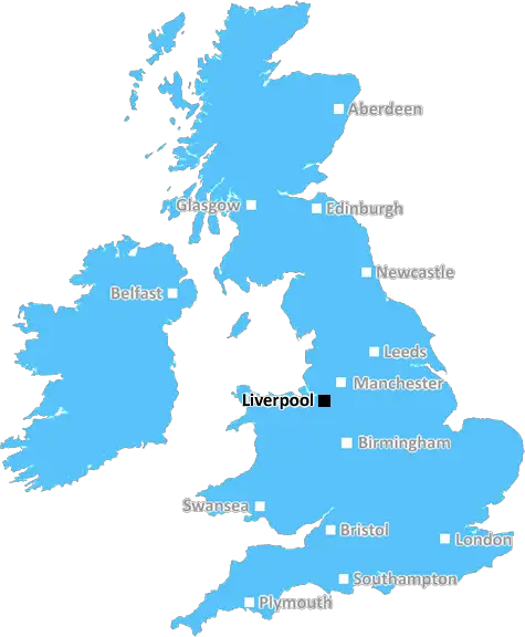
Liverpool (L69)
The L69 postcode area is located in the Liverpool postcode town region, within the county of Merseyside, and contains a total of 1698 individual postcodes.
There are -1 electoral wards in the L69 postcode area, including which come under the local authority of the Liverpool Council.
Combining the whole postcode region, 15% of people in L69 are classed as having an AB social grade, (i.e. 'white-collar' middle-upper class), compared to 27% across the UK.
This does not mean that the people of L69 are poorer than other areas, but it may give an indication that there are areas of deprivation.
The L69 postcode is a suburban area of Liverpool, located in the north of the city. It is part of the Kirkdale, Norris Green and Croxteth wards in the city. The main high streets in the area are Longmoor Lane and Rice Lane, while the main shopping centres are the Pallasades Shopping Centre and clock Shopping Centre.
The area is well connected with transport links provided by the Merseyrail, with stations located centrally, like Kinglassie station, and deeper into the area at Old Roan Station. It is also served by multiple bus routes that provides transportation to the city centre as well as outlying regions.
The L69 postcode covers a mix of residential and commercial properties. Residential housing options range from terraced houses and mid-rise apartment blocks to modern development like Lever Court and Gregson Close. For living there are many local schools, such as Mags High School and Browscene Primary School.
The L69 postcode is rich with amenities that cater to a range of needs. There are plenty of places to eat, from restaurants to local pubs and fast-food outlets, as well as the local supermarket on Longmoor Lane. The area also has several fitness facilities, including St Josephs Boxing Gym, Fairham Sports and Fitness Centre, and ECHO Arena Health and Wellbeing Centre. It is also home to historic sites, such as Croxteth Hall, and public places, like Roby Park.
The postcode provides a blend of a suburban area with the benefit of being close to the city centre. The area is family friendly, with plenty of amenities and great transport connectivity. This makes the area an attractive residential and business location, evidenced by the recent developments of new housing and the expansion of the commercial centre.

Demographics

Merseyside

L69 is located in the county of Merseyside, in England.
Merseyside has a total population of 1,406,400, making it the 9th largest county in the UK.
Merseyside has a total area of 250 square miles, and a population density of 2174 people per square kilometre. For comparison, Greater London has a density of 5,618 people/km2.
| Outward Code | L69 |
| Postal Town | Liverpool |
| MSOA Name | Liverpool 060 |
| LSOA Name | Liverpool 060A |
| County | Merseyside |
| Region | Merseyside |
| Country | England |
| Local Authority | Liverpool |
| Area Classification | Urban with Major Conurbation |
L69 Electoral Wards
The postal region of L69, includes the local towns, villages, electoral wards and stations of:
Dig even deeper into the L69 postcode by clicking on a postcode below:
Click on an outward postal code below for more information about the area. Each 'outward' postcode give you a comprehensive list of all postcodes within the outward code area (L) and estimated address.
Click on an 'outward' code for more information. For example, the outward postcode page 'EC2M' will give you an alphabetical list covering all postcodes located in the region, from 'EC2M 1BB' through to 'EC2M 7YA'.
Chris H
Monday, April 8, 2024
We don't have any views of L69 right now. If you live in L69 or have visited it, please help us to help others by telling others what you think of this neighbourhood.
Add your view of L69
People need your local expertise. If you live in L69 or have first-hand knowledge of the neighbourhood, please consider sharing your views. It's completely anonymous - all we ask is for your initials.
Please tell us what you like about the L69 postcode area, what you don't like, and what it's like to live or work here.
| LOCAL AMENITIES | |
| FAMILY FRIENDLY | |
| PARKING | |
| GREEN SPACES |
Local News Merseyside
'As Ten Hag's future hangs in balance, so do Liverpool's title hopes'
As Erik ten Hag's Manchester United's future hangs in the balance so do Liverpool's title hopes, writes Phil McNulty.
BBC NewsCinema gunman may have had 'suicide by cop' motive
A gunman who fired at a cinema, shop and house will have more psychiatric tests before being sentenced.
BBC NewsWhere in the UK can you see Monday's solar eclipse?
People in the UK can also see the solar eclipse happening in the US next week
BBC NewsThree-year-old girl rescued after falling into lake
Officers saved the child after she wandered out of a house and fell in a nearby lake, police say.
BBC NewsAnimal Rising rules out disrupting Grand National
Activist group Animal Rising says it will not disrupt the Grand National on 13 April and is suspending its campaign of direct again against horse racing.
BBC NewsNail technicians join forces to raise prices
Nail technicians unite to raise their charges in what they call "National Nail Price Increase Day.
BBC NewsEverton beat Burnley to boost survival hopes
Dominic Calvert-Lewin capitalises on an Arijanet Muric error to score his second goal in as many games and help Everton to a priceless win over fellow strugglers Burnley.
BBC NewsSurrey only face 21 balls on rain-affected day
Openers Rory Burns and Dom Sibley are only able to add four runs as rain ruins Surrey's reply to Lancashire's 202.
BBC NewsFrom the Postcode Area blog

Deciphering Crime Rates - a Deep Dive Into UK Postcode Analysis
Ever wondered about the crime rate in your UK postcode? You're not alone. We've dug deep into the data, uncovering trends and patterns that'll make your head spin.

Death of the High Street?
The BBC reports that despite councils' attempts to kurb them, the UK's high streets have seen a huge growth in fast food outlets. Could this mark the death knell for the Great British high street, and what can we do about it to halt its decline?

Discrimination by Postcode
You really couldn't make it up, could you? Some of the country's most vulnerable people are missing out on their weekly £25 Cold Weather Payment, just because the system that's in operation is discriminating against them because payments are based on postcode, rather than geographic location.

The Redesign is Underway
Well, the current website was absolutely in dire need of a good redesign - from the ground up. So I set out to pull it all apart and get it up and running again to become the most comprehensive guide to every postcode in the UK. And it's been a long, tough job from start to finish - and quite possibly the biggest project I've ever undertaken.
SOCIAL GRADES
According to census records, 15% of people here have a social grade of AB (highest), compared to the national average of 27%.