liverpool L5 Postcodes
Spending a fortune on conveyancing?

Compare instant, low-cost online quotes from trusted conveyancing solicitors.
Backed by experts, our no-obligation service searches through the best conveyancing quotes on the market to save you time and money.
Liverpool (L5)
The L5 postcode area is located in the Liverpool postcode town region, within the county of Merseyside, and contains a total of 730 individual postcodes.
There are 3 electoral wards in the L5 postcode area, including Bootle, Liverpool, Ormskirk, Prescot which come under the local authority of the Liverpool Council.
Combining the whole postcode region, 7% of people in L5 are classed as having an AB social grade, (i.e. 'white-collar' middle-upper class), compared to 27% across the UK.
This does not mean that the people of L5 are poorer than other areas, but it may give an indication that there are areas of deprivation.
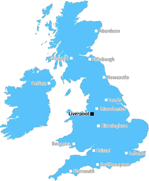
The L5 postcode covers parts of the city of Liverpool in the North West of England, and is part of the wider city region. Its postcode district is the most north-easterly of any in the city.
The postcode areas of L5 includes the neighbourhoods of Vauxhall, Kirkdale, Everton, Islington, Walton, Orrell Park, Anfield, Fairfield and Stanley. The area is split between two parliamentary constituencies, Liverpool Walton and Everton.
As well as being traditionally the home of Liverpool FC and its iconic Anfield Stadium, the area holds a diverse range of structures, from historic Mills to iconic bridges. Stanley Park, an ancient woodland and Grade I listed historic park, also falls within the area.
Kirkdale has always been an industrial area; with the Kirkdale Industrial Estate now welcoming a number of local firms and the historic Stanley Dock one of the largest brick warehouses in the world. Other major landmarks in L5 include The Royal Hospital, St John's Market, Stanley Theatre and the Fourways Crossroundabout.
The area supports a variety of shops, pubs, restaurants and services, including popular independent shops like Bramleys and The Vintage Post, plus a range of national chains and local services like Lark Lane Post Office.
Notable schools in the L5 postcode district include Islington Primary School, Sacred Heart Catholic Primary School, Stanley School, Jericho Primary School and Fairfield High School. Additionally, The University of Liverpool has campuses within the district.
In terms of transport, one of the major roads in L5 is the A59 and various other main arterial routes to the South and North Liverpool. The area also benefits from good public transport links, with three rail stations (Sandhills, Brunswick, and Orrell Park) as well as two of the city's main bus routes connecting to the city centre.
The area is home to many of the city's main centres of community life and culture, such as the Capstone Theatre, The Baltic Triangle and Lark Lane, as well as numerous historic buildings such as The Bluecoat, the Adelphi Hotel, and Bluecoat Chambers. Popular culture in the area is represented by some much loved local pubs, such as London Carriage Works, The Belvedere, Little ECC and Crane Lane Brewery.

Demographics

Merseyside

L5 is located in the county of Merseyside, in England.
Merseyside has a total population of 1,406,400, making it the 9th largest county in the UK.
Merseyside has a total area of 250 square miles, and a population density of 2174 people per square kilometre. For comparison, Greater London has a density of 5,618 people/km2.
| Outward Code | L5 |
| Postal Town | Liverpool |
| MSOA Name | Liverpool 023 |
| LSOA Name | Liverpool 023A |
| County | Merseyside |
| Region | Merseyside |
| Country | England |
| Local Authority | Liverpool |
| Area Classification | Urban with Major Conurbation |
L5 Electoral Wards
The postal region of L5, includes the local towns, villages, electoral wards and stations of:
Dig even deeper into the L5 postcode by clicking on a postcode below:
Click on an outward postal code below for more information about the area. Each 'outward' postcode give you a comprehensive list of all postcodes within the outward code area (L) and estimated address.
Click on an 'outward' code for more information. For example, the outward postcode page 'EC2M' will give you an alphabetical list covering all postcodes located in the region, from 'EC2M 1BB' through to 'EC2M 7YA'.
Chris H
Sunday, April 7, 2024
We don't have any views of L5 right now. If you live in L5 or have visited it, please help us to help others by telling others what you think of this neighbourhood.
Add your view of L5
People need your local expertise. If you live in L5 or have first-hand knowledge of the neighbourhood, please consider sharing your views. It's completely anonymous - all we ask is for your initials.
Please tell us what you like about the L5 postcode area, what you don't like, and what it's like to live or work here.
| LOCAL AMENITIES | |
| FAMILY FRIENDLY | |
| PARKING | |
| GREEN SPACES |
Local News Merseyside
Train strikes: How will you be affected?
Rail workers at 16 companies are taking industrial action but tube strikes have been called off.
BBC NewsWhere in the UK can you see Monday's solar eclipse?
People in the UK can also see the solar eclipse happening in the US next week
BBC NewsAnimal Rising rules out disrupting Grand National
Activist group Animal Rising says it will not disrupt the Grand National on 13 April and is suspending its campaign of direct again against horse racing.
BBC NewsPC who had sex with vulnerable mother jailed
Cheshire Police constable Jordan Masterson insisted he was the victim but a jury rejected his claims.
BBC NewsCannabis farm compost given to local community
Cheshire Police has donated soil from a cannabis farm raid in Warrington to the town council.
BBC NewsThree-year-old girl rescued after falling into lake
Officers saved the child after she wandered out of a house and fell in a nearby lake, police say.
BBC NewsArtistic fantasy world gets listed status
The flat, known as Ron's Place, was secretly transformed by its tenant with weird and wonderful features.
BBC NewsCatalans edge St Helens in thriller to go top
Catalans Dragons edge an absorbing and bruising Super League encounter with title rivals St Helens to go top of the table.
BBC NewsFrom the Postcode Area blog

Deciphering Crime Rates - a Deep Dive Into UK Postcode Analysis
Ever wondered about the crime rate in your UK postcode? You're not alone. We've dug deep into the data, uncovering trends and patterns that'll make your head spin.

Death of the High Street?
The BBC reports that despite councils' attempts to kurb them, the UK's high streets have seen a huge growth in fast food outlets. Could this mark the death knell for the Great British high street, and what can we do about it to halt its decline?

Discrimination by Postcode
You really couldn't make it up, could you? Some of the country's most vulnerable people are missing out on their weekly £25 Cold Weather Payment, just because the system that's in operation is discriminating against them because payments are based on postcode, rather than geographic location.

The Redesign is Underway
Well, the current website was absolutely in dire need of a good redesign - from the ground up. So I set out to pull it all apart and get it up and running again to become the most comprehensive guide to every postcode in the UK. And it's been a long, tough job from start to finish - and quite possibly the biggest project I've ever undertaken.
SOCIAL GRADES
According to census records, 7% of people here have a social grade of AB (highest), compared to the national average of 27%.